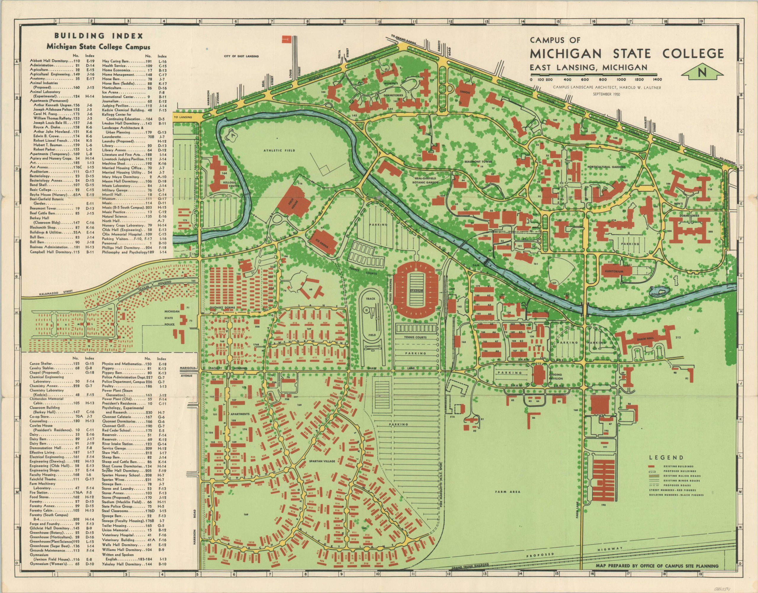
Campus of Michigan State University
Postwar campus plan of Michigan State University in East Lansing.
Out of stock

Description
With attendance buoyed by the G.I. Bill, Michigan State University underwent an ambitious program to significantly expand the campus in postwar East Lansing. Between 1950 and 1965, student enrollment increased from 15,000 to 38,000.
This plan was designed by the campus landscape architect, Harold Lautner, and published by the Office of Campus Site Planning. It uses bold color to identify existing buildings and major roads, while proposed additions are showed in hashed outlines. An accompanying building index identifies over 100 locations identified within the map.
The verso features a map of the city of East Lansing. Published in 1950, the year after Michigan State was admitted to the Big Ten Conference.
Map Details
Publication Date: 1950
Author: Harold W. Lautner
Sheet Width (in): 18.6
Sheet Height (in): 14.5
Condition: A-
Condition Description: Folding brochure with creasing and light wear along fold lines. Small spots of separation and faint discoloration along the outer edges of the sheet, confined to the margins. Very good condition overall.
Out of stock