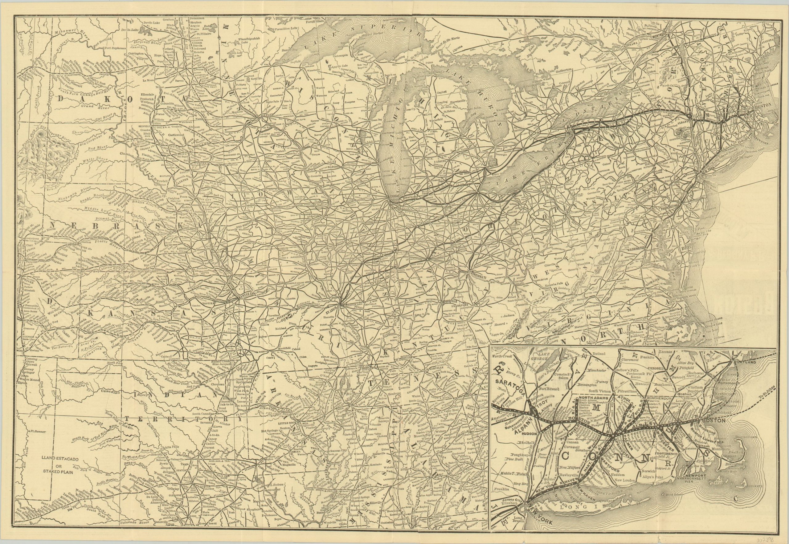
Boston and Albany and New York Central and Hudson River Railroads
$200.00
Boston to Denver via Albany, Buffalo, and St. Louis.
1 in stock
Description
The Boston & Albany Railroad was formed in 1870 as, at the time, the longest and most expensive point to point railroad in the United States. The lines are shown here a decade and a half later, after expanding with several spurs throughout Massachusetts. These developments are shown in further detail in a regionalized inset map in the lower right.
The primary image shows the entire country east of Denver, with lines of the B&A, New York Central and other connecting routes emphasized in bold. Railroads are shown connecting cities like arteries to organs, offering the potential traveler numerous options from point to point.
Text on the verso sets the B&A apart as America’s aorta, as “the only double track route from New England to the West” (Chicago and St. Louis, in this case). Although this may not sound like much today, the ability for trains to go both directions allowed for a huge savings in time for the traveler. Printed in Boston by the Rand Avery Supply Company in 1885.
Map Details
Publication Date: 1885
Author: Rand Avery Supply Co.
Sheet Width (in): 21.25
Sheet Height (in): 14.50
Condition: A
Condition Description: Formerly folded into 12 panels, with creasing and light wear along former fold lines. Small bits of separation at fold intersections and a few edge tears that do not enter the image. One extraneous crease near the top of the page, but overall in very good condition.
$200.00
1 in stock

