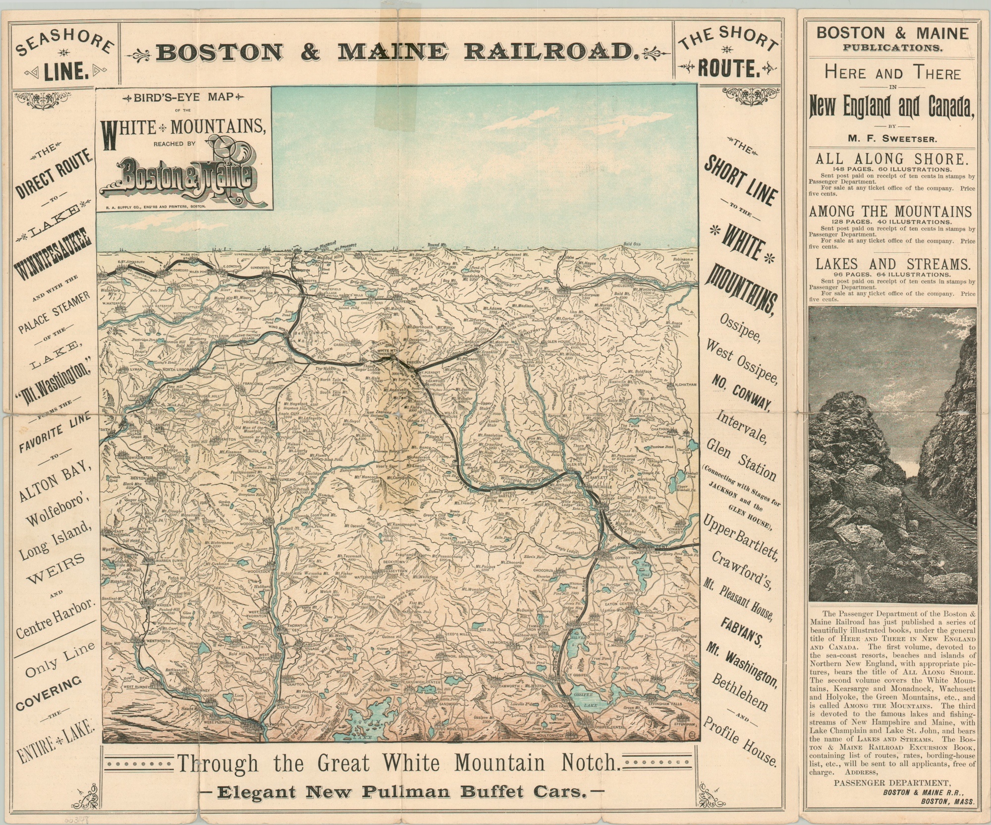
Bird’s Eye Map of the White Mountains, Reached by Boston & Maine RR
Ride the Boston & Maine Railroad through the Great White Mountain Notch.
Out of stock
Description
This striking aerial perspective provides a sweeping view of the White Mountains in northern New Hampshire. It was published in Boston in 1889 by the Rand Avery Supply Company on behalf of the Boston and Maine Railroad.
The company routes through the scenic region shown with bold black lines, connecting between Ossipee Center in the foreground to St. Johnsbury in the upper left. Towns and mountains are depicted pictorially; elevations for the latter are provided in feet.
Text surrounding the image names the various stations served by the B&M lines, while an advertisement on the right side lists other railroad publications available for sale. Timetables on the verso, along with a lovely view of the Willey Brook Bridge in Crawford Notch.
Map Details
Publication Date: 1889
Author: Rand Avery Supply Co.
Sheet Width (in): 17.6
Sheet Height (in): 14.5
Condition: B
Condition Description: Old cellophane tape applied to both sides to stop separation along former fold lines. Tears around the edges and holes at fold intersection are present in numerous areas, resulting in very minimal paper loss. Fair to good condition overall.
Out of stock

