
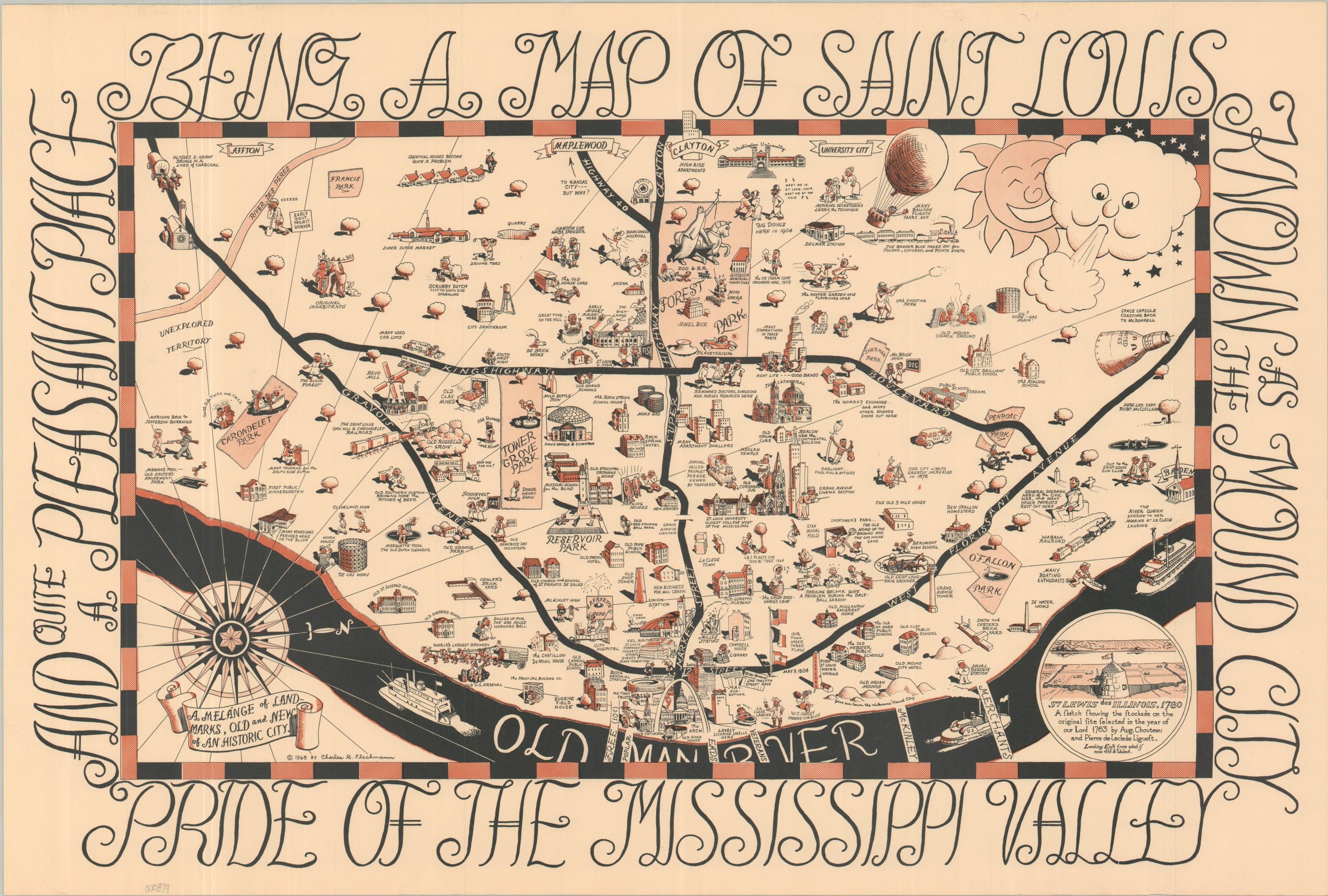
Being a Map of Saint Louis Known as the Mound City Pride of the Mississippi Valley and Quite a Pleasant Place
$350.00
“A melange of landmarks, old and new, of an historic city.”
1 in stock
Description
This bold pictorial map of the “Mound City” (St. Louis, Missouri) is oriented with west at the top and features numerous vignettes highlighting noteworthy sites, local landmarks, and historical events. The image reflects the city’s self-identity in the postwar years and presents an interesting mix of civic pride, local commentary, and decorative elements that blend historic and contemporary timeframes.
Somewhat juvenile (but admittedly, occasionally clever) humor is scattered throughout: the American Can Co., a reformatory school, and growing suburbanization are all shown with tongue-in-cheek illustrations.
This is the revised 1965 edition of Chuck Flachmann’s map, which was first published in 1950. Several racist caricatures in the earlier edition have been removed, though offensive stereotypes of Native Americans persist. The map was issued in several different styles, including a souvenir mailer and a version sponsored by Anheuser-Busch.
Map Details
Publication Date: 1965
Author: Charles Flachmann
Sheet Width (in): 26.10
Sheet Height (in): 17.50
Condition: A
Condition Description: Color printed map on a single-sided sheet of sturdy paper. A bit of light edge wear, where previously rolled, but overall in near fine condition.
$350.00
1 in stock