
Bath and Boothbay Route Eastern Steamboat Co.’s Line
Rusticating along Maine’s coast in the late 19th century.
Out of stock
Description
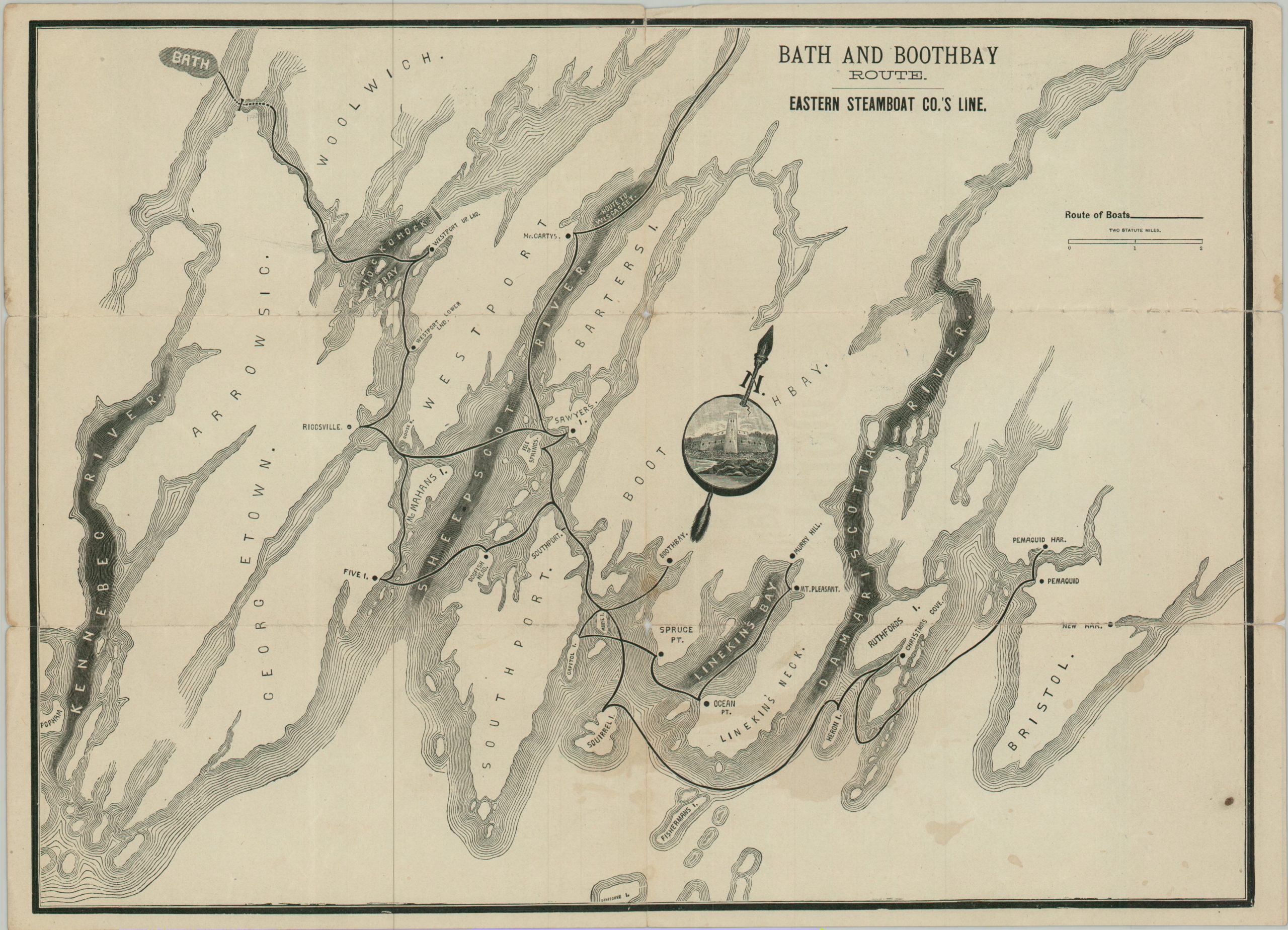
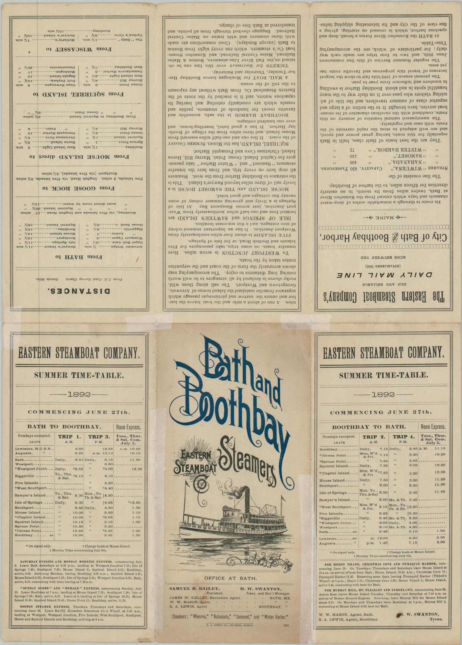
This ephemeral map and timetable was published by the Rand Avery Supply Company of Boston to promote the 1892 summer excursions available on the Bath and Boothbay Steamship Route. Operated by the Eastern Steamboat Company, a fleet of four ships regularly departed from Bath for a network of coastal destinations that were rapidly exploding in popularity among seasonal travelers from New England’s major cities. These urban tourists, known colloquially as “Rusticators,” sought to escape the oppressive summer heat to enjoy natural, coastal retreats. To serve their growing numbers, an array of grand wooden hotels, boarding houses, and private cottages were established at landings across the region.
The straightforward map outlines the vessels’ winding island-hopping route between Bath (upper left) and Pemaquid Harbor (lower right). Apart from major geographic features, islands, and the individual passenger stops – such as Riggsville, Sawyer’s Island, and Ocean Point – there are few distracting toponyms to obscure the graphic, perhaps leaning into the tranquil “rustic” appeal of the destination. The decorative compass rose features a detailed view of Fort Popham, the massive Civil War-era granite fortress sitting at the mouth of the Kennebec River that served as a major visual landmark for passengers. The verso of the sheet offers rich descriptive text about the route, a comprehensive list of departure times, and additional traveler information.
Map Details
Publication Date: 1892
Author: Rand Avery Supply Company
Sheet Width (in): 15.20
Sheet Height (in): 10.90
Condition: B
Condition Description: Double-sided brochure in six panels, with heavy wear, splits, and toning along folds. Archival repairs on verso have stabilized the sheet, but there is still a bit of spotting and edge wear.
Out of stock