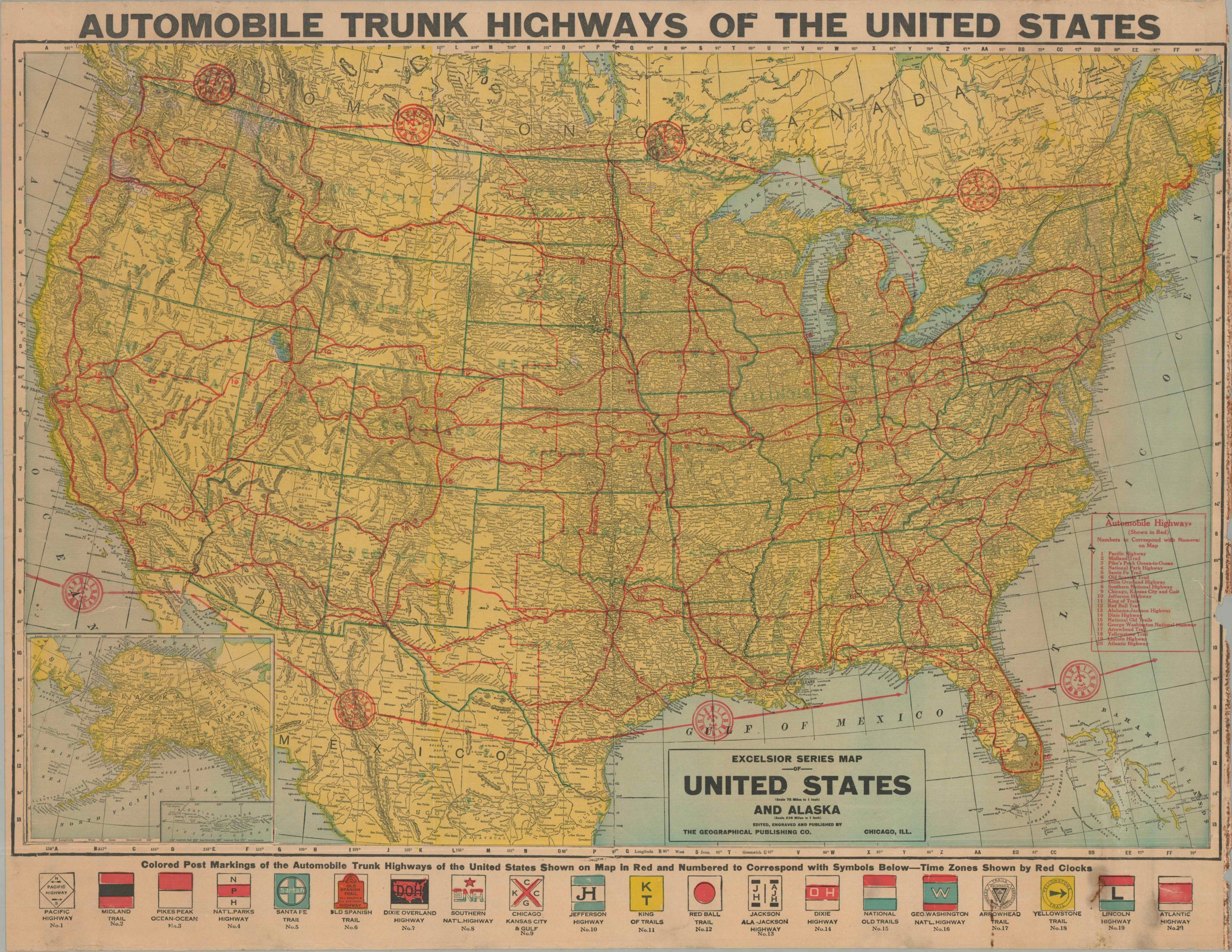
Automobile Trunk Highways of the United States
$500.00
A sharp depiction of America’s highways in the early 1920s.
1 in stock
Description
This eye-catching wall map of America’s evolving transportation network was published around 1921 by the Geographical Publishing Company of Chicago. The firm’s Excelsior Series Map of the United States and Alaska has been updated with red overprinting and a series of illustrated pole markings, transforming a mundane political overview into an uncommon snapshot of the country’s early road network. Twenty different Automobile Highways are shown in bright red, stretching from coast to coast and visually surpassing the railroads (represented with small black lines). Of particular interest are the three popular transcontinental routes: Lincoln Highway (#19), National Old Trails Road (#15), and the Old Spanish Trail (#6). Others, like the Red Ball Trail, Pacific Highway, and Arrowhead Trail, are regional in scope and were perhaps included to ensure broad geographic distribution.
These motorways were sponsored by private organizations that relied on local participants to post signage (shown along the bottom) and distribute promotional material. Competition could be fierce, routes were inefficient and often overlapped, and the lack of any supervising authority meant that accurate information could be difficult to obtain. The implementation of the National Numbered Highway System in 1926 was done in large part to alleviate these issues.
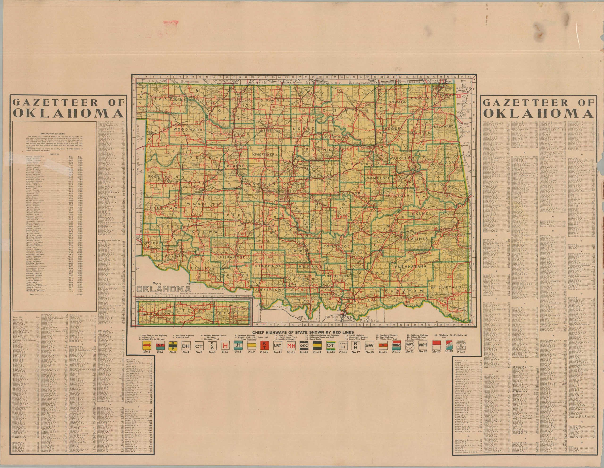
The verso of the sheet offers a Gazetteer of Oklahoma, which provides a color map in addition to an index of towns and their populations, which ranged from 2 (Fonda, Ziegler) to 91,295 (Oklahoma City). The hundreds of entries reflect an impressive growth since the first Sooners settled on the former Indian Territory about three decades earlier. As on the recto, the map shows the Chief Highways of Oklahoma in red, twenty-five in total, with their corresponding markings illustrated along the bottom.
Map Details
Publication Date: c. 1921
Author: Geographical Publishing Company
Sheet Width (in): 35.50
Sheet Height (in): 27.75
Condition: B-
Condition Description: Double-sided map on a single unfolded sheet, formerly part of a set enclosed within a metal band on the right side. There is heavy wear, rusting, and minor image loss along that edge as a result. About a 6" closed tear repaired on the verso with archival tape, along with a few other closed tears on the left edge that are less offensive. Soiling and rusting in the lower right, along with a few other spots of scattered soiling. Better than fair, but not quite good condition overall.
$500.00
1 in stock