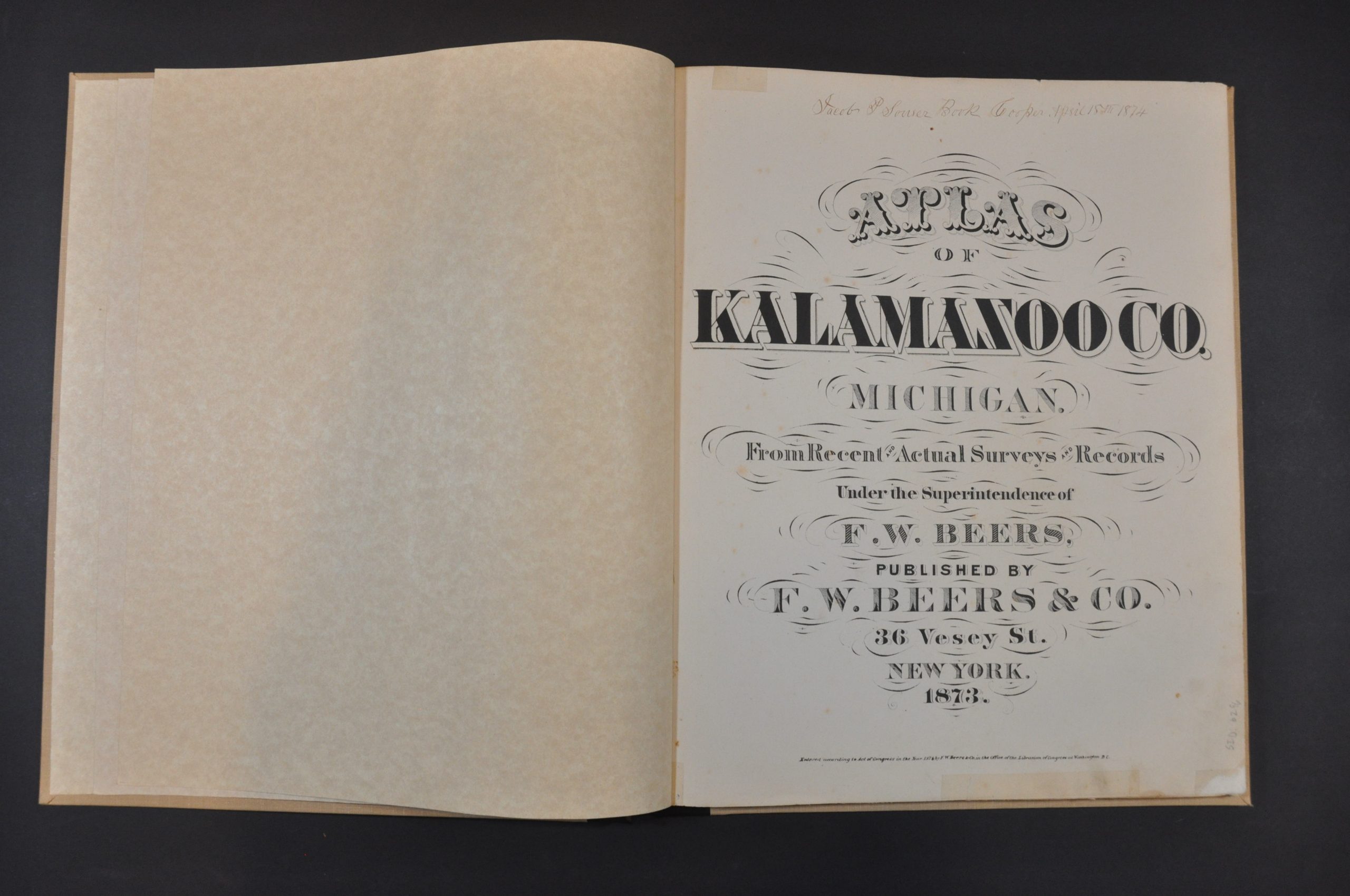
Atlas of Kalamazoo Co. Michigan
Detailed atlas of Kalamazoo County, Michigan in the early 1870s.
Out of stock


Description
This incredible atlas provides a thorough overview of Kalamazoo County, Michigan near the end of the 19th century. A river, city, and township all share the name of the county in the southern part of the state’s ‘boot’, but its exact indigenous etymology is debated. The atlas is comprised of 96 pages, the contents of which can be summarized as follows.
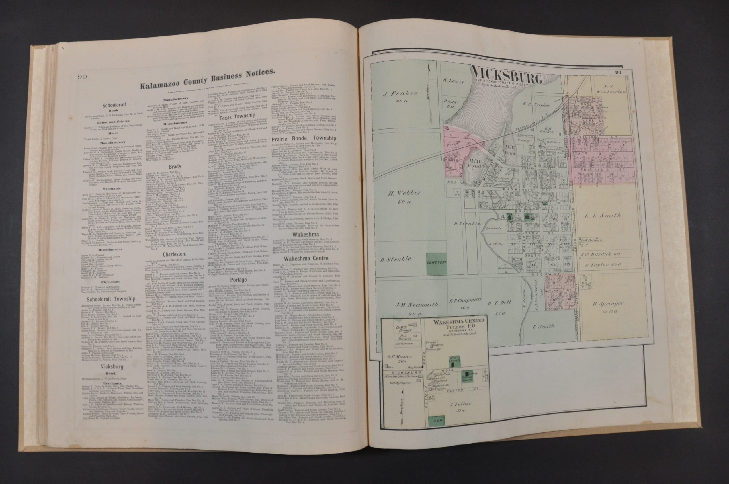
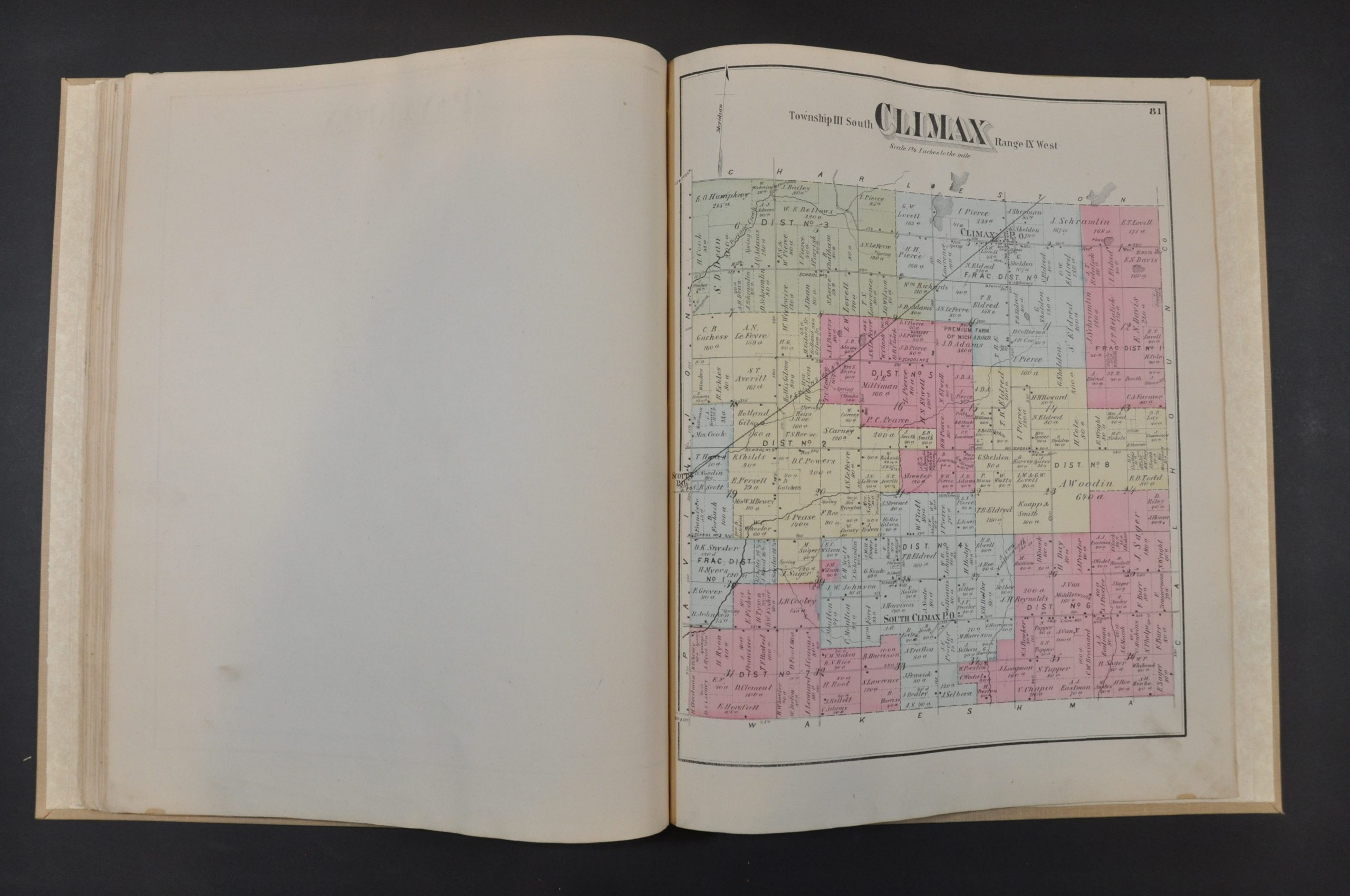
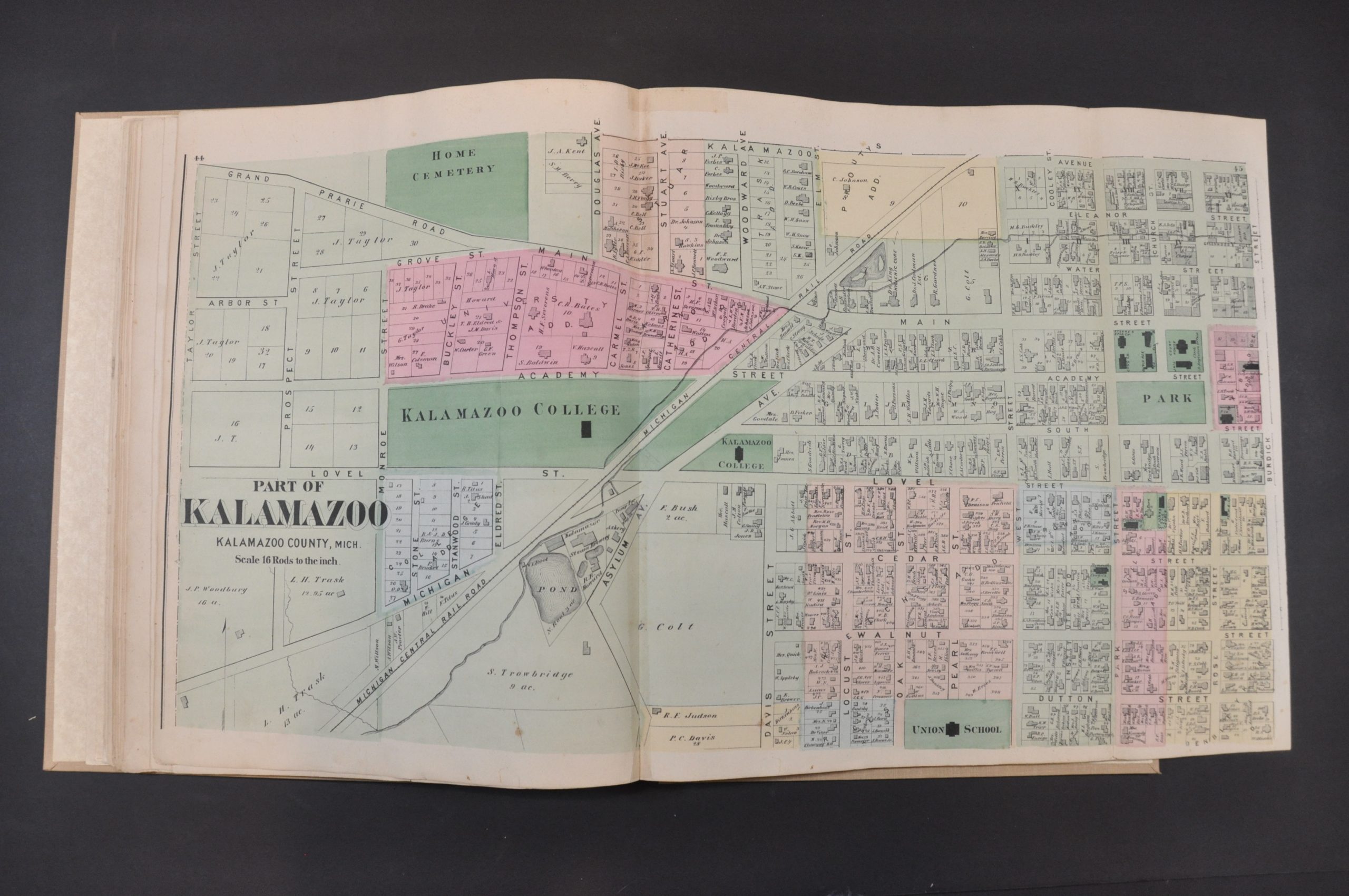
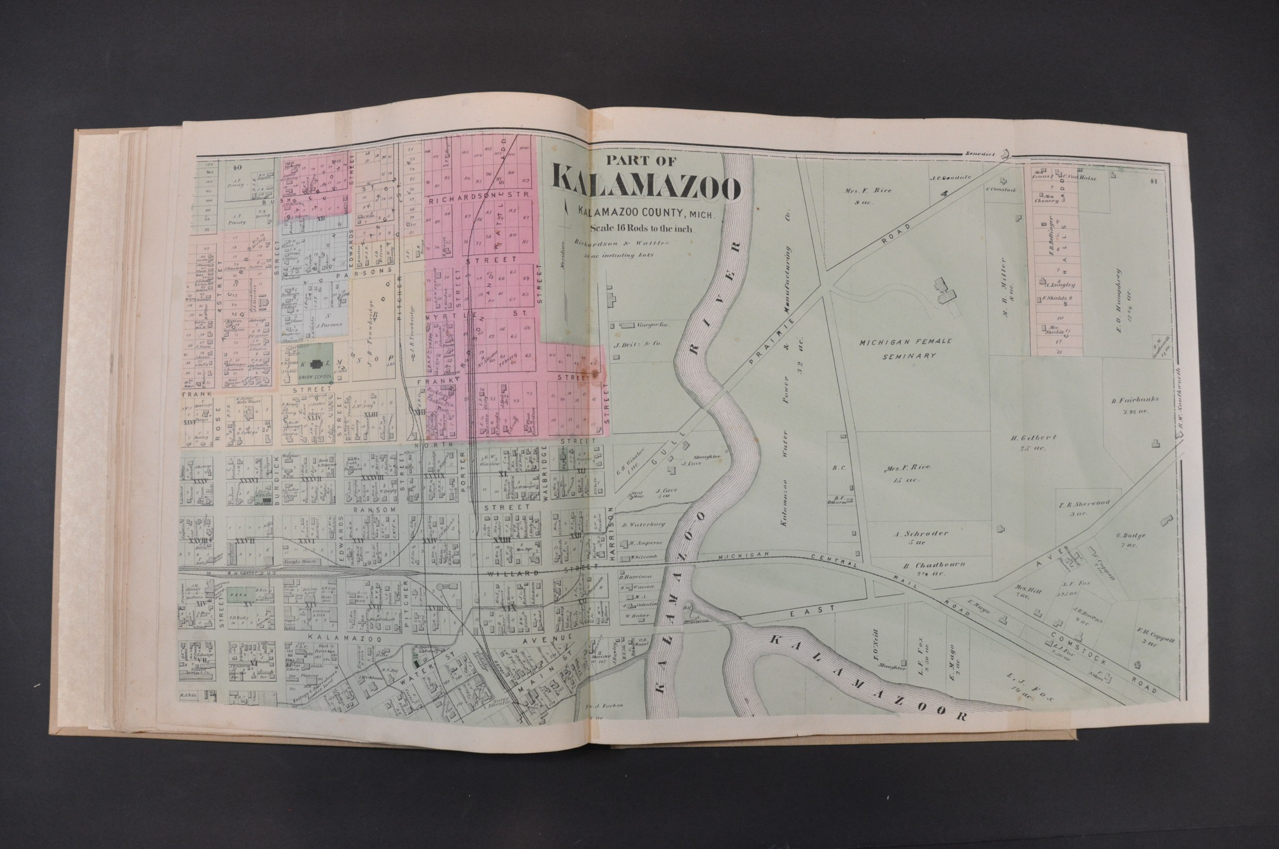
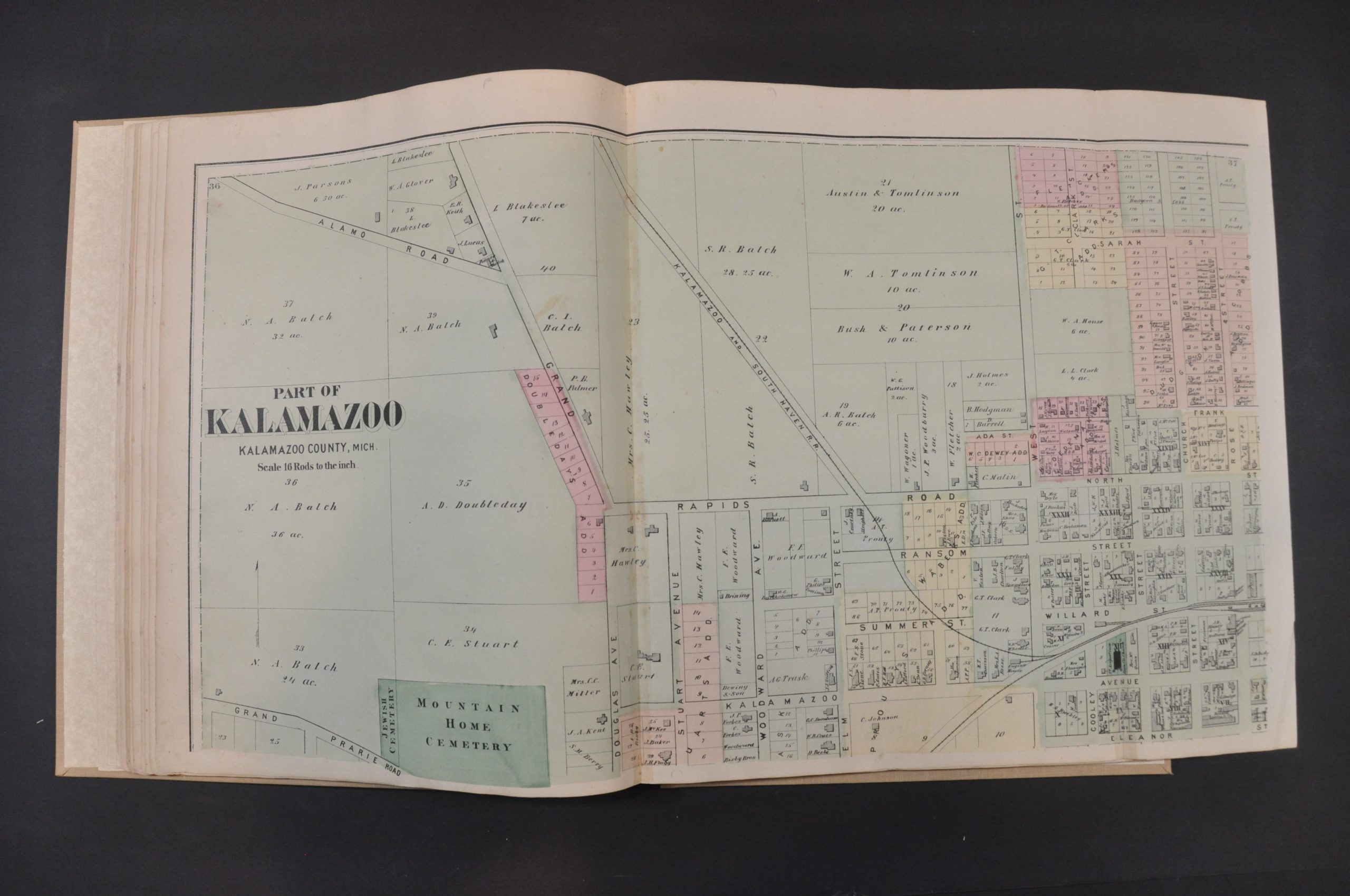
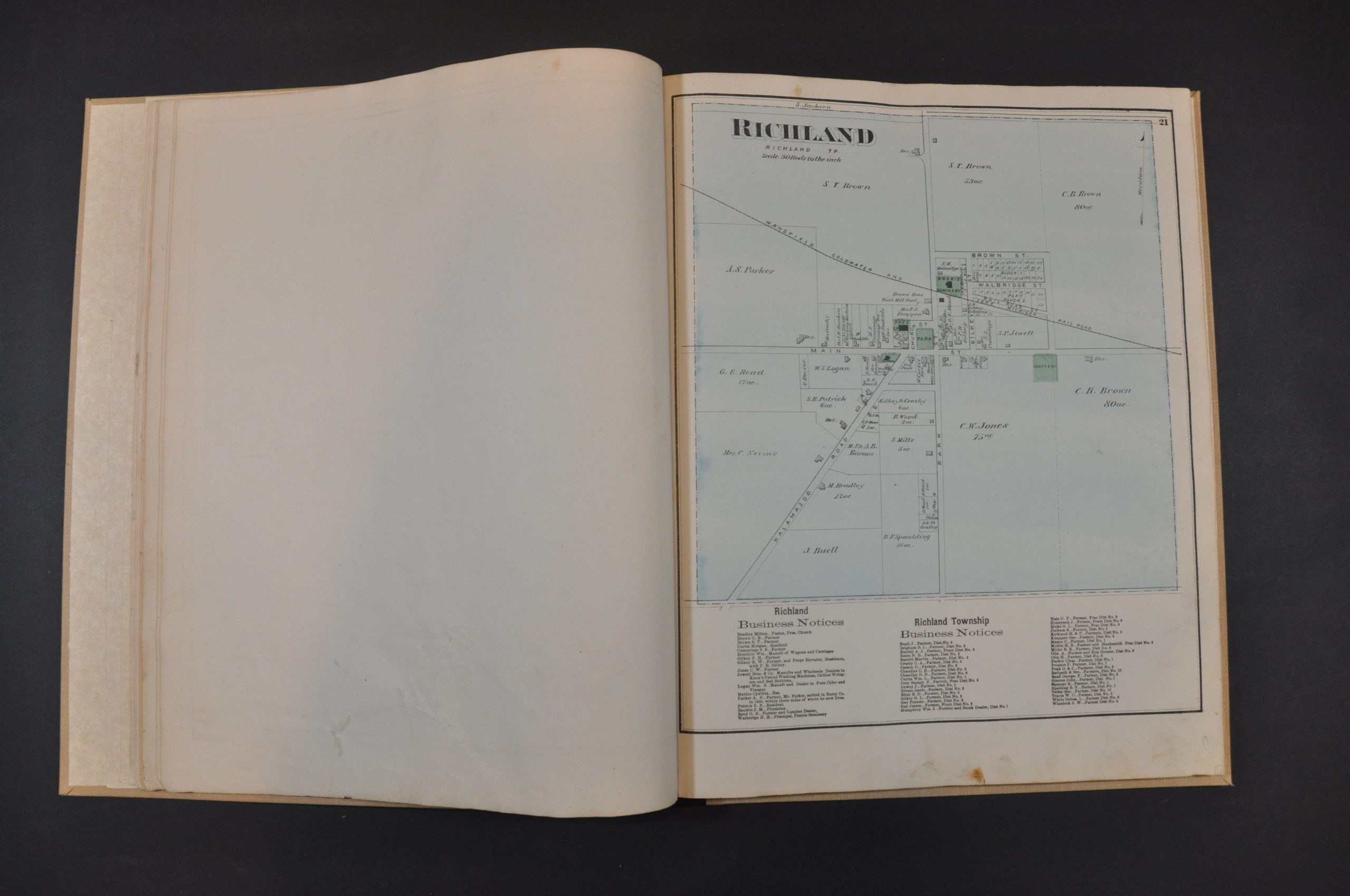
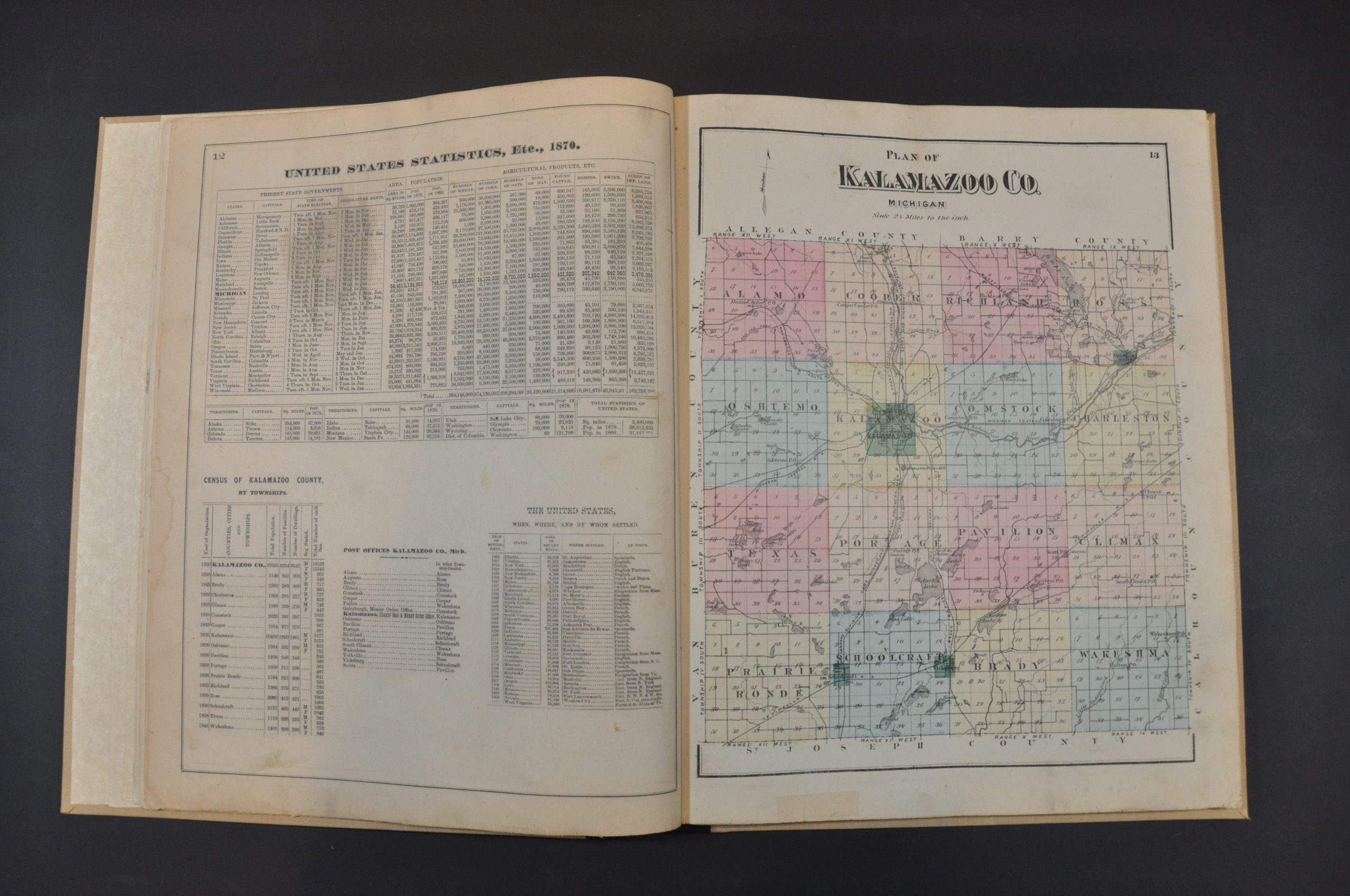
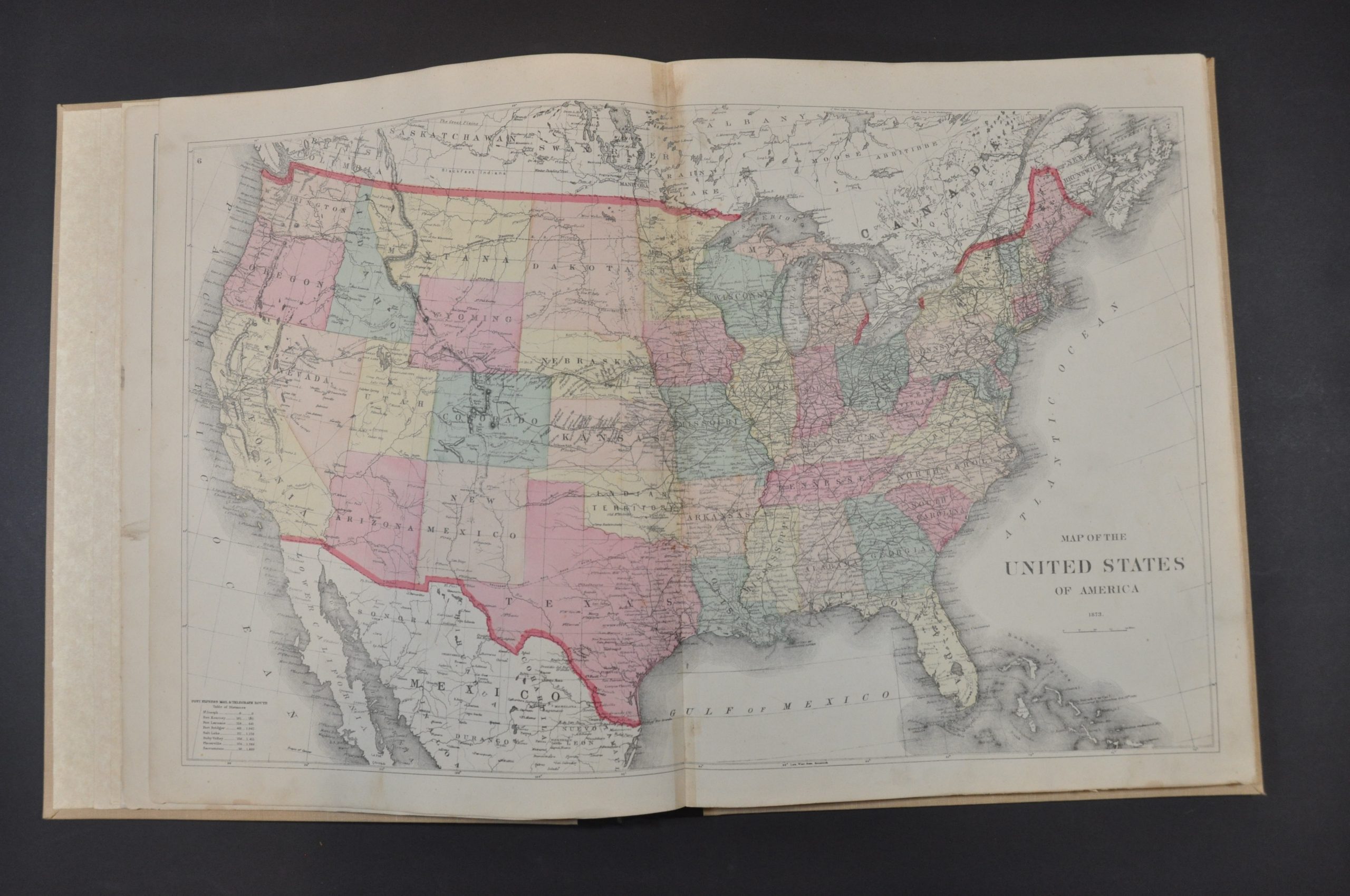
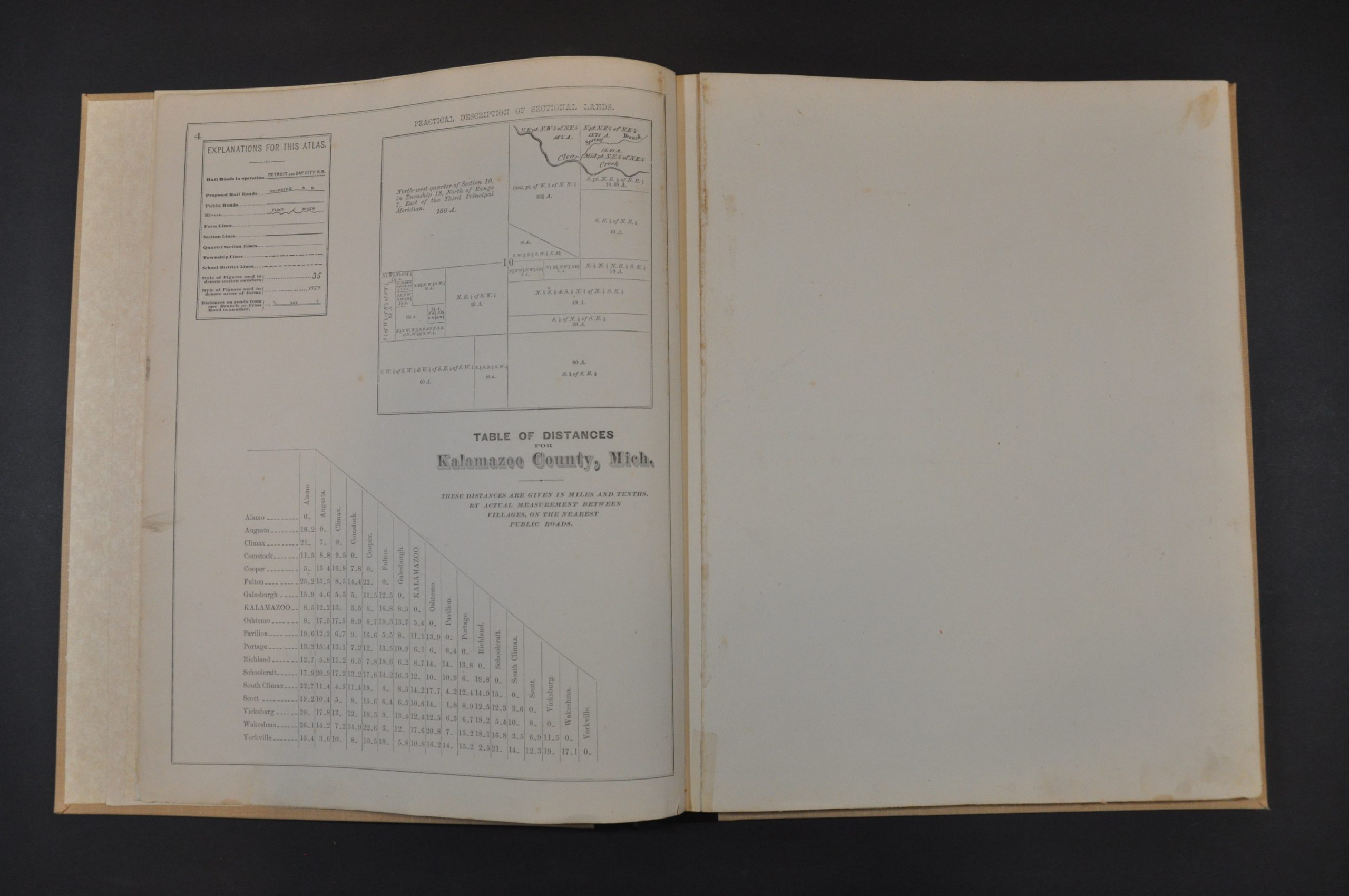
Original title page and table of contents are followed by a general reference sheet outlining a table of distances across the county, a legend, and a visualization of how land is sectioned during surveying. Then comes a double-page map of the United States, a sheet of population statistics, and single-page maps (probably by Colton) of Michigan and its Upper Peninsula/Lake Superior. The next page presents a map of Kalamazoo County, noting transportation routes, settlements, post offices, and geographic features – including the numerous lakes that dot the region. These are followed by 10 double-page and 22 single-page maps of townships, village street plans, and city wards. The majority of these provide information on land ownership, property divisions, public areas (parks, cemeteries, etc.), and important buildings. Of particular interest is the eight-sheet plan of Kalamazoo – each plate has a folding flap to ensure the entire city is covered.
Historical sketches provide fascinating background information about many of the referenced communities. Numerous maps include business directories and lists of local patrons. This likely refers to the list of residents and business people who ‘subscribed’ to the publication of the atlas by providing funds up-front to defray the costs. This was a common method of publishing county atlases in the late-19th century. For a set fee, subscribers were among the first to receive the finished work and often had the opportunity to pay extra for custom additions. As a result, many examples of county atlases include portraits of individual patrons, views of personal residences and businesses, and even images of prize farm animals!
The maps were surveyed and drafted under the direction of F.W. Beers. The atlas was published in New York by F.W. Beers and Co. in 1873.
Map Details
Publication Date: 1873
Author: F.W. Beers
Sheet Width (in): 16
Sheet Height (in): 13
Condition: A-
Condition Description: Professionally restored and rebound in new full brown cloth with black leather spine. Original gilt embossed cover has been cut and adhered to the front. New textured endpapers. Contents are complete - 96 pages with 11 double page (including 8 fold outs) and 23 single page maps. Generally in very good condition, with scattered soiling, a few old tape repairs, spotting, and closed marginal tears. Old owner's inscription on the title page, dated 1874. Moderate soiling along the vertical centerfold on several sheets, and a few others have small dark spots of staining, usually no bigger than a dime.
Out of stock