
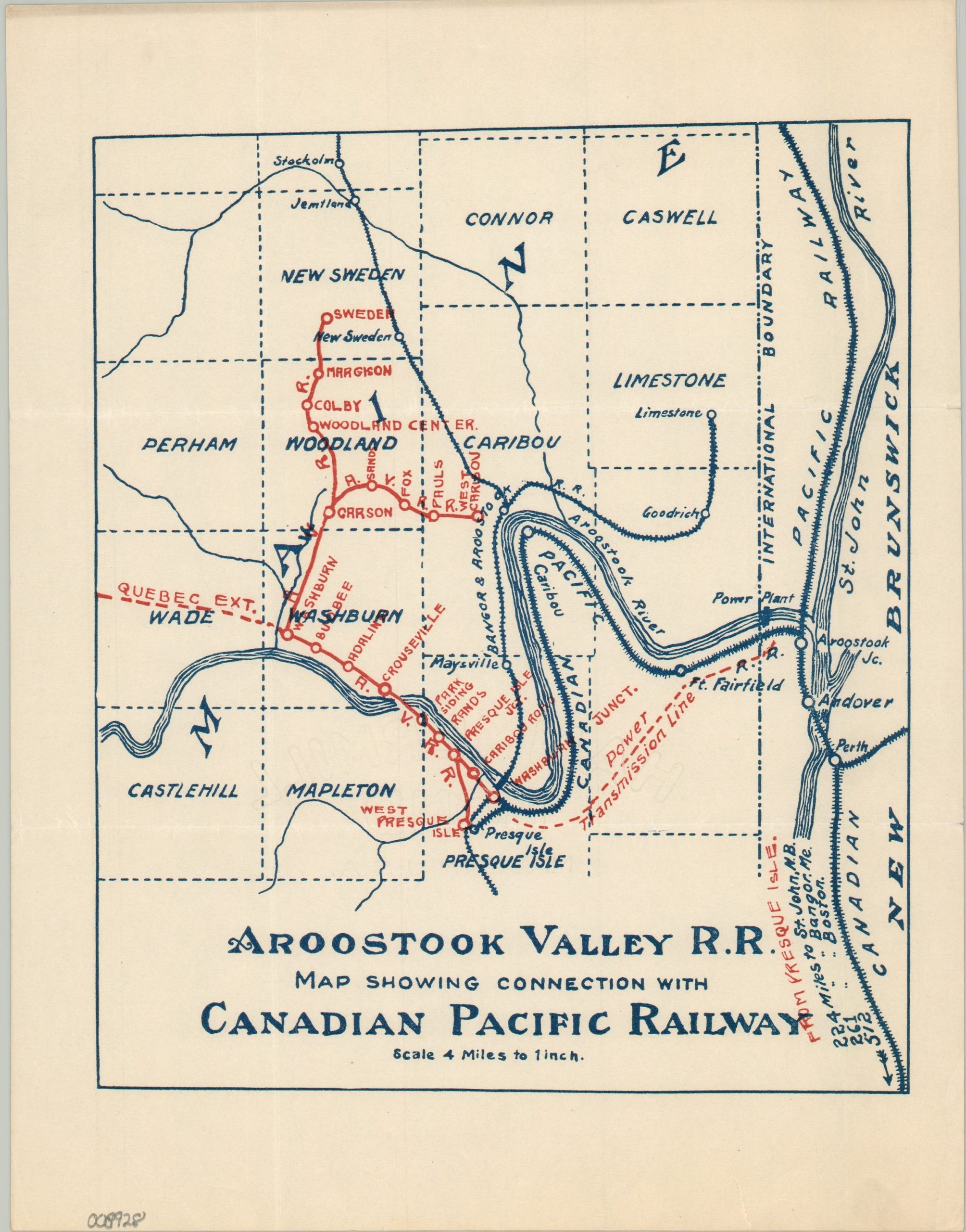
Aroostook Valley R.R. Map Showing Connection with Canadian Pacific Railway
$250.00
Regional connections of the Aroostook Valley Railroad.
1 in stock
Description
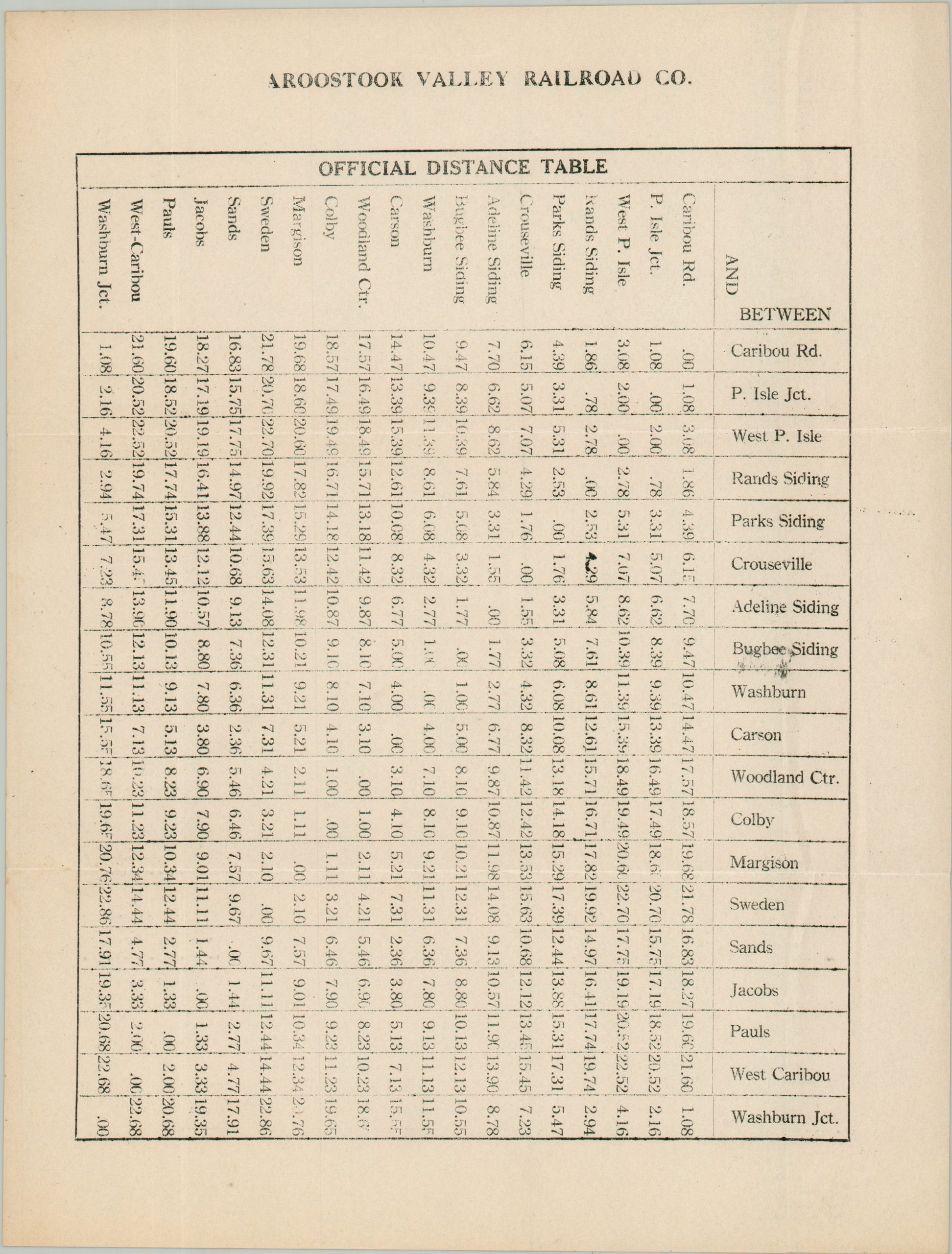
This uncommon map and accompanying distance table were issued, probably around 1930, to highlight the operations of the Aroostook Valley Railroad. The routes are shown in red, running between the towns of West Presque Isle, Sweden, and Caribou in Northern Maine. The Quebec Extension, power transmission lines, and the Canadian Pacific Railway are also noted. The table of distances offers a handy reference – the longest segment (Sweden to Washburn Junction) was only about 23 miles.
The Aroostook Valley Railroad was the brainchild of successful Maine businessman and politician Arthur Gould, who hoped to use the line to access new timber reserves. A charter was granted in 1902, but construction on the electrified line wasn’t completed until 1910. In addition to passengers, the most popular freight product was Aroostook County’s famous potato harvest. Gould had plans for an extension (shown on the map), but sold his interests to the Canadian Pacific in 1932. Diesel conversion took place in the 1940s, around the time that passenger service ended. Operations continued, but slowed down after the completion of the Interstate system, eventually ending completely in 1996.
Source: Maine Memory
Map Details
Publication Date: c. 1930
Author: Aroostook Valley Railroad
Sheet Width (in): 8.50
Sheet Height (in): 11.00
Condition: A
Condition Description: Two sheets - a single-sided timetable and map, size given for the latter. Light wear, consistent with age, with some toning on the timetable. Very good condition overall.
$250.00
1 in stock