Arnold Arboretum (Harvard University)
$275.00
Scarce turn of the century pocket map showing the oldest arboretum in the U.S.
1 in stock

Description
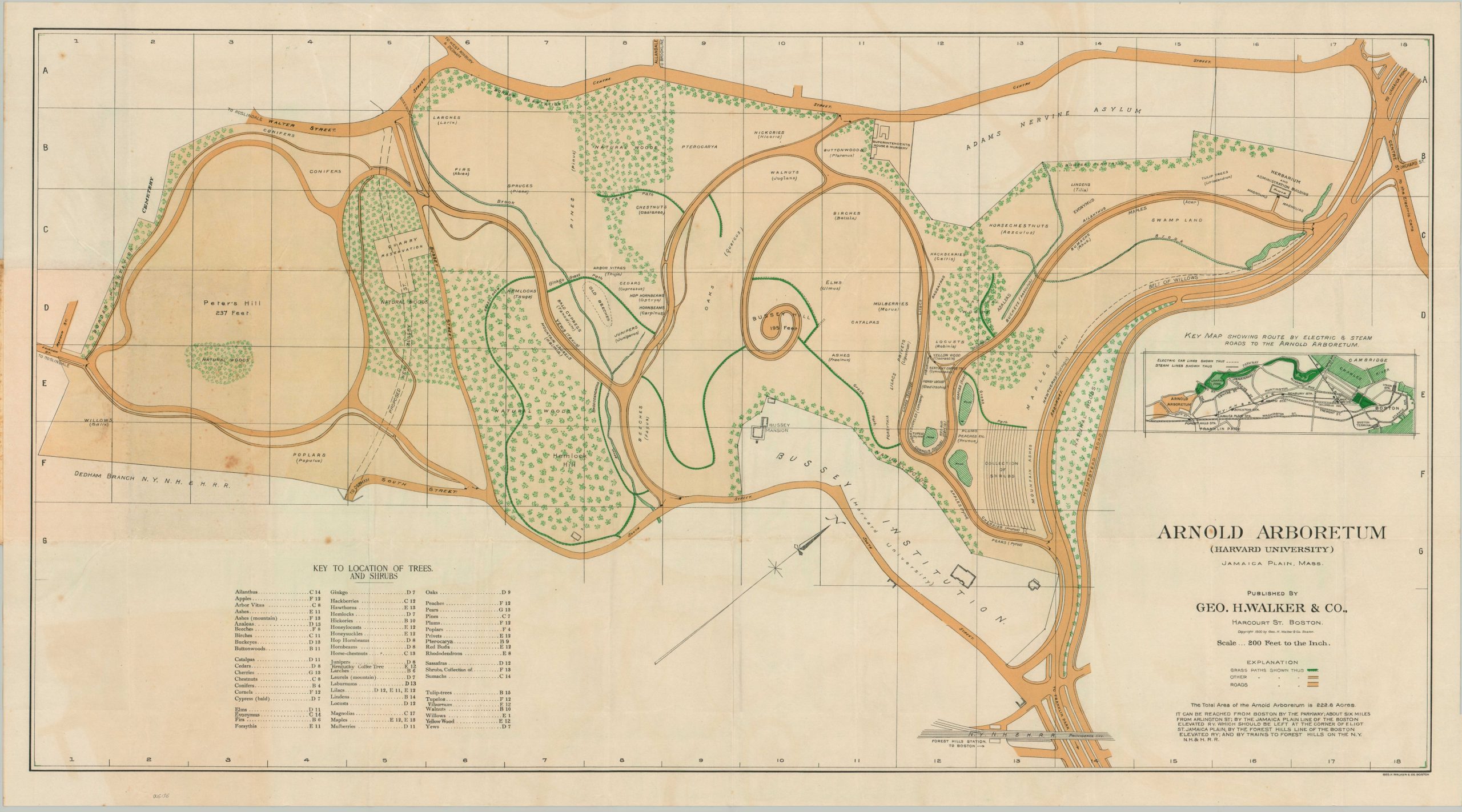
This detailed plan shows the grounds of Harvard-affiliated Arnold Arboretum in Jamaica Plain, Massachusetts. It was copywritten and published in nearby Boston by George H. Walker & Company in 1900. Named after the original donor of (some) of the land on which it sits, Arnold Arboretum is comprised of over 220 acres and is the oldest public arboretum in the United States.
The network of paths and roads is colored amid labeled buildings and landscape features designed by Charles Sprague Sargent and Frederick Law Olmsted. Over sixty different species of trees and shrubs are identified in the corresponding key (lower left). An inset shows the electric and steam railway lines to Boston, with further transportation details provided by the text block in the lower right.
The map is uncommon on the market and institutionally. As of May 2024, WorldCat notes examples in 3 different institutions – Harvard University (2 examples), the American Antiquarian Society, and the Boston Athenaeum. The Boston Public Library also holds a copy. OCLC# 7764486.
Map Details
Publication Date: 1900
Author: George H. Walker & Co.
Sheet Width (in): 37
Sheet Height (in): 20.5
Condition: B+
Condition Description: Pocket map folded into 36 panels and affixed to original paper wraps. Moderate irregular creasing and some waviness visible` throughout the sheet, though no loss of image or separation. Moderate spotting visible on the left side, concentrated in the center, adjacent to the covers. Good condition overall. Blank on verso.
$275.00
1 in stock