Arkansas Twin Lakes and White River in Northwest Arkansas
$95.00
The striking majesty of the Ozark Mountains, near the border of Missouri and Arkansas.
1 in stock
Description
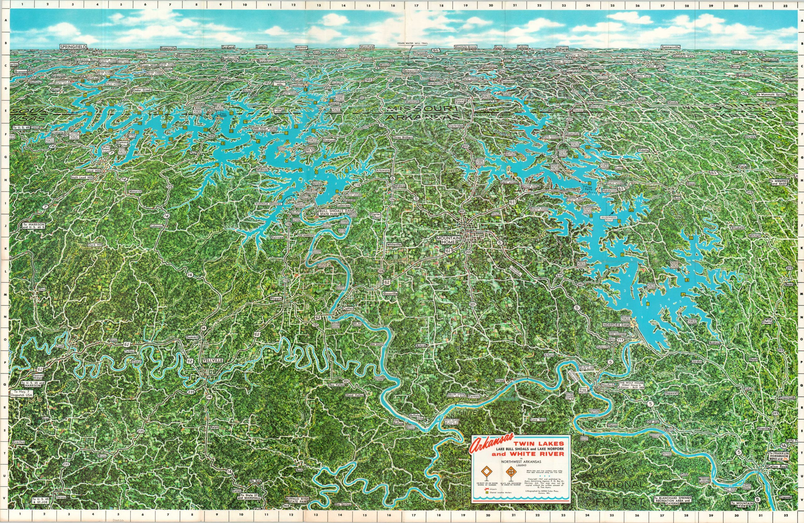
Major hydroelectric projects totally transformed the landscape of the Ozark Mountains during the 20th century; creating numerous dams, reservoirs, and controlled waterways that facilitated a burst of industrial and recreational enthusiasm. This map shows the Twin Lakes and White River areas in northwestern Arkansas, featuring two large artificial bodies of water.
The solid, almost uncanny, blue waters of Lake Bull Shoals and Lake Norfork make a striking visual statement, surrounded by the verdant green forests of the Ozark Mountains. Towns, transportation routes, geographic features, and boating access points are labeled throughout the image. Numerous local advertisements are printed on the verso.
The image, signed Stewart in the lower right, was copyrighted in 1967 by the Ayers Advertising Agency of Harrison, Arkansas. Published in several editions, this one dated 1971-1972 on the front panel. Lithographed by MWM Color Press of Aurora, Missouri.
Map Details
Publication Date: 1971
Author: Ayers Advertising Agency
Sheet Width (in): 34
Sheet Height (in): 21.9
Condition: B+
Condition Description: Large centerfold image printed on one side of a folding brochure. Several areas of clean separation along folds (about 4" cumulatively) repaired on the verso with archival tape. Numerous small edge tears and some light toning in the margins, concentrated most heavily in the lower left (see scan). Good condition overall.
$95.00
1 in stock