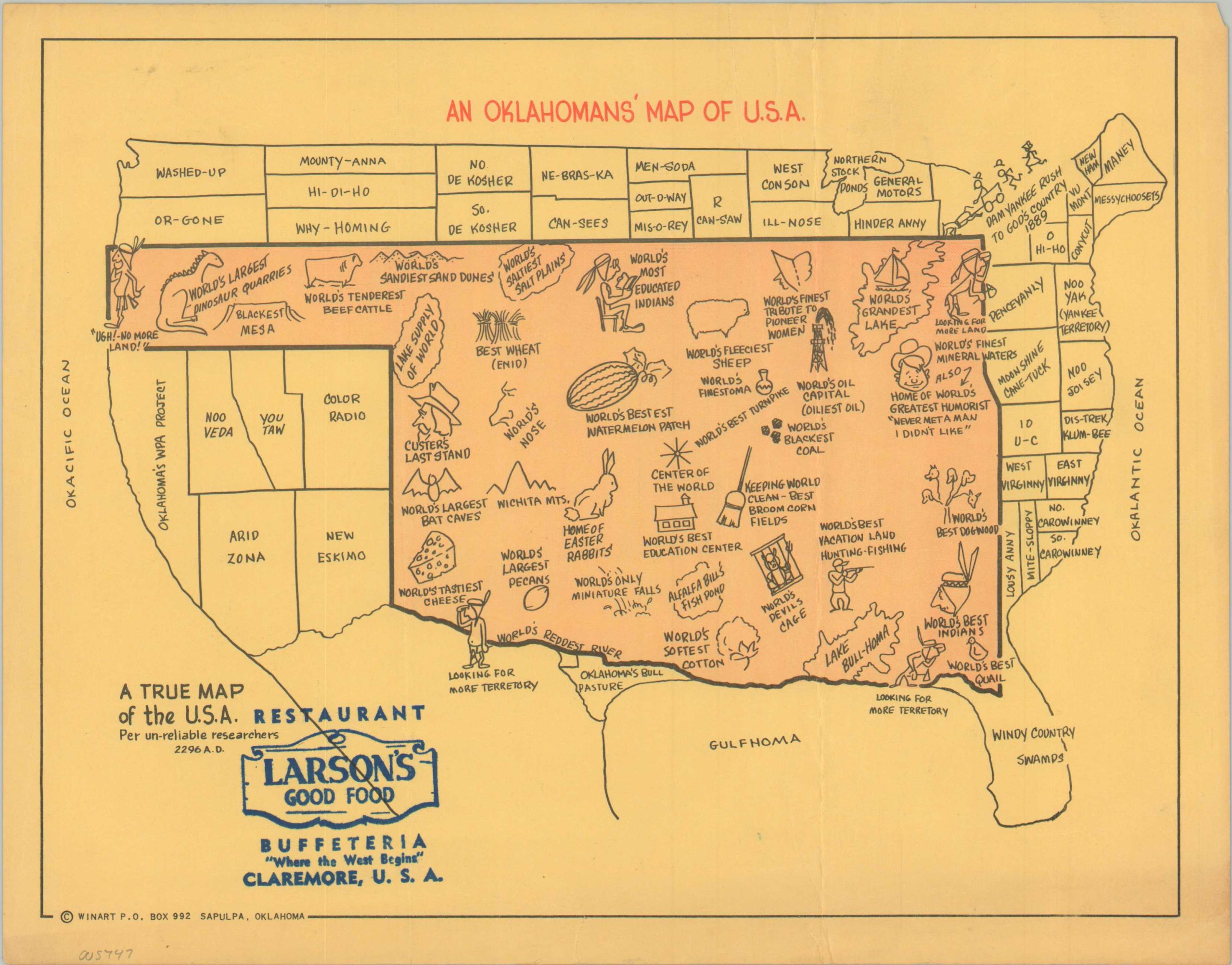
An Oklahoman’s Map of U.S.A.
$225.00
“A true map of the U.S.A., per un-reliable researchers.”
1 in stock
Description
This uncommon and humorous pictorial map was designed by WinArt of Sapulpa, OK, and published to promote Larson’s Buffeteria in Claremore, OK. The Sooner State occupies the majority of America, with the other states clustered around the borders and labeled using an amusing mix of literal Southern ‘twang and geographic illiteracy.
Numerous vignettes are captioned with a host of superlatives that describe Oklahoma’s geographic features, agricultural products, and industrial exports. Examples include the World’s Largest Dinosaur Quarries, the World’s Fleeciest Sheep, and the World’s Reddest River. Native Americans are referenced throughout in a contemporary stereotypical style. Several are shown searching for ‘more land’ along the outer edges of the sheet – a gross misinterpretation of Oklahoma’s history.
The map was published as a tri-fold souvenir, designed to be folded and mailed, with spots for addresses and stamps on the verso. Scarce and unlisted in WorldCat, though examples have been identified in the archives at the University of Tulsa and Oklahoma University.
Map Details
Publication Date: c. 1955
Author: Winart
Sheet Width (in): 11
Sheet Height (in): 8.5
Condition: B+
Condition Description: Creasing and light wear, including a bit of wrinkling and small tears, along the outer edges and orignally issued fold lines. Good to very good condition overall.
$225.00
1 in stock

