An Historical and Pictorial Map of Casco Bay
$250.00
Bicentennial reprint of a vibrant pictorial map of Maine’s southern coast.
1 in stock
Description
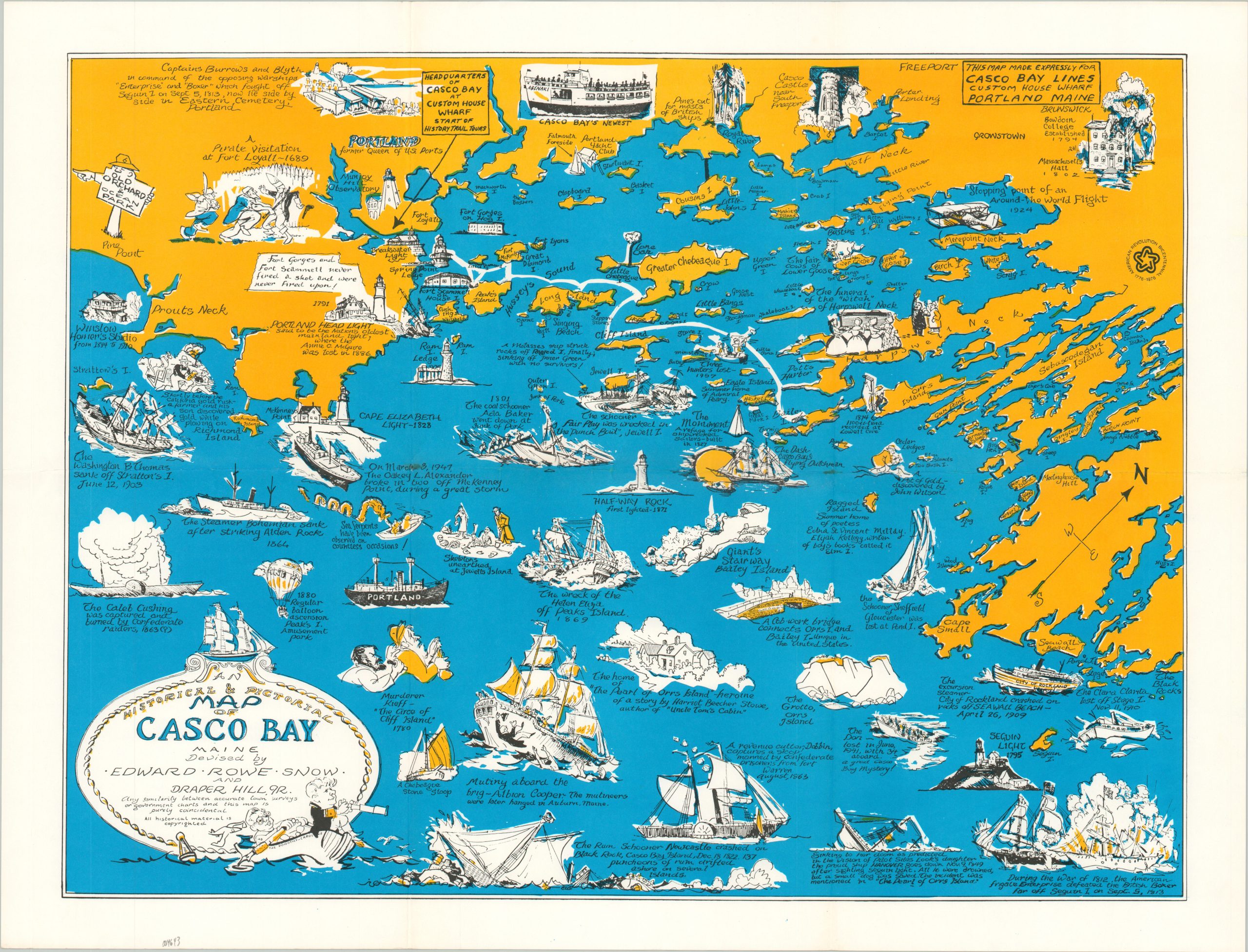
This lively map of Casco Bay covers an approximately 60-mile swath of the southern Maine coastline between Pine Point and the Black Rocks. It was issued as a tourist map for a local ferry company and its numerous vignettes highlight the area’s rich maritime traditions, history, and architecture.
The unfortunate fates of over a dozen different ships are illustrated and captioned, along with coastal lighthouses and notable historic events. Interesting examples include the use of a hot-air balloon at Peak’s Island Amusement Park, a witches funeral at Harpswell Neck, and even sightings of sea serpents!
The map was drawn by Edward Rowe Snow and Draper Hill, Jr. and published for the Casco Bay Lines in Portland around 1950. This particular example was reissued in 1976, according to the American Bicentennial Logo in the upper right. The original Casco Bay Lines went bankrupt just a few years after publication (1981) and was acquired by the Casco Bay Island Transit District, who maintains operations to this day.
Sources: Casco Bay Lines;
Map Details
Publication Date: 1976
Author: Edward Rowe Snow and Draper Hill, Jr.
Sheet Width (in): 22.75
Sheet Height (in): 17.25
Condition: A
Condition Description: Light creasing along old fold lines and minor wear at the fold intersections in the center of the sheet. Otherwise in fine condition.
$250.00
1 in stock