An Historical and Pictorial Map of Casco Bay
Original, signed edition of a vibrant pictorial map of Maine’s southern coast.
Out of stock
Description
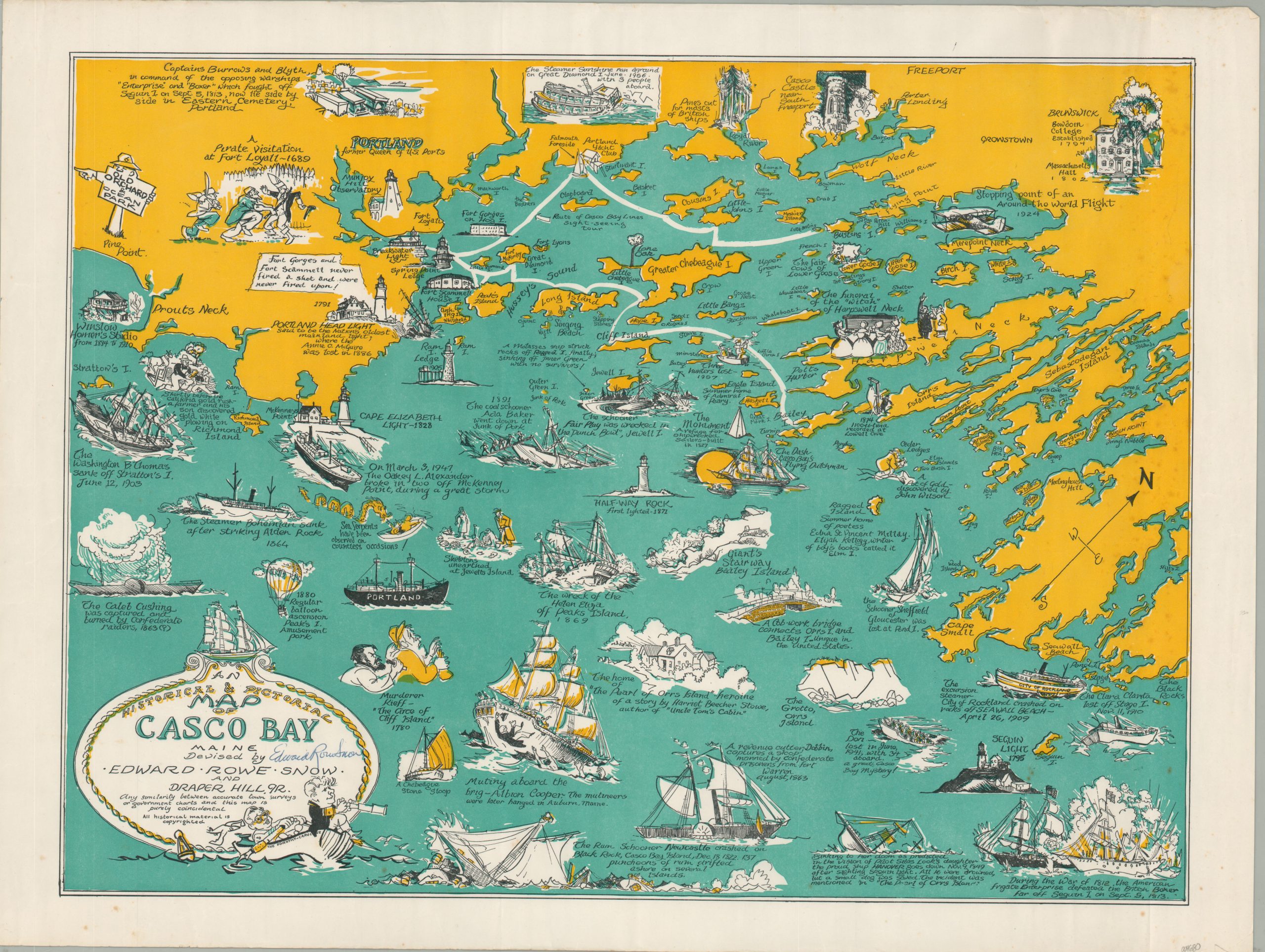
This lively map of Casco Bay covers an approximately 60 mile swath of the southern Maine coastline between Pine Point and the Black Rocks. It was issued as a tourist map for a local ferry company and its numerous vignettes highlight the area’s rich maritime traditions, history, and architecture. The unfortunate fates of over a dozen different ships are illustrated and captioned, along with coastal lighthouses and notable historic events. Interesting examples include the use of a hot-air balloon at Peak’s Island Amusement Park, a witches funeral at Harpswell Neck, and even sightings of sea serpents!
The map was drawn by Edward Rowe Snow and Draper Hill, Jr. and published for the Casco Bay Lines in Portland around 1950. A signature possibly belonging to the artist (unverified) can be seen in the title cartouche. A second, more common, example was reissued in 1976, and has an American Bicentennial Logo in the upper right. The original Castco Bay Lines went bankrupt just a few years after publication of that map (1981) and was acquired by the Casco Bay Island Transit District, who maintains operations to this day.
Source: Casco Bay Lines;
Map Details
Publication Date: c. 1950
Author: Edward Rowe Snow and Draper Hill, Jr.
Sheet Width (in): 23.1
Sheet Height (in): 17.4
Condition: B+
Condition Description: Minor wrinkling throughout the image and around the outer edges of the sheet, where previously rolled. Scattered spotting in the margins and a bit in the upper right corner of the image. Artist's signature (unverified) in the title cartouche. Good to very good overall.
Out of stock