All About U.S. 27 A Fast and Scenic Route Between Canada and Fabulous Florida
“Drive Sensibly, Live and Let Live, Enjoy Your Trip on U.S. 27”.
Out of stock
Description
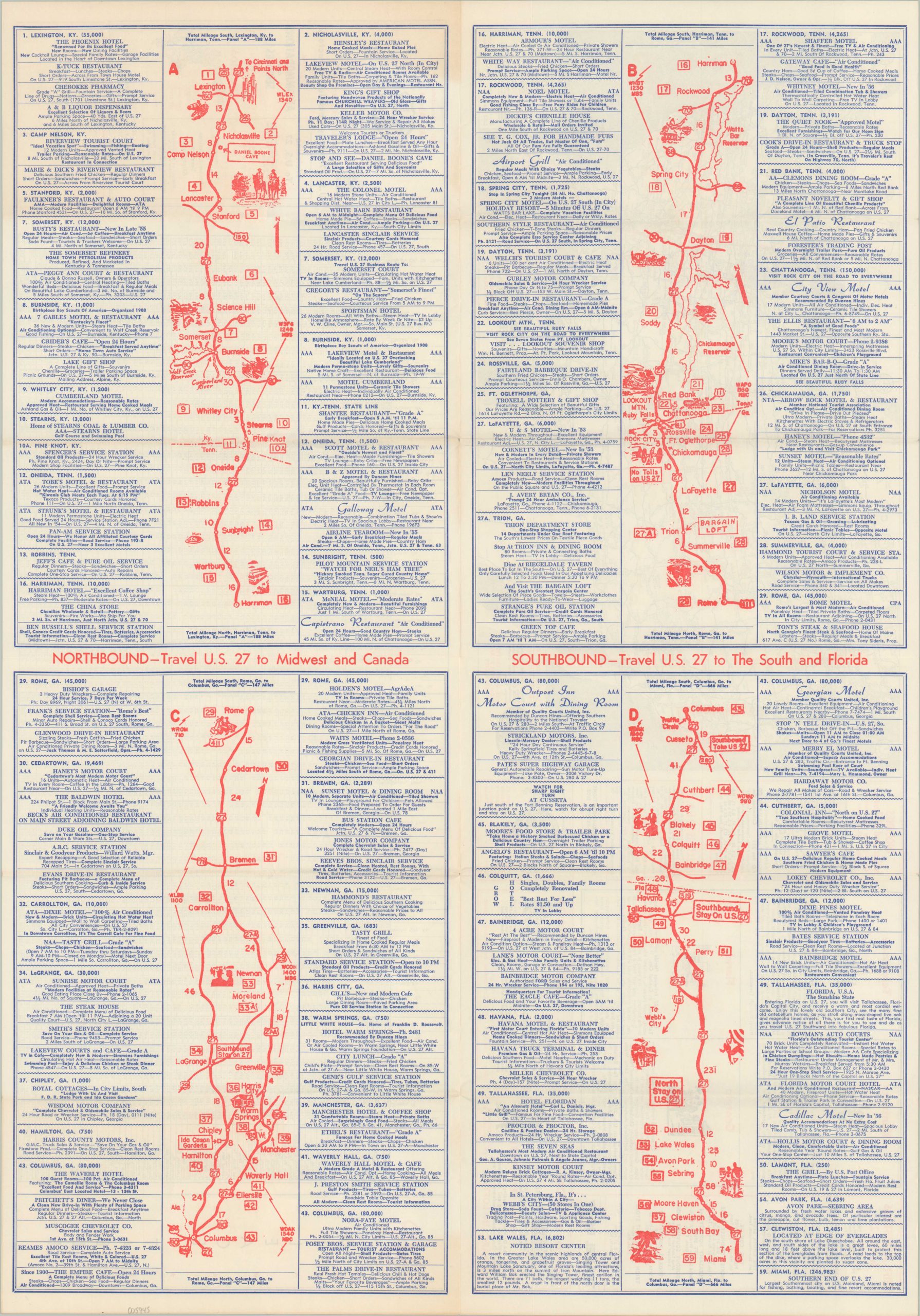
This utilitarian assembly of maps, advertisements, and mileage chart was compiled by the Highway Map Publishing Company of Columbus, GA in 1956. It was issued to promote motor tourism along the route of U.S. Highway 27, running from the Canadian border at Mackinaw City, Michigan all the way to Miami, Florida.
The brochure unfolds to show four strip maps that comprise the entire route. Primary settlements, distances between points, and locations of interest are noted within, while advertisements on either side provide information on local accommodations, restaurants, and traveler amenities. The verso presents additional promotions, as well as a road map of the U.S. and Highway 27 mileage chart.
Distributed compliments of the White Barn Restaurant in Lancaster, KY, according to the rubberstamp on the front cover.
Map Details
Publication Date: 1956
Author: Highway Map Publishing Company
Sheet Width (in): 18.75
Sheet Height (in): 26.6
Condition: A
Condition Description: Creasing and light wear along originally issued fold lines. Faint toning on the front cover. Very good overall.
Out of stock