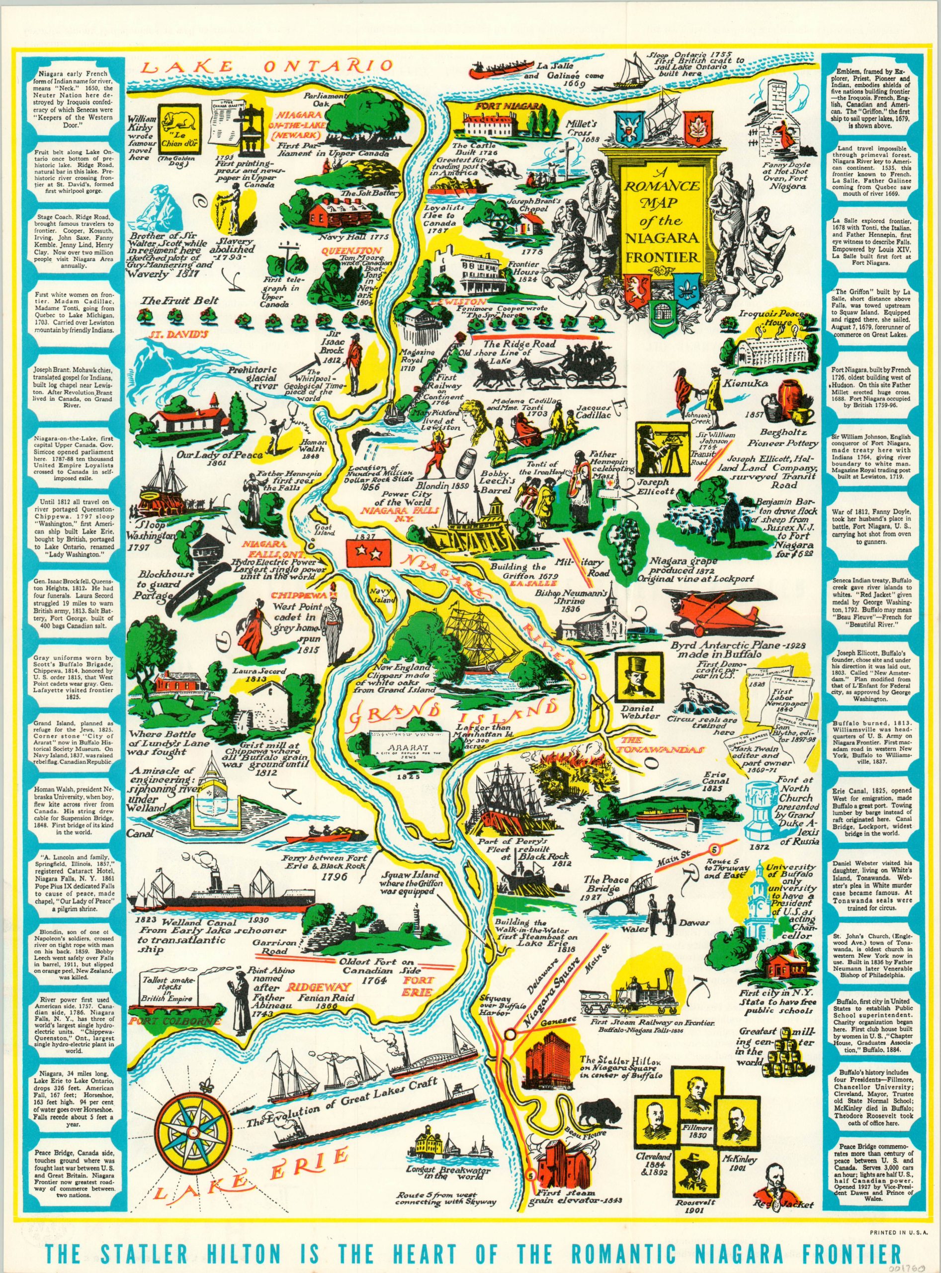
A Romance Map of the Niagara Frontier
Later issue of a popular pictorial map of the Niagara River.
Out of stock
Description
This interesting pictorial map captures the rich history of the Niagara Frontier, situated between Lakes Ontario and Erie along the border of Ontario and New York. It was originally produced in 1931 by Mildred Green and Josephine Wickser, the latter of whom would consult on several other productions in the popular ‘Romance Map’ series.
This particular example was issued shortly after the Statler Hotel was bought by the Hilton Company, and features a few updates from the original. Most obvious, the new hotel has been added to the bottom of the image, which omits the original authors and a few other vignettes.
Elsewhere, the image is largely the same; featuring charming illustrations and short annotations surrounded by a border comprised of more substantive historical notes. The verso features numerous photographs of the hotel and its interior, as well as a large scale plan of downtown Buffalo.
Map Details
Publication Date: c. 1955
Author: Mildred C. Green
Sheet Width (in): 12.00
Sheet Height (in): 16.00
Condition: A
Condition Description: Originally folded into a six panel brochure. Minor creasing along fold lines, otherwise in fine condition.
Out of stock