A Pictorial Map of Boston
Prewar pictorial map of Beantown, distributed by a local insurance broker.
Out of stock
Description
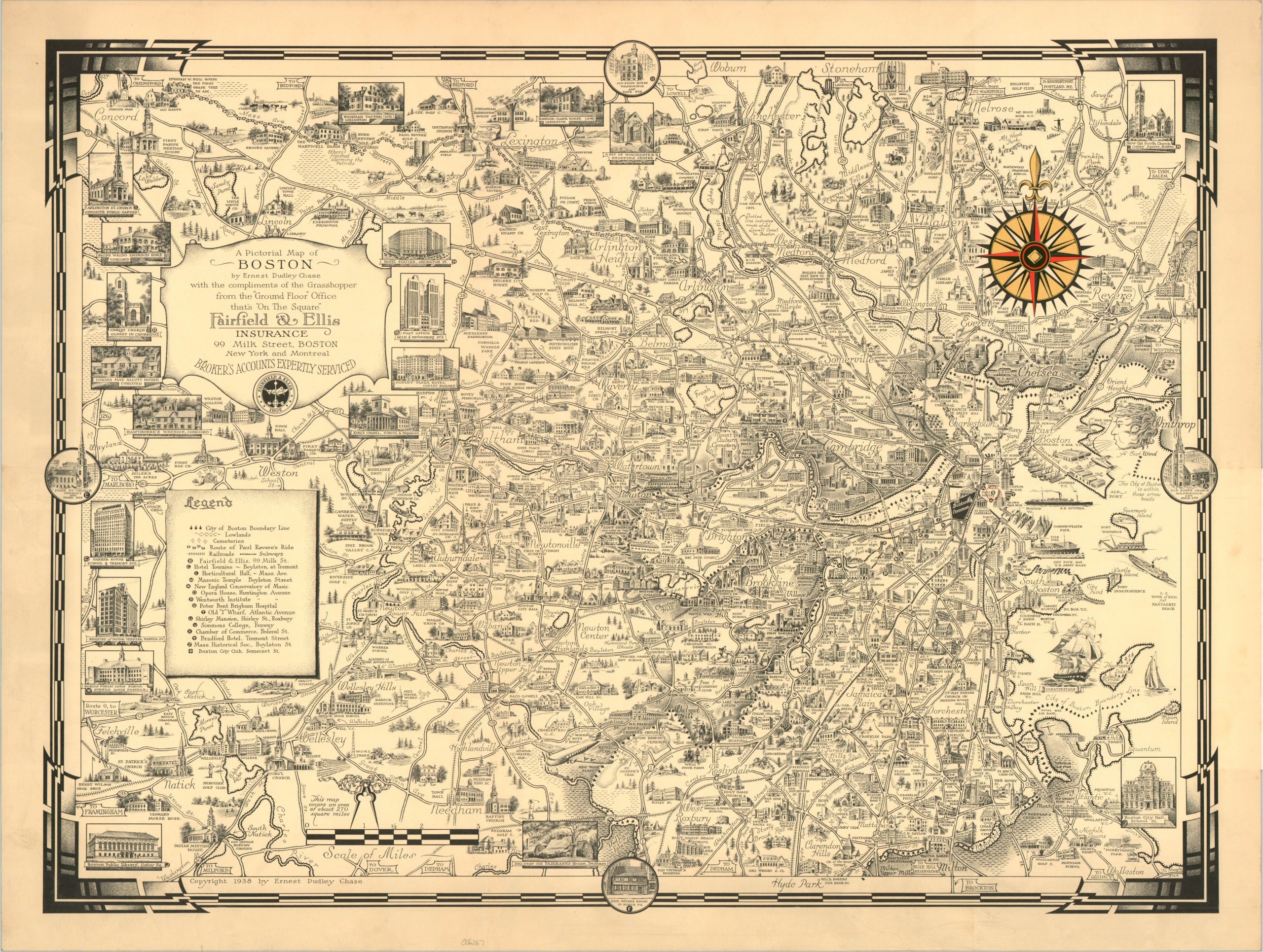
This engaging pictorial map covers an area of about 270 square miles in and around the historic city of Boston, Massachusetts. It was designed, illustrated, and published in 1938 by the talented Ernest Dudley Chase. Scores of vignettes showcase the historic and contemporary architecture of the region. Schools, churches, hospitals, and other important structures are faithfully represented and connected by a stylized network of transportation routes. Various locations of interest, the city boundary lines, and Paul Revere’s Ride are noted according to the legend in the center-left. The map was distributed ‘compliments of the Grasshopper’ by the Insurance firm of Fairfield & Ellis.
Ernest Dudley Chase (1878-1966) was an American cartographer and illustrator renowned for his intricately detailed pictorial maps covering various areas across America. Born in Lowell, Massachusetts, Chase initially worked as a greeting card designer before transitioning to mapmaking, where his artistic skills found a new outlet. His maps, celebrated for their artistic elegance and meticulous craftsmanship, often combined geographical accuracy with whimsical and decorative elements, reflecting both the cultural and historical context of the areas depicted.
Map Details
Publication Date: 1938
Author: Ernest Dudley Chase
Sheet Width (in): 25
Sheet Height (in): 19
Condition: A
Condition Description: Creased along an old vertical fold lines and faint toning and soling visible in the margins. Includes a gift tag from Fairfield & Ellis, affixed to the back and folded over. Very good condition overall.
Out of stock