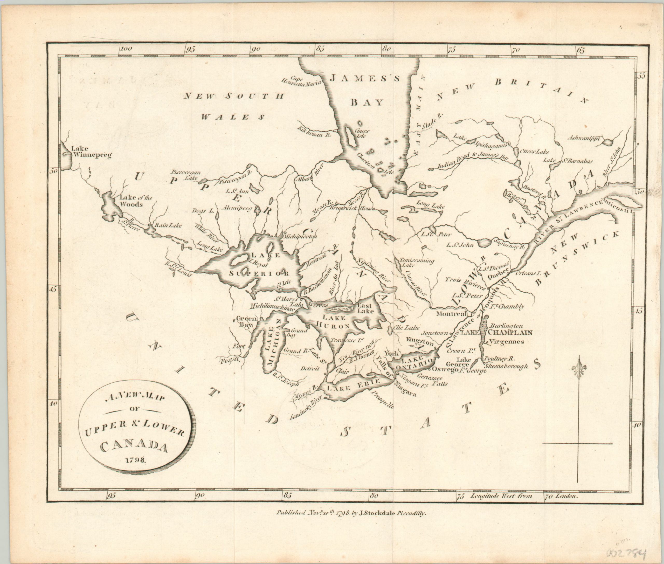
A New Map of Upper & Lower Canada.
Fascinating map of the Great Lakes from the late 18th century.
Out of stock
Description
This charming small map of the Great Lakes and portions of British Canada was published in London by John Stocksdale in 1798 for inclusion in Travels Through the States of North America. It’s possible this example was issued slightly later, as it was printed on paper with an ‘1804’ watermark.
The image captures the region between Lake Winnipeg and the St. Lawrence River, and includes and approximate outline of the Great Lakes and surrounding hydrological systems. Only a handful of scattered settlements and frontier fortifications are depicted; York (the predecessor to Toronto), Detroit, and Quebec City among them. Niagara Falls, the Brunswick House (a trading post), and an ‘Indian Road to James’s Bay’ are also labeled.
Map Details
Publication Date: 1798
Author: John Stockdale
Sheet Width (in): 9.7
Sheet Height (in): 8.25
Condition: A
Condition Description: Very faint offsetting from the title cartouche in the center of the sheet, and light creasing along originally issued fold lines. Very good to near fine overall.
Out of stock