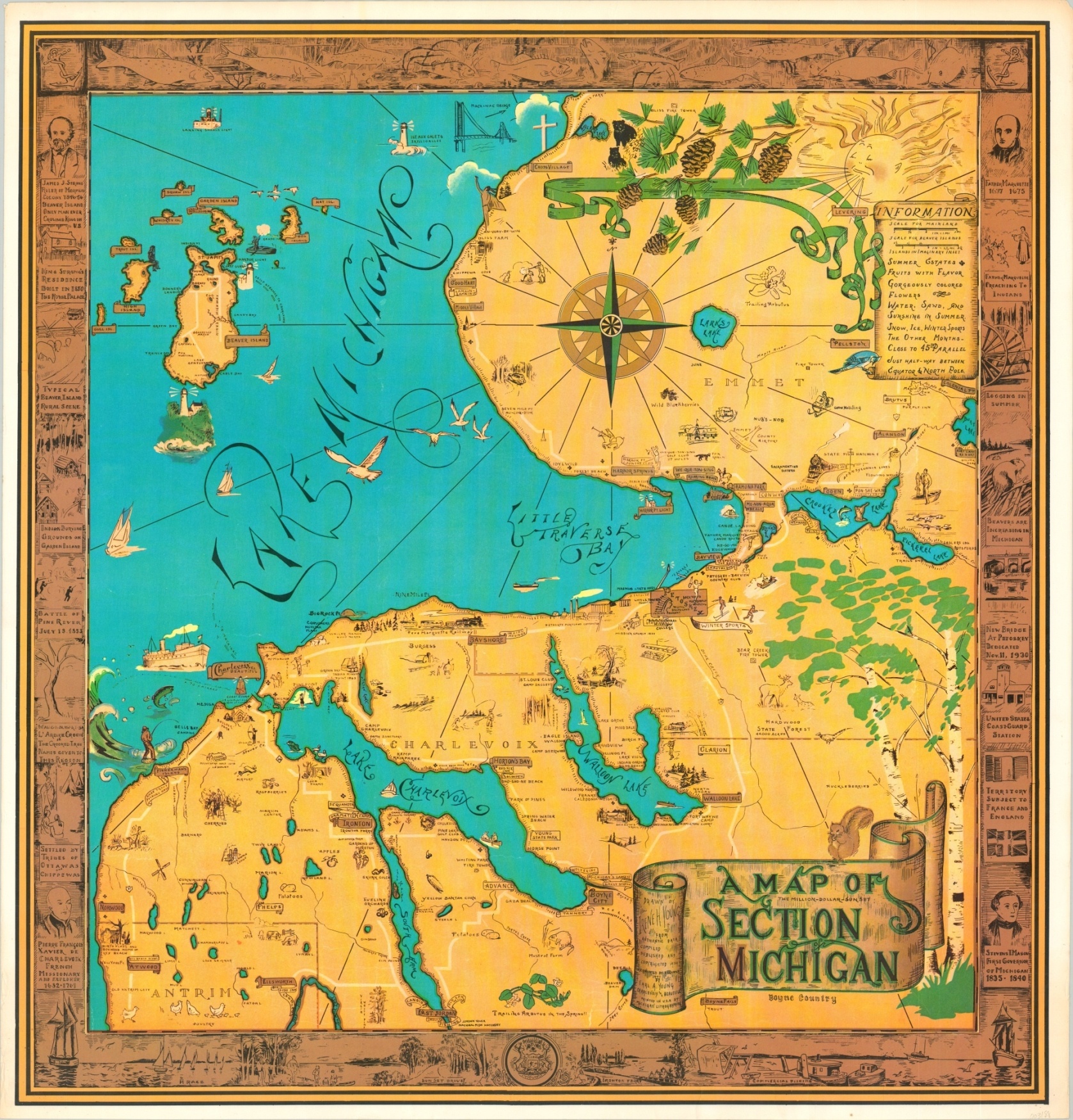
A Map of the Million Dollar Sunset Section of Michigan
Rare pictorial map of a popular tourist area in northern Michigan.
Out of stock
Description
This arresting map covers a broad area along Michigan’s northeastern coast between Charlevoix and the Mackinac Bridge. The area is popular for its natural beauty and outdoor activities, as numerous vignettes scattered throughout the image can testify.
A rich blue hue colors the waters of Lake Michigan, Little Traverse Bay, Lake Charlevoix, and the numerous other bodies of water that dot the region. Place names, locations of interest, and historic sites are individually labeled. The entire image is surrounded by a border of illustrations that highlight important historical people, places, and events.
The map was drawn by the talented artist Irene Harsha Young and originally published in 1934. According to text adjacent to the title cartouche, this edition was reprinted by request by her husband, Earl Young, in 1971.
Map Details
Publication Date: 1971
Author: Irene Young
Sheet Width (in): 35.5
Sheet Height (in): 37
Condition: A
Condition Description: Light wear and discoloration along the outer edges, including toning and a few tiny edge tears consistent with age. Very good to near fine overall.
Out of stock