
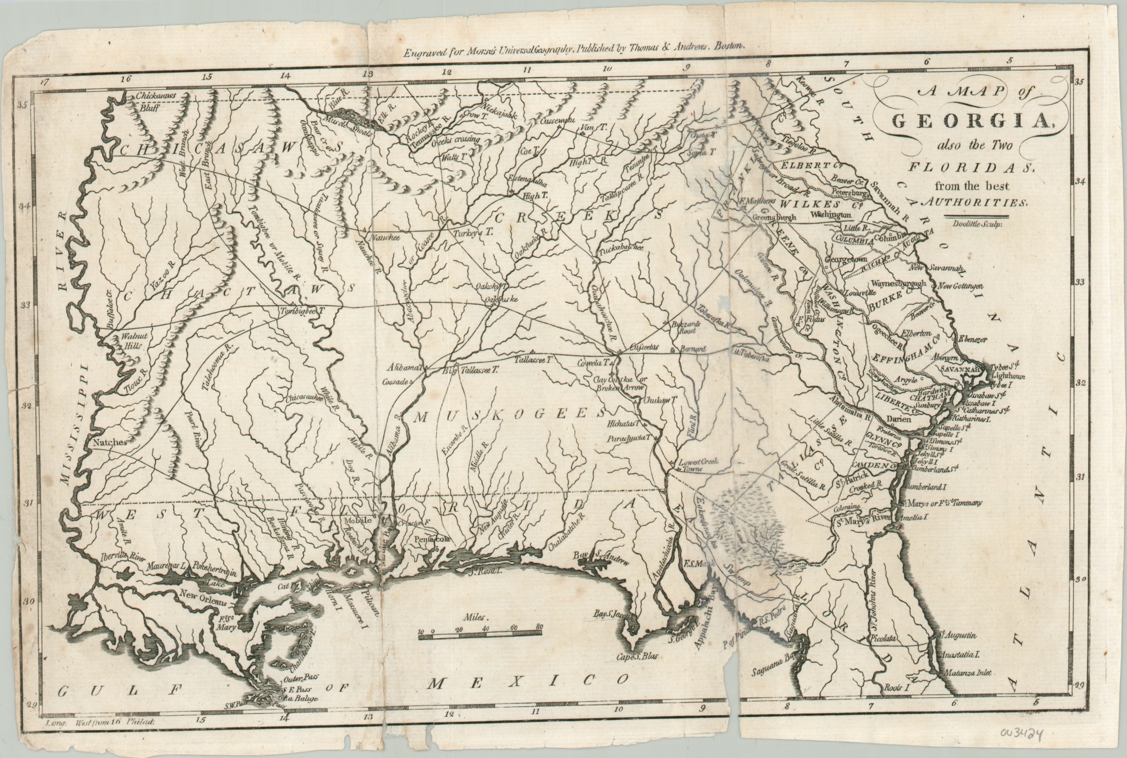
A Map of Georgia also the Two Floridas
$150.00
The state of Georgia just a few years after the ratification of the Constitution.
1 in stock
Description
This fascinating late 18th-century map of the southeastern United States shows the brand new state of Georgia in an embryonic form, with borders reaching from the Mississippi River to the Atlantic Ocean. The state was one of the last to cede its westernmost land claims, originating from the British colony, in 1802.
A rudimentary network of trails is shown connecting the disparate settlements, comprised mostly of indigenous villages. The eastern portions of the state show an early county configuration, indicating that the rest of the territory was then under the control of various Native American tribes. East and West Florida were then under Spanish authority, having been returned by Britain after the American Revolution.
The map was created by Jedidiah Morse and engraved by Amos Doolittle. Published in Boston in 1796 by Thomas and Andrews as part of Morse’s Universal Geography
Map Details
Publication Date: 1796
Author: Jedidiah Morse
Sheet Width (in): 12.40
Sheet Height (in): 8.10
Condition: C
Condition Description: Poor to fair condition overall, with the sheet formerly separated along each fold line and now repaired with archival tape. Several spots of discoloration, small tears, and a few paper chips visible in the margins.
$150.00
1 in stock