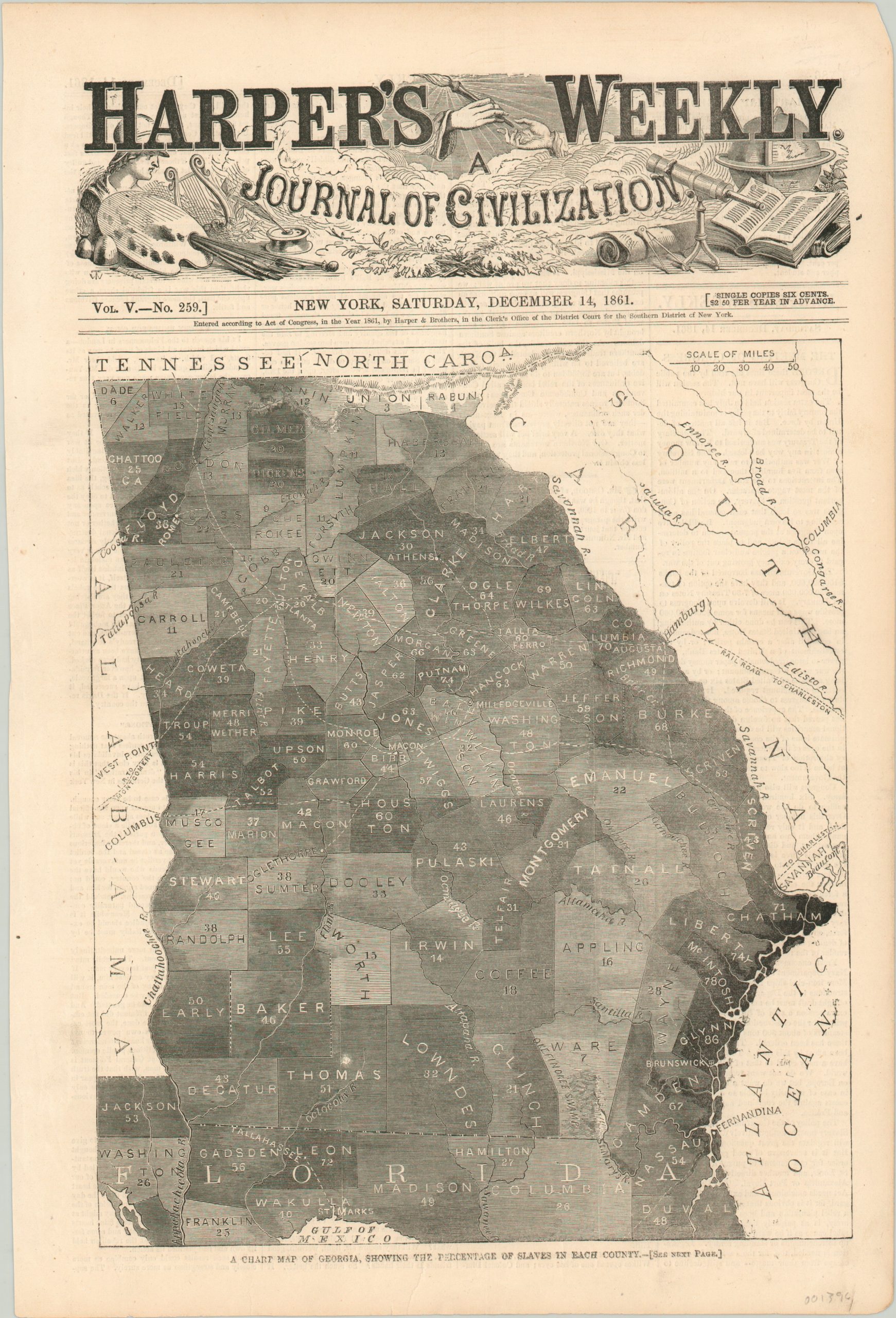
A Chart Map of Georgia, Showing the Percentage of Slaves in Each County
$95.00
Woodcut map of Georgia showing how slaves comprise a majority of the population.
1 in stock
Description
This black and white map was published as the title page to the December 14, 1861 edition of Harper’s Weekly magazine. Various shades have been applied to each county to reflect the proportion of slaves within.
Union and Rabun counties in the north (the latter never officially seceded from the Union) were as low as 3 percent and 1 percent, respectively, while the populations of certain coastal counties are as high as 86% slave. Accompanying text on the verso points out, “it will be noticed that the largest slave communities are on the seaboard and route the points to be occupied by our troops.”
As Union forces approached, slaves fled plantations by the thousands to escape to the Federal lines. These “contrabands” were invaluable to the Northern war effort, providing an important source of manual labor, as well as occasional fighting forces.
Map Details
Publication Date: 1861
Author: Harper's Weekly
Sheet Width (in): 10.60
Sheet Height (in): 15.75
Condition: A-
Condition Description: Some creasing and wear in the left margin, and faint toning to the sheet from age. Remains in very good to fine condition overall.
$95.00
1 in stock

