A Bird’s-Eye View of the Pioneer Valley…in Massachusetts
An unusual depiction of a charming 1940 pictorial map of Pioneer Valley.
Out of stock
Description
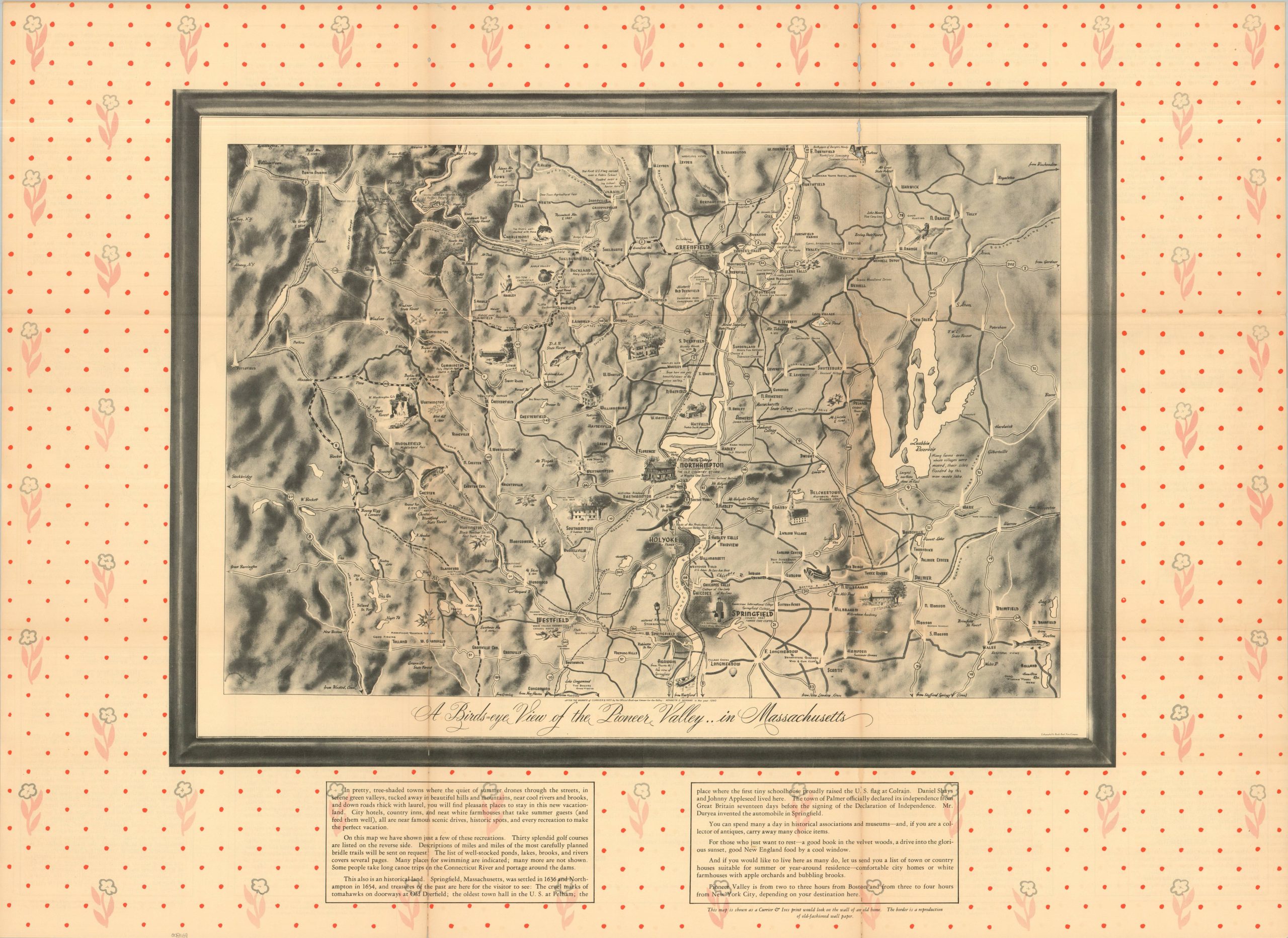
“This map is shown as a Currier & Ives print would look on the wall of an old home. The border is a reproduction of old-fashioned wallpaper.” – Text, lower right.
This lovely black and white ‘framed’ pictorial map presents an inviting overview of the Massachusetts Pioneer Valley (the colloquial name for the MA portion of the Connecticut River Valley). The important waterway bisects the center of the image, while the surrounding area is filled with shaded relief terrain, illustrated vignettes, transportation routes, and geographic features. Text at the bottom of the page offers further details on the local recreation and history, while the verso presents summaries of the primary towns, a list of golf courses, and a regional transportation map.
The map was designed by Kenneth Morang in 1940 and published by the Pioneer Valley Association of Northampton, Massachusetts. Printed by the Brooks Bank Note Company.
Map Details
Publication Date: 1940
Author: Kenneth Morang
Sheet Width (in): 35.00
Sheet Height (in): 24.25
Condition: B
Condition Description: Double-sided folding map, issued as a mailer. Heavy wear along old folds, including toning, several splits (repaired on verso), and a bit of minor image loss in the upper right corner (see scan). About good condition overall.
Out of stock