Kentucky & Tennessee
$75.00
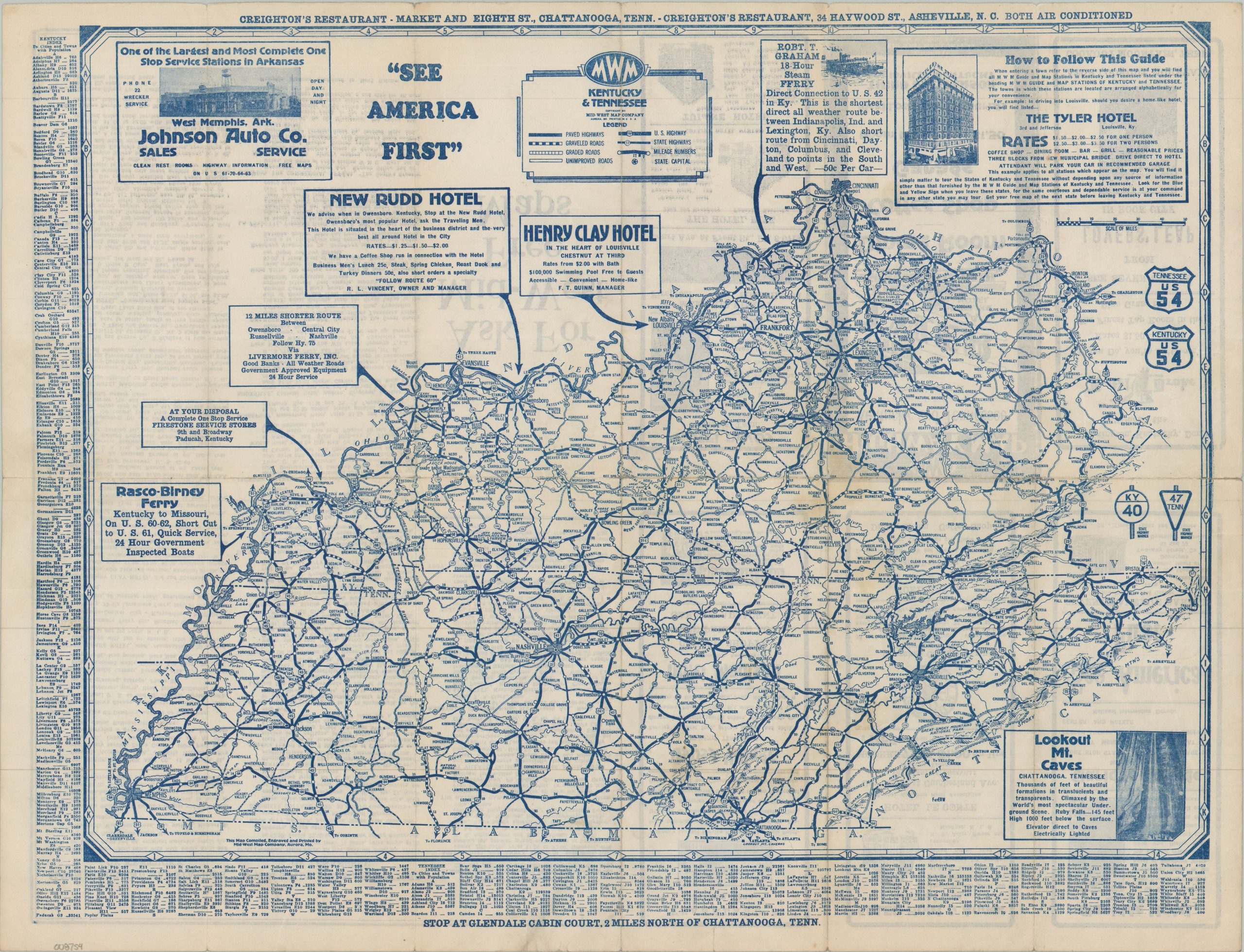
A Depression-era travel guide to the roads, hotels, and restaurants of Kentucky and Tennessee.
1 in stock

Description
This rather straightforward road map of Kentucky and Tennessee encourages the audience to ‘See America First’ via the increasingly popular automobile. Paved, graveled, graded, and unimproved roads are noted with four styles of lines, with distances between points noted and U.S./State Highways numbered. Several advertisements pepper the negative space, drawing attention to places like Louisville’s Henry Clay Hotel or Creighton’s Restaurant in Chattanooga. Additional ads on verso, as well as an alphabetical list of recommended accommodations.
The work was published around 1930 by the Mid-West Map Company. The Mid-West Map Company of Aurora, Missouri began issuing maps in the late 1920s to promote the products of oil companies that sponsored their publications. This would soon develop into broader efforts to create a ‘Nation-Wide Map Service’ that provided free informational road maps to motor tourists across the contiguous United States. MWM partnered with local businesses (hotels, garages, restaurants) to offer a full-service guide, giving drivers the means to stretch their dollar even further while on the road.
Map Details
Publication Date: c. 1930
Author: Mid-West Map Company
Sheet Width (in): 22.00
Sheet Height (in): 17.00
Condition: B
Condition Description: Double-sided map brochure with moderate wear along original folds, including toning and about 5" of clean splits, repaired on the verso with archival tape. A few tiny marginal tears. About good condition overall.
$75.00
1 in stock