
Zoning for Cambridge Report of the Planning Board
$250.00
Introducing zoning laws to Cambridge, MA.
1 in stock



Description
Legislative changes at the state and federal levels during the early 20th century empowered cities to take greater authority over local land use. Zoning laws were (and remain) the primary mechanism for control, beginning with the New York City 1916 Zoning Resolution.
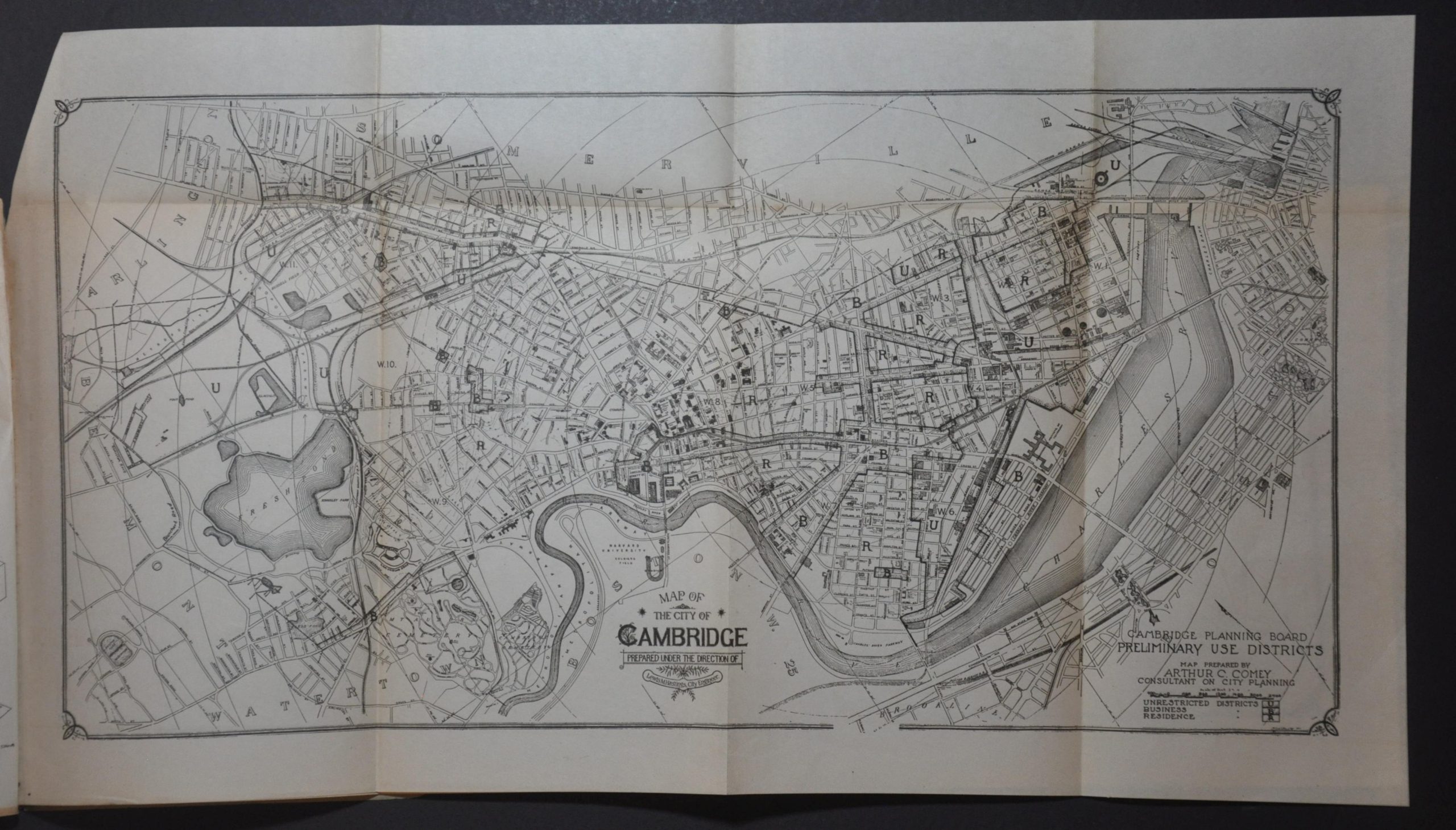
This early report on zoning in Cambridge, Massachusetts, was prepared by consultant Arthur C. Comey and published in 1920 by the local Planning Board. The contents provide a foundation for the legality of zoning, recommendations for implementation, and several proposed benefits. Single-page maps show the heights of buildings and the percentage of lots covered across the city, while a series of diagrams outline structural orientation for various designations in the building code. The booklet includes two detailed fold-out maps (also prepared by Comey) that outline the preliminary use districts (Unrestricted, Residential, Business), as recommended by the board.
Map Details
Publication Date: 1920
Author: City of Cambridge Planning Board
Sheet Width (in): 6
Sheet Height (in): 9
Condition: A-
Condition Description: 30 pp. booklet with stapled binding and original blue paper wraps. Covers are heavily soiled and worn, with a split spine, penciled annotations, and scattered soiling. Contents are generally good, with moderate marginal wear and toning consistent with age. Includes two fold-out maps (each about 20.75" x 11.25") that are moderately toned along creases. Good to very good overall.
$250.00
1 in stock