
Plan of New Orleans
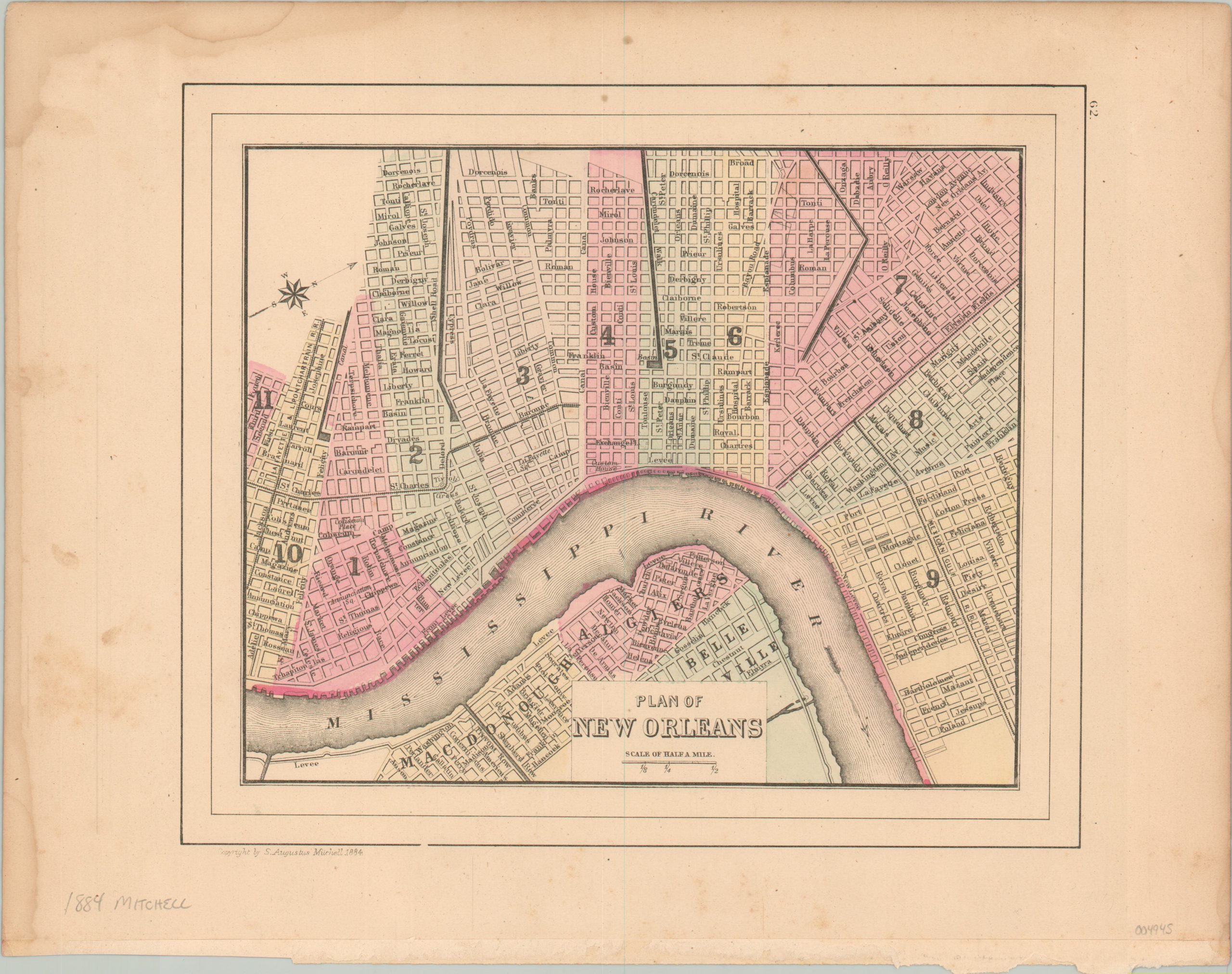
New Orleans in the mid-1880s.
Out of stock
Description
This detailed city plan of New Orleans, Louisiana was copywritten in 1884 by Samuel Augustus Mitchell. Mitchell was one of the most prominent American mapmakers of the 19th century and initially got involved with cartography as a school teacher who was frustrated with the quality of available maps. He collaborated with skilled engravers and produced high-quality maps and atlases that contained the most up-to-date information available. Mitchell’s son (of the same name) would take over the business after his death in 1860 and continue the tremendous output.
His attention to detail is evident within the image, which provides an engaging snapshot of The Big Easy in the midst of the Gilded Age. Vibrant original color distinguishes the different city wards, as well as neighborhoods south of the Mississippi (Macdonough, Algiers, and Belleville) prior to their annexation. Streets are labeled and the routes of canals and railroads are noted. Otherwise, only the Customs House, Tivoli Circus, Coliseum Place, and Lafayette Square are named.
Map Details
Publication Date: 1884
Author: Samuel Augustus Mitchell
Sheet Width (in): 15
Sheet Height (in): 11.9
Condition: B+
Condition Description: Moderate damp staining visible in the margins, along with scattered soiling. A few spots visible within the plateline, most evident in the upper center. About good condition overall, with original color.
Out of stock