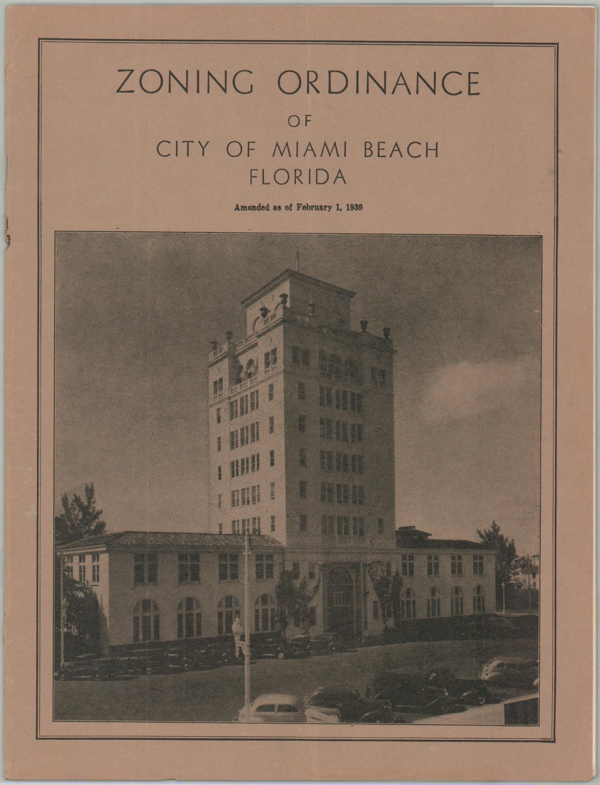
Zoning Ordinance of City of Miami Beach, Florida
$1,400.00
Codifying Miami Beach’s zoning ordinance in 1939.
1 in stock


Description
“By the 1930s, the racial zoning movement had run its course. This is not to suggest that the racial imperatives of zoning disappeared, however. The 1930s and 1940s constituted an important period in local planning since many cities had just recently devised plans that called for separate Black sections regulated in various ways. Federal initiatives in public housing and slum clearance provided additional resources for reconstructing the social landscape, and Southern and non-Southern cities eagerly participated in these efforts.” – Christopher Silver.
This somewhat diminutive volume represents a powerful tool in the hands of local politicians in Miami Beach. In 1939 Florida passed legislation allowing its municipalities to establish general zoning patterns to ensure the health, safety, and economic prosperity of their residents. While Miami Beach’s Ordinance No. 289 (the Zoning Ordinance) predates this by over a decade, thanks to a special act by the state legislature, it did undergo amendments in February of that year. The results are available here, consisting of 13 pages of text and 10 single-page maps.
While the text of the ordinance does not specifically mention any race or classes of people, there is a section that specifically notes it does not contravene any existing covenants or property restrictions. Much of Miami Beach’s residential property featured deeds with legal clauses that restricted sale to people of color or of Jewish faith. For African-Americans, local controls were even worse. Miami Beach was widely considered as a ‘Sundown Town’ until after World War II. Black visitors (those not employed as hotel maids, domestic servants, or restaurant staff) were unwelcome at night, with violators suffering the threat of physical abuse, legal repercussions, or worse.
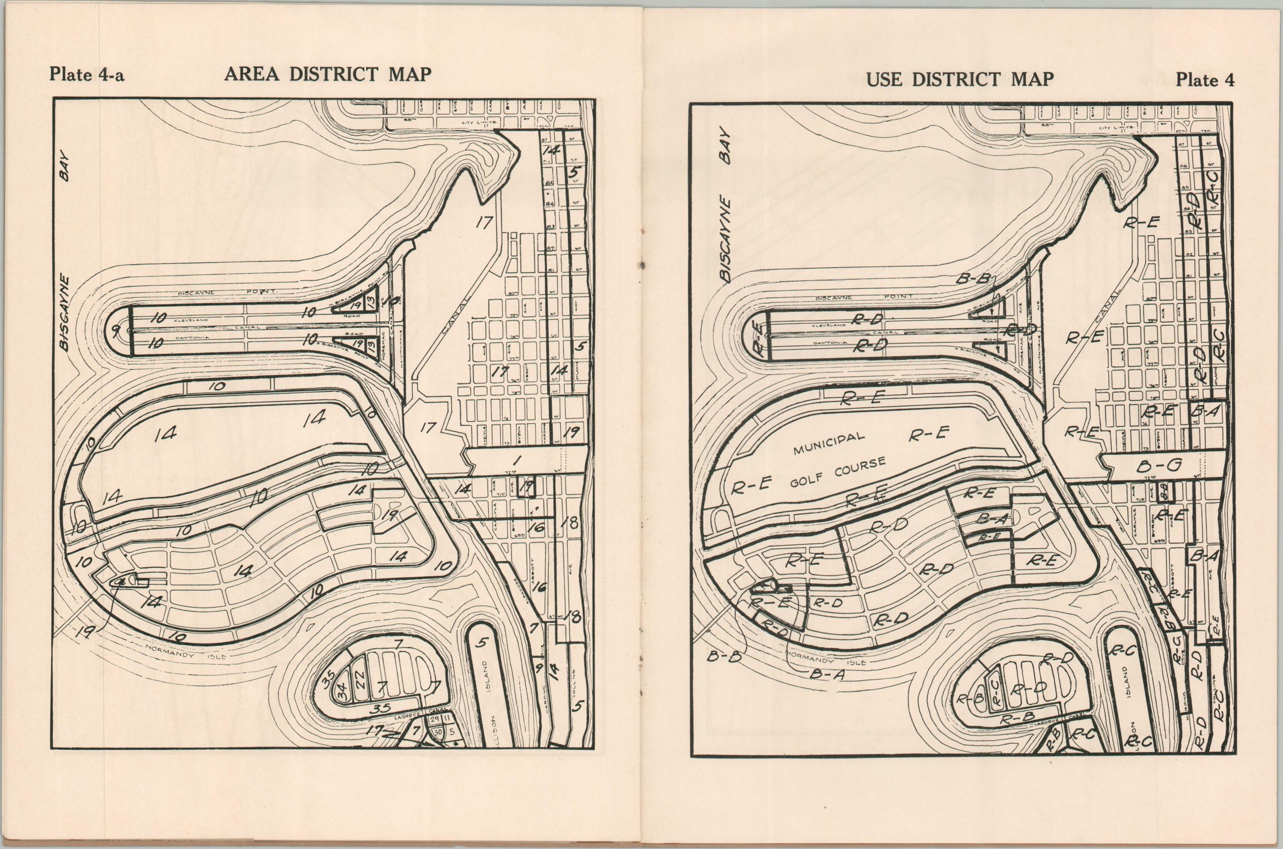
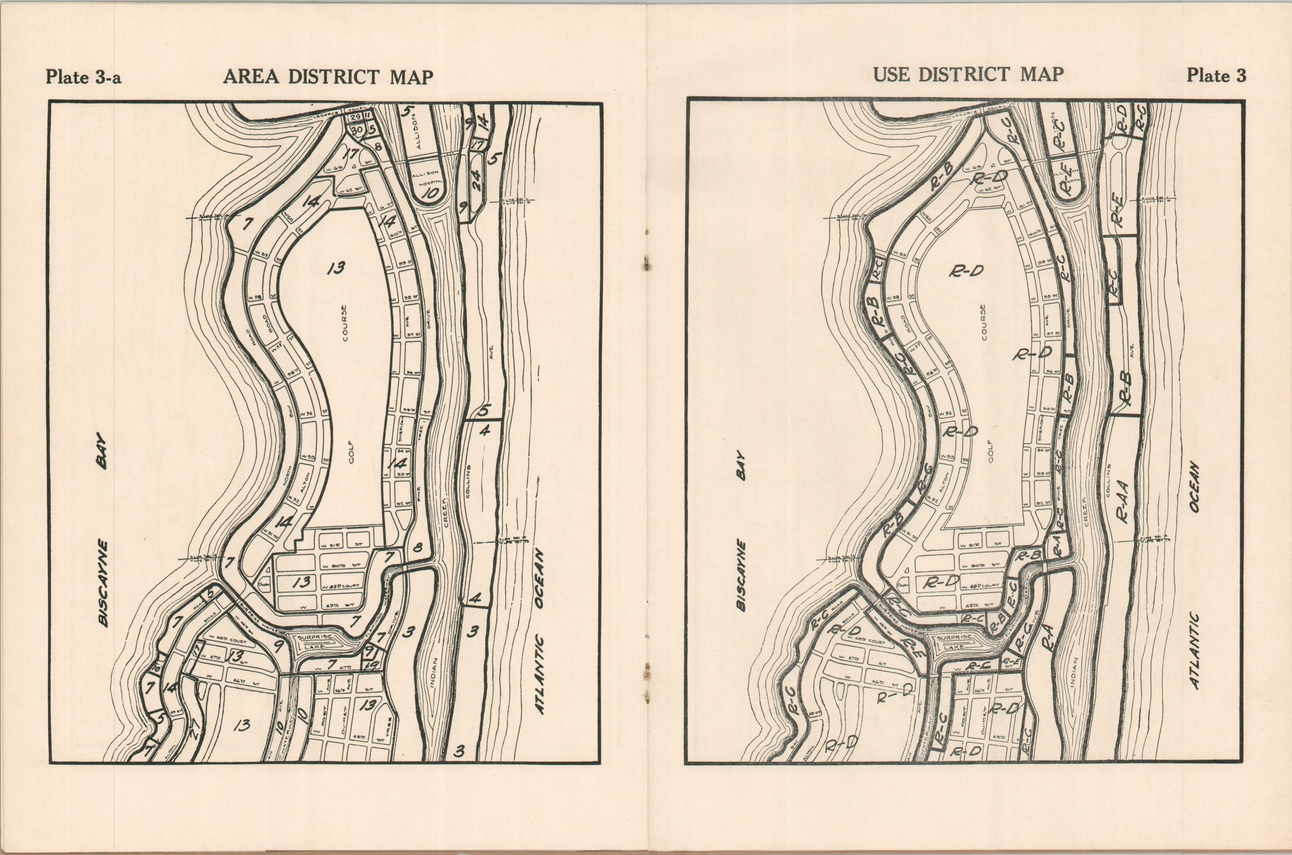
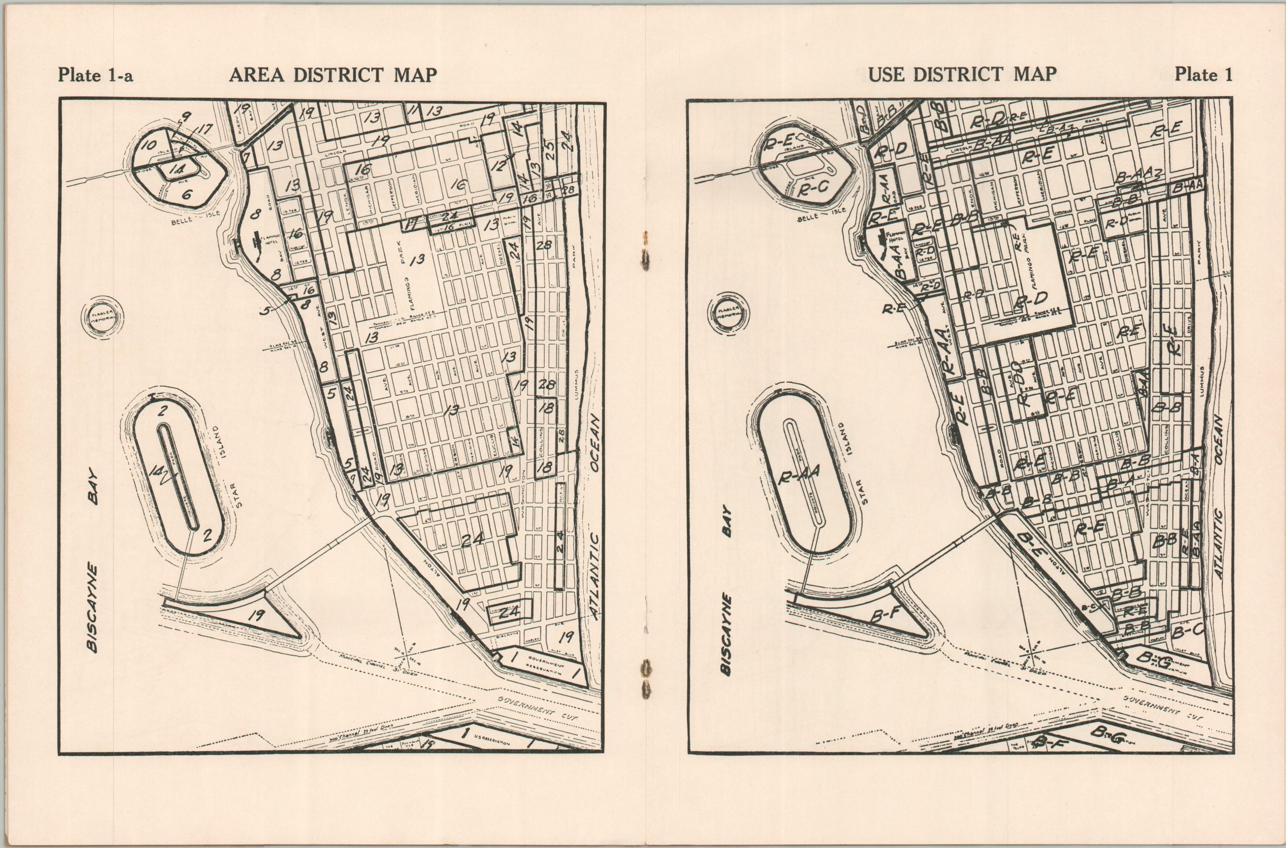
The ten maps consist of five pairs of street maps, with each duo covering the same portion of Miami Beach, but showing different information. The first plan outlines the respective District Numbers of each property. According to the text, the 37 different possibilities represent minute variations in the yard sizes of residential areas – a thinly veiled attempt to control the racial and economic composition of certain neighborhoods. The second plan features lettering, ranging from RAA to BG, that identifies the properties’ respective zoning, from lavish residential estates to heavily industrialized business districts. Transportation routes (waterways and roads), prominent geographic features, and major landowners are labeled across both. Of notable interest are Star Island (completed in 1922), the Flamingo Hotel, Bay Shore Golf Course (the Miami Beach Golf Club), and Fisher Island (labeled Peninsula Terminal Company after Carl Fisher’s plans for a deep-water seaport).
Sources: The Racial Origins of Zoning; Miami New Times; History & Social Justice
Map Details
Publication Date: 1939
Author: City of Miami Beach
Sheet Width (in): 8.25
Sheet Height (in): 10.75
Condition: B
Condition Description: 26 pp. text bound with staples in original brown paper wraps. The staples have rusted, resulted in some discoloration and minor paper loss near the spine for several sheets, though they remain tightly bound. Faintly creased along a vertical fold. Good condition overall.
$1,400.00
1 in stock