Yosemite Valley What to do – Where to go – What to see
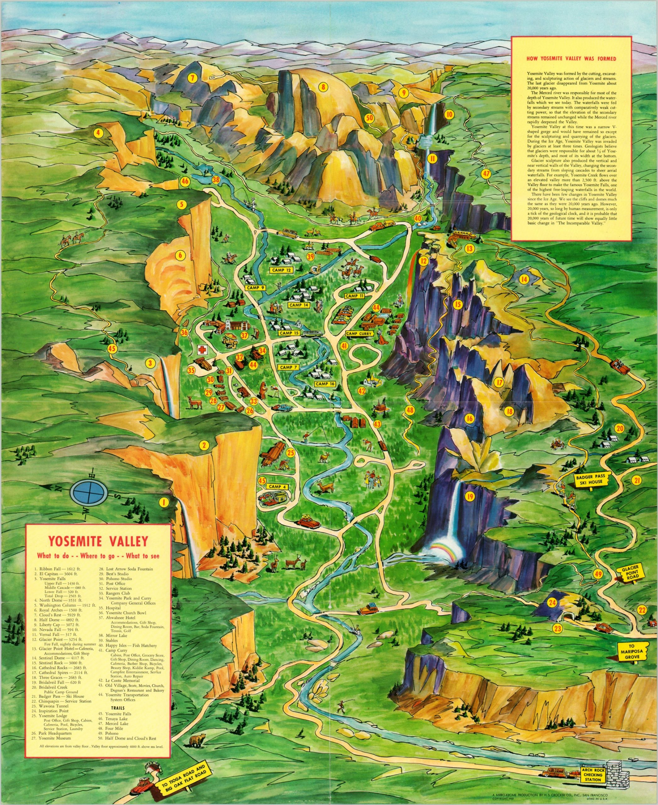
An early edition of the Pic-Tour map of the Yosemite Valley.
Out of stock
Description
This attractive illustrated view of the Yosemite Valley shows a lovely panorama of the popular tourist destination and National Park in California. The Merced River can be seen meandering through the middle of the image, which is oriented with east at the top.
Fifty different locations of interest, recreational activities, and local amenities are numbered within and labeled in the title block in the lower left. Their respective elevations are also provided, showing the dramatic height changes. The upper right holds a second text box that describes the geological formation of the valley.
The map was designed by the H.S. Crocker Company, Inc. in 1952 and published in San Francisco by 5 Associates, Inc. It was marketed as a ‘Pic-Tour’ map, with photographs and space for mailing information on the verso. Numerous such Pic-Tour maps were issued by H.S. Crocker & Co. during the 1950s and 1960s.
Map Details
Publication Date: 1952
Author: H.S. Crocker & Co.
Sheet Width (in): 17.75
Sheet Height (in): 21.5
Condition: A
Condition Description: Light creasing along originally issued fold lines and very faint wear around the outer edges of the sheet. Near fine overall.
Out of stock