
Yosemite National Park
Early 1950’s guide to Yosemite National Park courtesy of the National Park Service.
Out of stock
Description
“It is by far the grandest of all the special temples of Nature I was ever permitted to enter.” – John Muir.
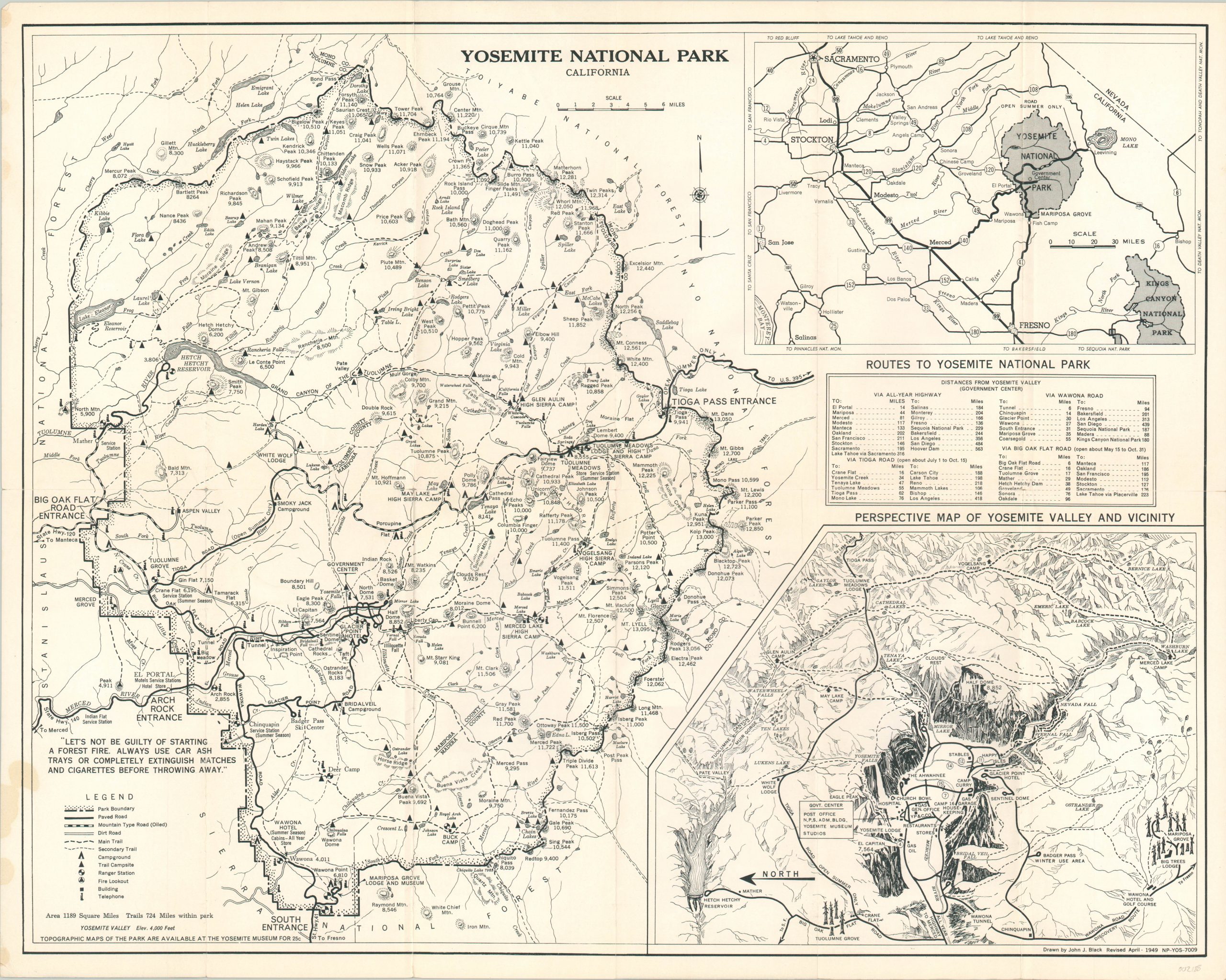
The splendor of Yosemite National Park cannot be distilled into two dimensions, but the National Park Service made a valiant effort on their brochure for the 1951 tourist season. The primary image shows a basic outline of the park with transportation routes and amenities like campgrounds, ranger stations, and telephones identified according to the legend in the lower left.
The right side of the page features two inset maps. The first shows primary transportation routes across Central California, accompanied by a table of distances immediately below. The second inset provides a pictorial perspective of the park, facing east. Simple illustrations of El Capitan, Yosemite Falls, and the Half Dome are supplemented by a few photographs and extensive descriptive text on the verso.
Map Details
Publication Date: 1951
Author: Government Printing Office
Sheet Width (in): 23.00
Sheet Height (in): 18.50
Condition: A-
Condition Description: Originally issued folded into 12 panels, with light wear and creasing along fold lines. Small damp stain in the lower left corner that barely enters the image. Remains in very good condition overall.
Out of stock