Yellowstone National Park Picture Map
$150.00
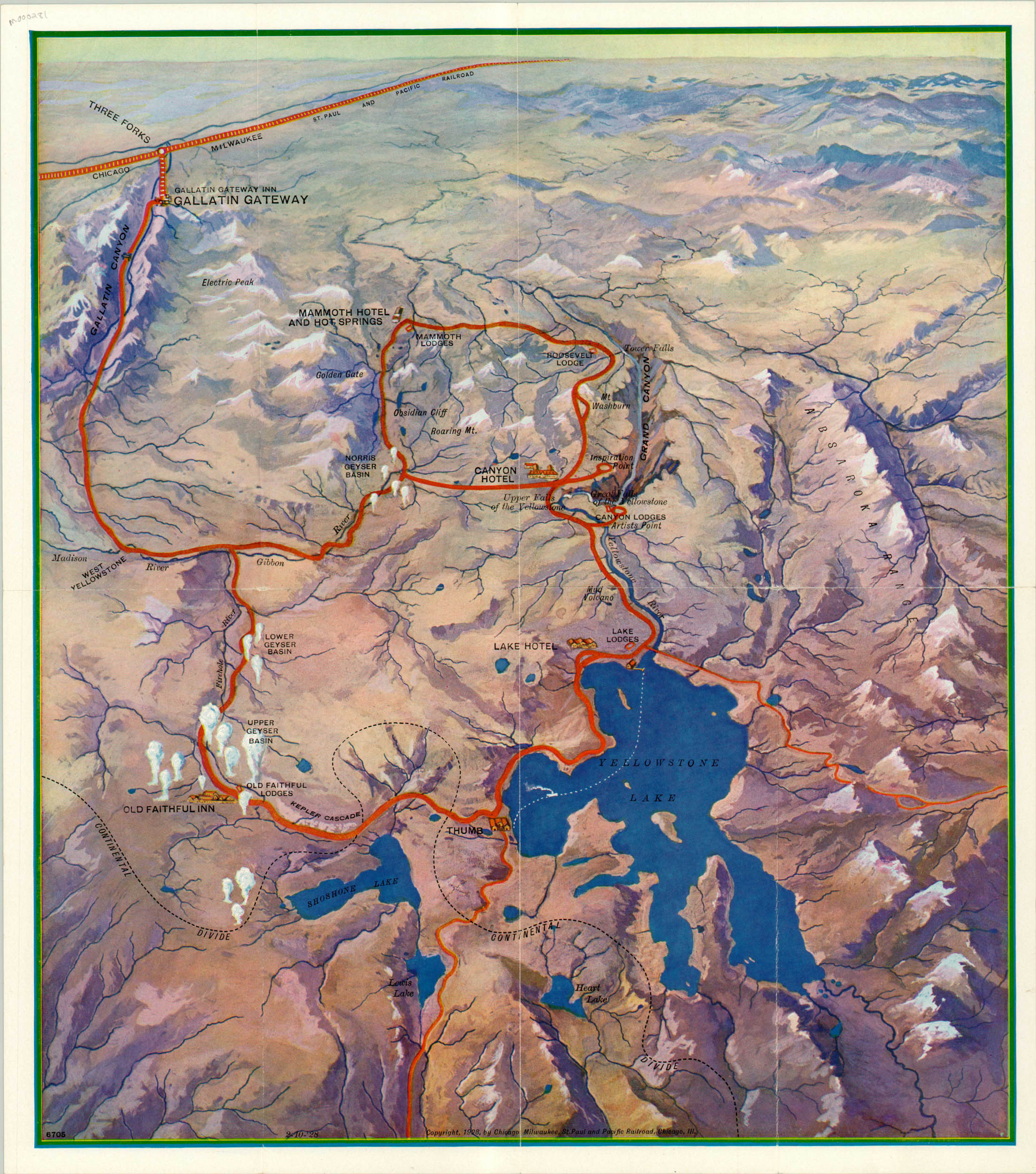
Charming pictorial map of the nation’s first National Park.
Description
After his first visit to Yellowstone, John Muir asserted that visitors “will be brought to a standstill hushed and awe-stricken before phenomena wholly new to you.” However, it was the work of a predecessor, Ferdinand Hayden, whose diligent promotion and dedication to the landscape would ultimately preserve the park’s beauty for the public masses. Hayden led an expedition through the area that would comprise the park in 1871 and, with the artist Thomas Moran and photographer William Henry Jackson, created a report convincing Congress of the need for preserving the stunning geothermal and mountainous features. However, simply drafting the legislation was not enough. Park proponents understood that the best way to ensure the perpetuity of public land was to ensure public participation. With that in mind, the parks often partnered with railroads (and later, automobile clubs) to promote tourism to the area.
This map was sponsored by the Chicago, Milwaukee, St. Paul and Pacific Railroad, which operated a connection line to the Gallatin Gateway. The image depicts the route around Yellowstone that a visitor could take via automobile after departing the train, including Old Faithful, the Canyon Hotel, Mammoth Hot Springs, and Yellowstone Lake. Topographical detail is delicately transmitted through clever use of shading and snow-capped peaks, while the Continental Divide can be seen snaking through the lower portion of the image. On the verso is a strip map of the 83 miles between the Gallatin Gateway train station and the entrance to the park.
Map Details
Publication Date: 1928
Author: Poole Brothers
Sheet Width (in): 16
Sheet Height (in): 18
Condition: B+
Condition Description: The map is in very good condition, with two small splits along originally issued fold lines.
$150.00