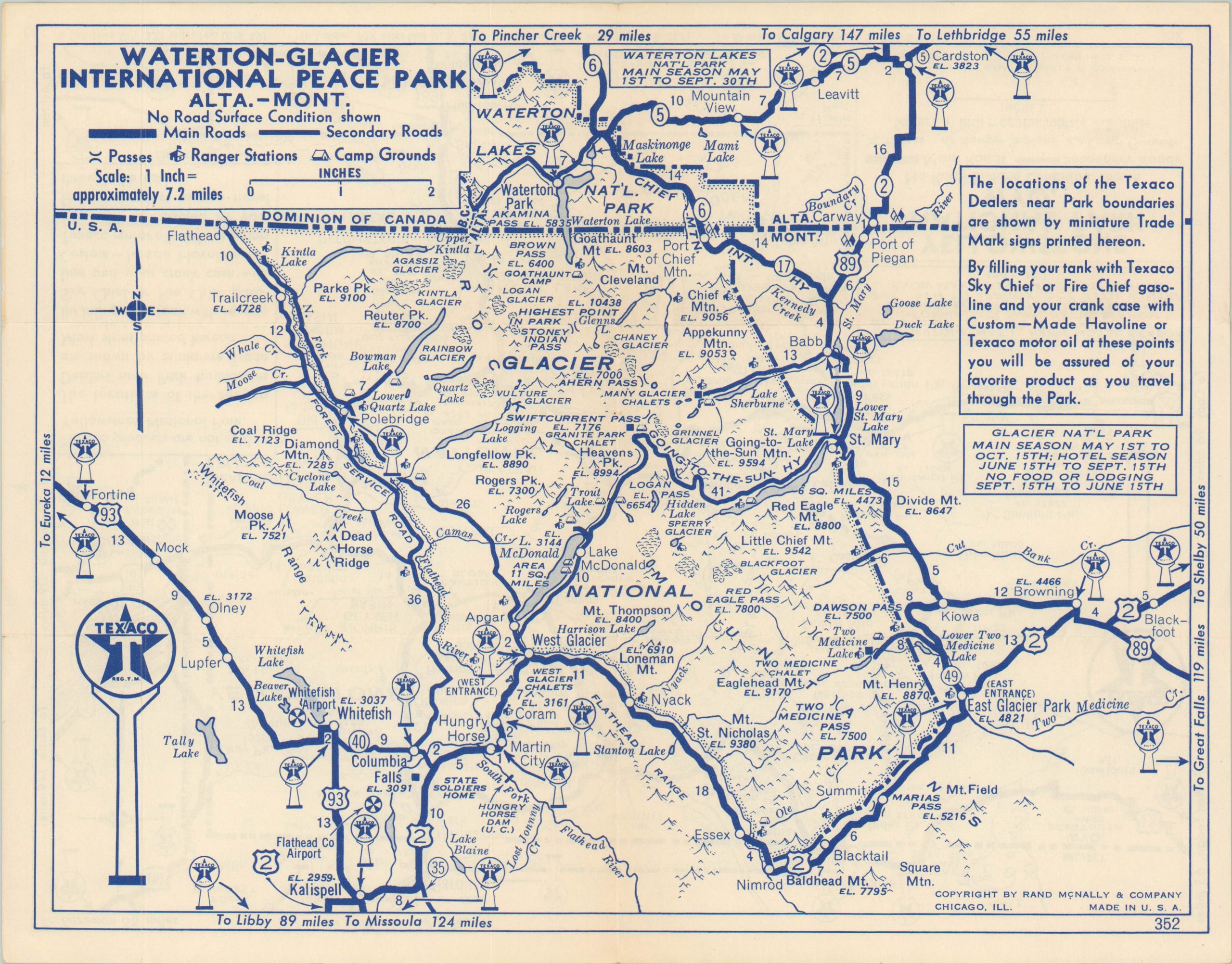
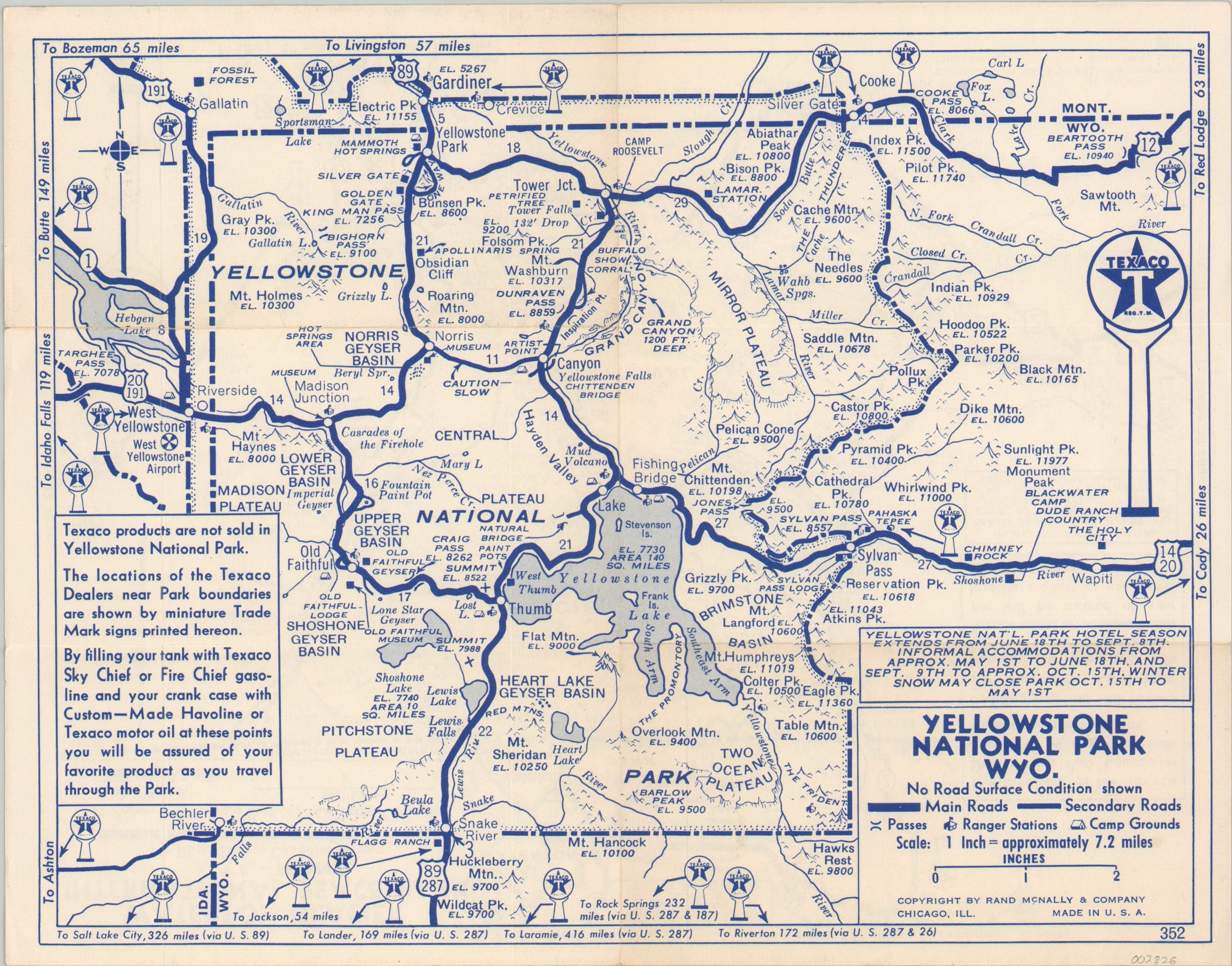
Yellowstone National Park [and] Waterton-Glacier International Peace Park
$75.00
Double sided road map showing two of America’s most popular National Parks.
1 in stock
Description
This detailed road map is emblematic of the enthusiasm Americans had for hitting the roads in the decade following the Second World War. National Parks and Monuments were some of the most popular destinations, and this sheet captures the local transportation routes for both Yellowstone National Park in Wyoming and the Glacier-Waterton International Peace Park in Montana.
Each side features a clearly legible map with geographic features, roads, and locations of interest individually labeled. Park information and Texaco advertisements accompany the verso and recto. Published in Chicago by Rand McNally in 1953.
Map Details
Publication Date: 1953
Author: Rand McNally
Sheet Width (in): 13.40
Sheet Height (in): 10.40
Condition: A
Condition Description: Light creasing along originally issued fold lines and mild wear along the outer edges. Very good to near fine overall.
$75.00
1 in stock


