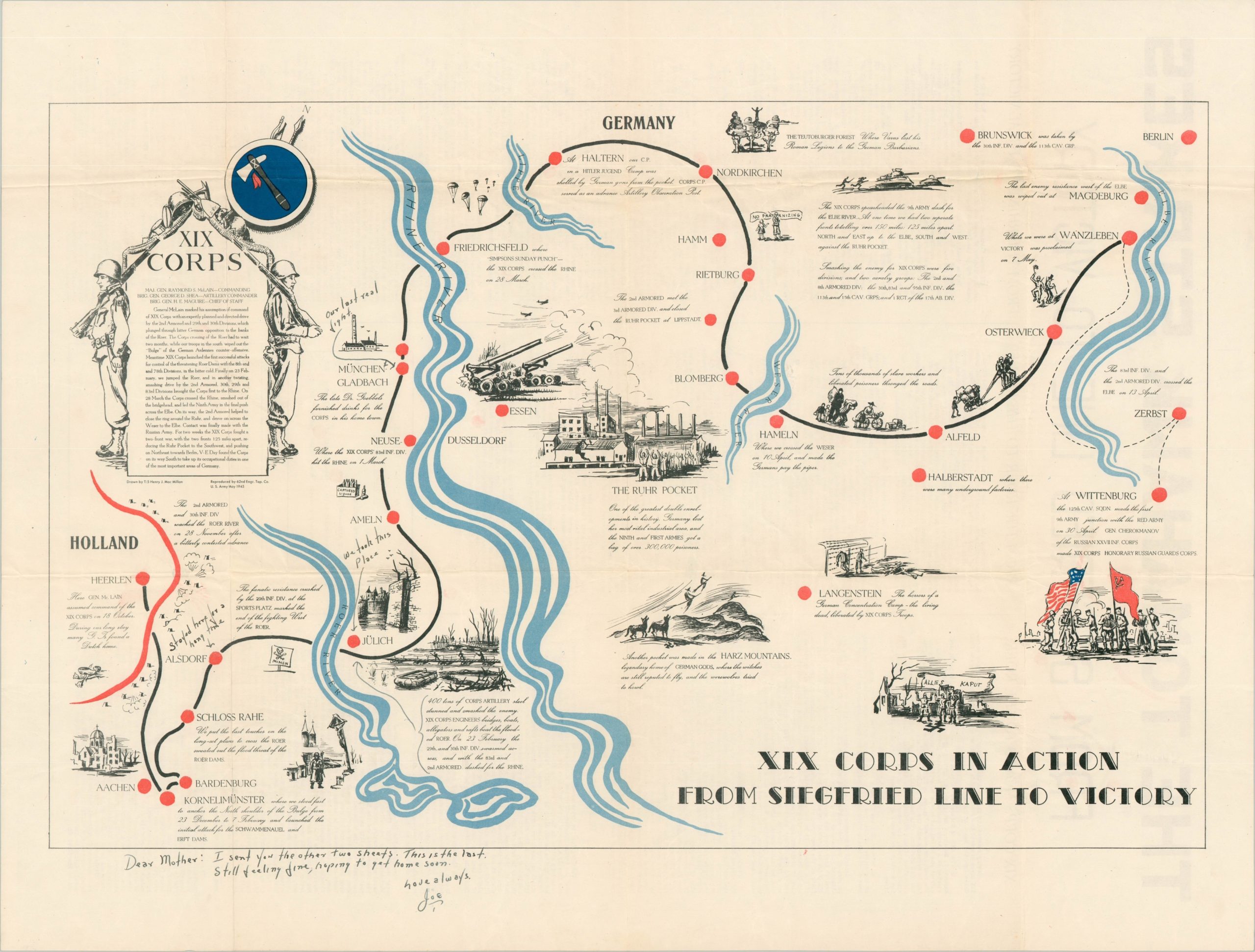
XIX Corps in Action
A pair of maps capturing the pride and sorrow of the U.S. armed forces in Europe during WWII.
Out of stock
Description
This pair of maps shows the route of the XIX Corps in the European Theater during World War II. The first sheet shows the march from the beaches of France in June of 1944 to the German border, while the second sheet continues the advance until V-E Day and unification with the Red Army. Both were issued as special commemorative issues of Le Tomahawk – the wartime corps publication – and feature an overview of the campaign and battle statistics on the verso. The maps were drawn by Technician Henry MacMillan and reproduced by the 62nd Engineer Topographic Company. From Susan Schulten’s book, A History of America in 100 Maps:
On both maps, MacMillan depicted the individual encounters that so profoundly affected the millions of Americans serving in Europe. Alongside depictions of tactical victories and enemy fire we find careful renderings of the local people as well as landmarks that MacMillan and so many others were seeing for the first time as they fought through Europe: the Eiffel Tower, Chartres, and – poignantly – the battlefield cemeteries of World War I…As an engineer with the 62nd Division, MacMillan took care to note the logistical support and tactical ingenuity that made it possible to cross five rivers, capture German soldiers, and liberate thousands of prisoners.”
These particular maps have a wonderful provenance. They were sent by Sgt. Joe Veraldi from in August of 1945 to his mother, Mrs. B. Veraldi, in Monongahela, Pennsylvania (the original envelope is also included). One map is addressed to his mother with a note – “I sent you the other two sheets [presumably the first map]. This is the last. Still feeling fine, hoping to get home soon. Love always, Joe.” He also wrote next to Munich – “Our last real fight.”
Veraldi was a member of the 1st battalion of the 271st Infantry Regiment (69th Infantry Division). He was decorated with a Bronze Star for “meritorious achievement in military operations against the enemy from 7 June 1944 to 18 June 1944” – certainly action that took place immediately after D-Day. He also received a purple heart, and was possibly recovering from his wounds in England when he sent the maps to his mother. According to his embarkation card, which is included with the maps, Veraldi left Southampton on September 15, 1945.
Map Details
Publication Date: 1945
Author: T/5 Henry Mac Millan
Sheet Width (in): 28.70
Sheet Height (in): 22.00
Condition: A-
Condition Description: Wear and creasing along fold lines, and a few spots of faint discoloration and staining. Very good to excellent condition, overall.
Out of stock


