XIX Corps In Action
$350.00
A pair of maps capturing the pride and sorrow of the U.S. armed forces in Europe during WWII.
1 in stock
Description
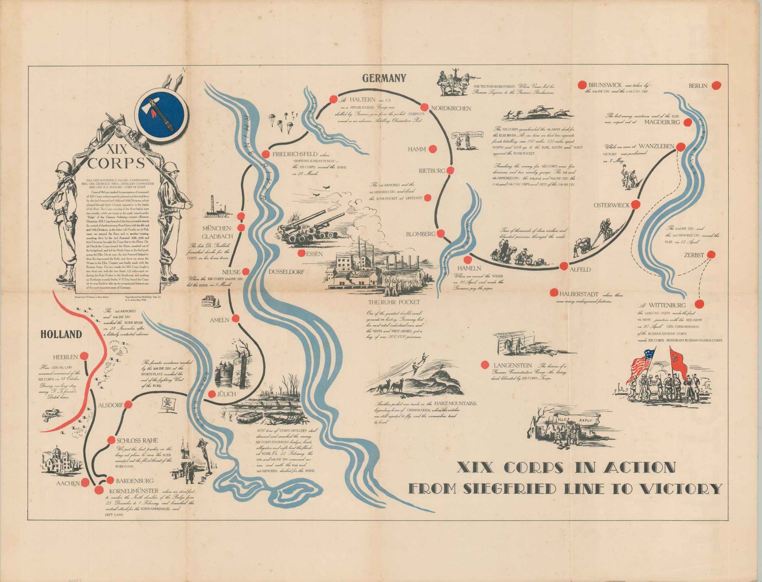
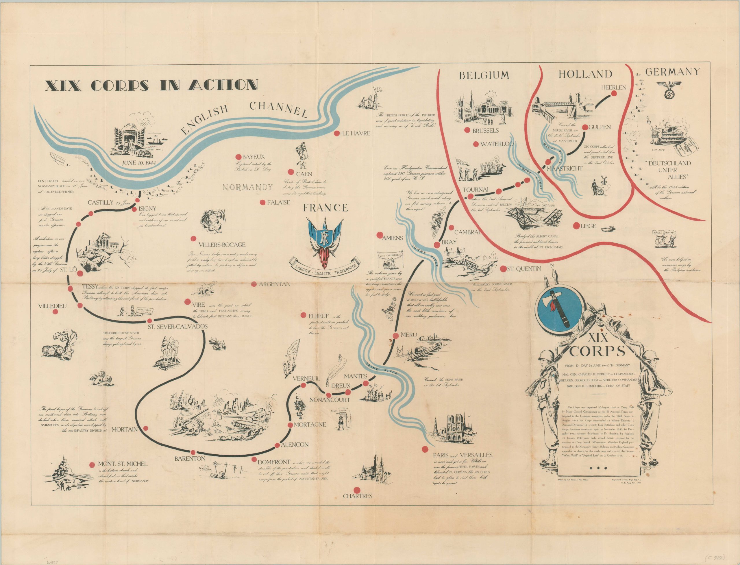
This pair of maps shows the route of the XIX Corps in the European Theater during World War II. The first sheet shows the march from the beaches of France in June of 1944 to the German border, while the second sheet continues the advance until V-E Day and unification with the Red Army. Both were issued as special commemorative issues of Le Tomahawk – the wartime corps publication – and feature an overview of the campaign and battle statistics on the verso.
The maps were drawn by Technician Henry MacMillan and reproduced by the 62nd Engineer Topographic Company. From Susan Schulten’s book, A History of America in 100 Map; “
On both maps, MacMillan depicted the individual encounters that so profoundly affected the millions of Americans serving in Europe. Alongside depictions of tactical victories and enemy fire we find careful renderings of the local people as well as landmarks that MacMillan and so many others were seeing for the first time as they fought through Europe: the Eiffel Tower, Chartres, and – poignantly – the battlefield cemeteries of World War I…As an engineer with the 62nd Division, MacMillan took care to note the logistical support and tactical ingenuity that made it possible to cross five rivers, capture German soldiers, and liberate thousands of prisoners.”
Map Details
Publication Date: 1945
Author: T/5 Henry Mac Millan
Sheet Width (in): 28.75
Sheet Height (in): 22.1
Condition: B+
Condition Description: Pair of double-sided sheets, each with moderate wear and creasing along old fold lines. Scattered spotting throughout. About good condition overall.
$350.00
1 in stock