
X Marks the Spot
$300.00
Targeting the next island in the Pacific Theater.
1 in stock
Description
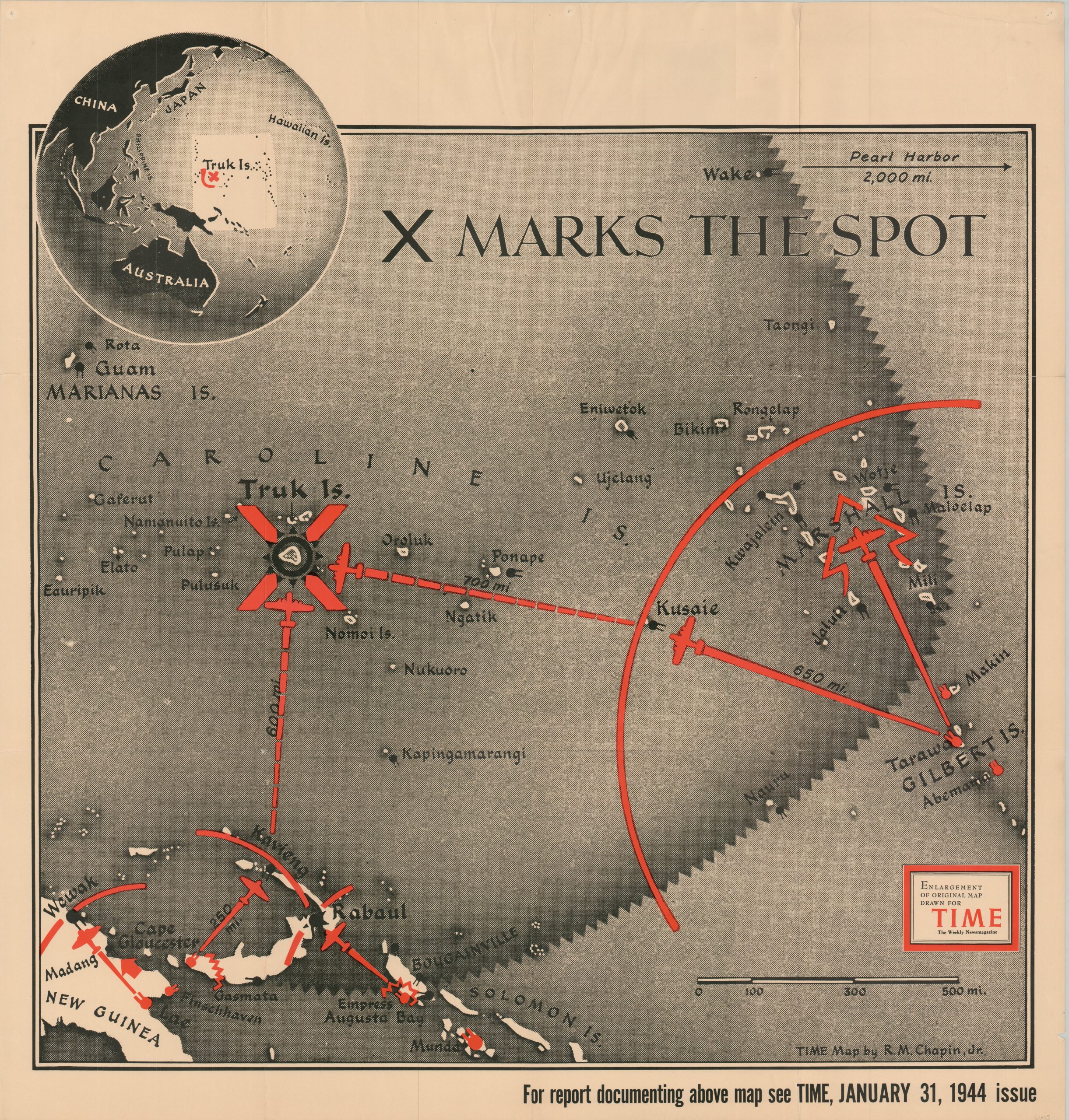
This striking image of the Central Pacific uses a standard treasure map theme in a militarized sense. It identifies the island of Truk in the Caroline archipelago with a large red ‘X’, though instead of buried gold, it denotes the next target in the Allied offensive. Air bases on the Solomon and Gilbert Islands (marked in red) provide departure points for bombers to attack Japanese defenses, extending the line of operations (also red). An inset in the upper left shows the presented area within the larger theater of war. The strategy behind the image is perhaps best defined by the original commentary,
“As the Navy views the Pacific (General MacArthur dissents), this campaign has been forced upon the U.S. by the caution of the Japanese Fleet, geography, and the development of modern weapons—particularly aircraft. The Pacific Fleet dares not steam straight across 5,000 miles of ocean through shoals of Japanese submarines, past the airfields in the Marshalls and the Carolines, and attempt to land an invasion force on the shores of Mindanao, in the Philippines. Nor, apparently, does it care to concentrate on MacArthur’s Southwest Pacific route. The Navy must secure bases in its rear as it moves. For the Pacific is dotted with unsinkable Jap airplane carriers and sub bases which cannot be left in the rear of an invading convoy. These island carrier-bases must be 1) neutralized or 2) taken.”
The map was designed by Robert M. Chapin, Jr. and published as a supplement for the January 31, 1944 issue of TIME Magazine. Chapin was a professionally trained architect who found jobs to be in low demand during the Great Depression. He took a job in the photo department at Newsweek in 1933, where he apparently picked up a knack for cartographic design. By 1937, he was hired by Time (a rival of Newsweek) as the head of the cartography department, a position he would hold until his retirement in 1970.
During his long tenure at Time, Chapin’s prolific output helped establish a pattern for 20th-century newsroom cartography. The use of bold colors, uncluttered design, and legible typography was immensely popular, and the maps were reprinted for distribution in classrooms and public spaces throughout the country. Despite their widespread appeal, the maps are uncommon on the market and often overlooked in institutional collections. This version is listed in only three examples in WorldCat as of May 2024 – Franklin & Marshall College, Duke University, and the University of Southern Maine.
Sources: OCLC# 4773508; TIME Magazine archives
Map Details
Publication Date: 1944
Author: Robert M. Chapin, Jr.
Sheet Width (in): 34.5
Sheet Height (in): 36
Condition: A-
Condition Description: The sheet is lightly toned and shows some faint wear and creasing along originally issued fold lines. Some extraneous wrinkling near the top of the page, running about 2" down into the image. Very good condition overall. Blank on verso.
$300.00
1 in stock