
Wyld’s Military Map of the United States, the Northern States, and the Southern Confederate States
A British view of the U.S. at the outbreak of the American Civil War.
Out of stock
Description
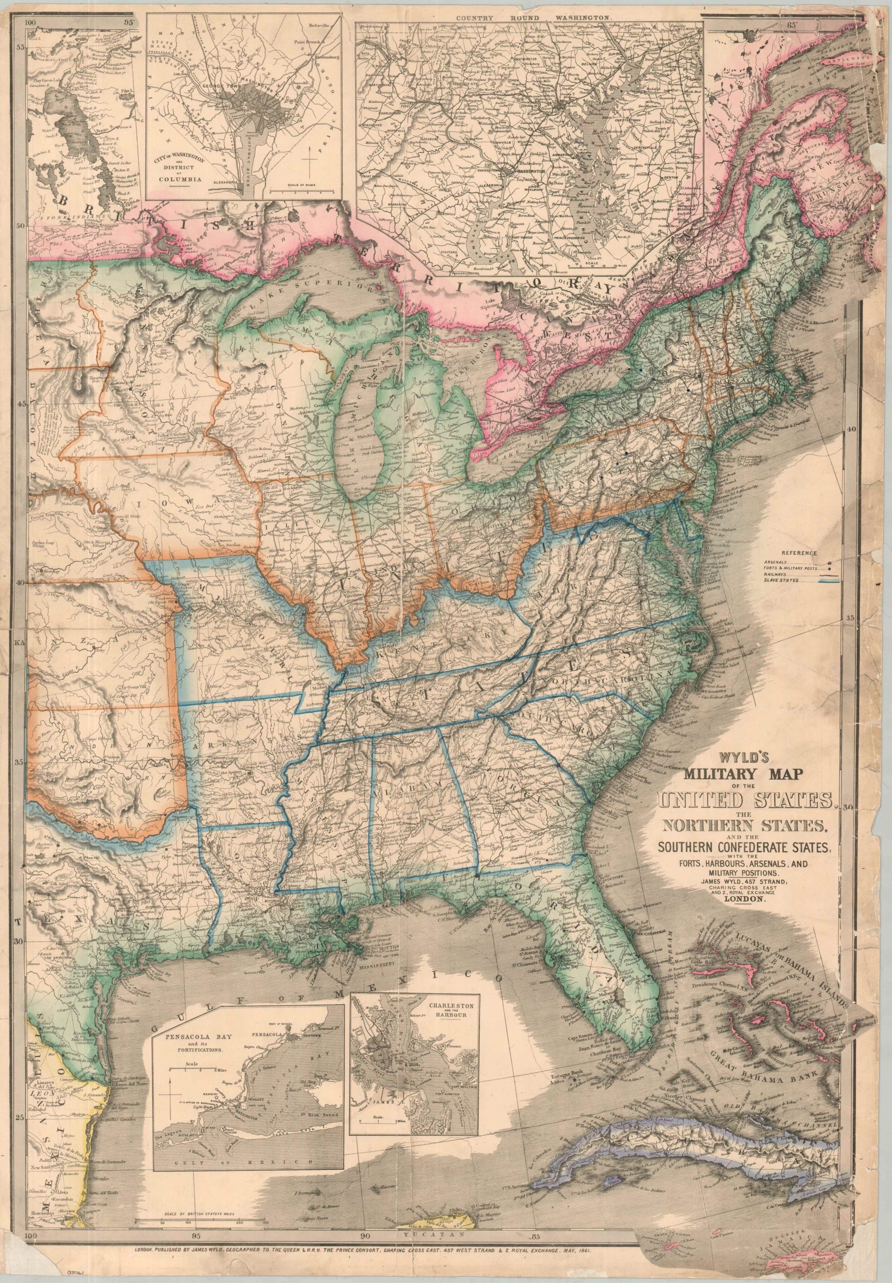
This wonderfully detailed map of the eastern United States was designed and published by British geographer James Wyld in London in 1861. It was apparently one of (at least) two variants issued in quick succession, with the earlier edition showing the American Succession Crisis and this example, dated in May, presenting the theater of the Civil War after the attack on Fort Sumter.
Vibrant blue borders distinguish slaveholding states from their northern counterparts, though the seceded territory is careful to exclude the strategically important border states of Missouri, Kentucky, Maryland, and Delaware. The Union, highlighted in orange, includes a split Dakota Territory (note the proposed Chippewa region) and contains demonstrably more miles of operational railroads than the South.
Forts and military posts are shown with small blue dots, while British possessions in Canada and the Caribbean are tinted with their distinctive pink hue. Insets show the militarily important areas of Pensacola Bay, Charleston Harbor, Washington D.C., and the immediate vicinity. Oddly, the last inset (upper center) fails to extend far enough south to include the Confederate capital at Richmond – only about 100 miles from the steps of the White House!
Despite showing a relatively subjective overview of the conflict, Wyld’s British audience had strong opinions about the American Civil War. Officially neutral, the nation was divided on how to approach (and profit from) the situation. Generally speaking, the upper classes and government officials often sympathized with the Confederacy due to economic ties to Southern cotton. However, the Union’s commitment to abolishing slavery, enunciated by the Emancipation Proclamation, and public wariness of a global trade war led the British to maintain their policy of neutrality.
Sources: Library of Congress; Yale University;
Map Details
Publication Date: 1861
Author: James Wyld
Sheet Width (in): 23.9
Sheet Height (in): 34.25
Condition: B-
Condition Description: hand colored map printed on a single sheet, formerly folded into quarters and mounted onto old linen. Heavy wear and moderate loss along the outer edges of the sheet, most evident in the corners and along the vertical center seam. Scattered surface discoloration and heavy wear and numerous tears are present along the right side. Between fair and good condition, considering the majority of the image remains intact and entirely legible.
Out of stock