Rand McNally World Atlas Pictorial Edition
1934 atlas of the world published by Rand McNally.
Out of stock

Description
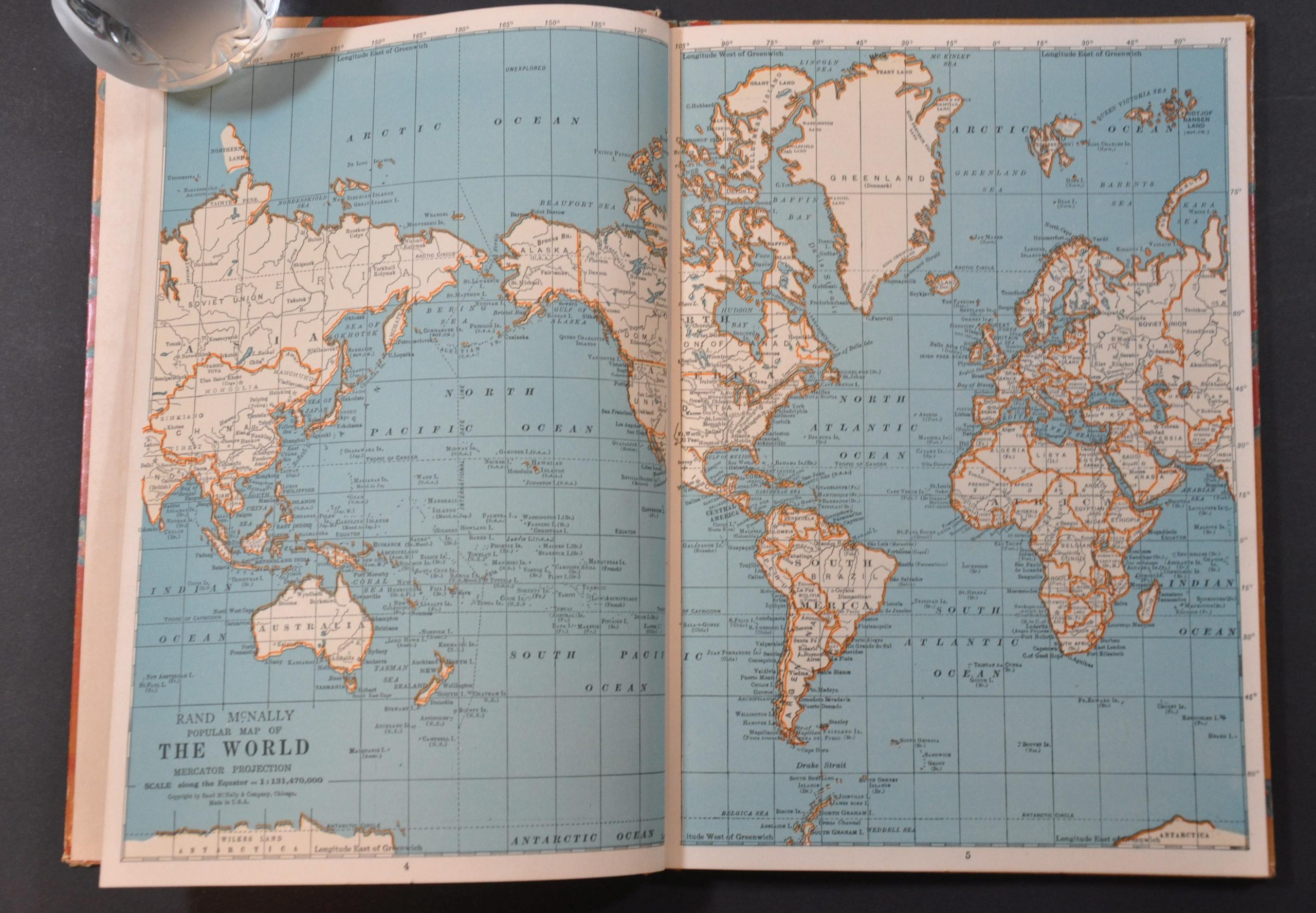
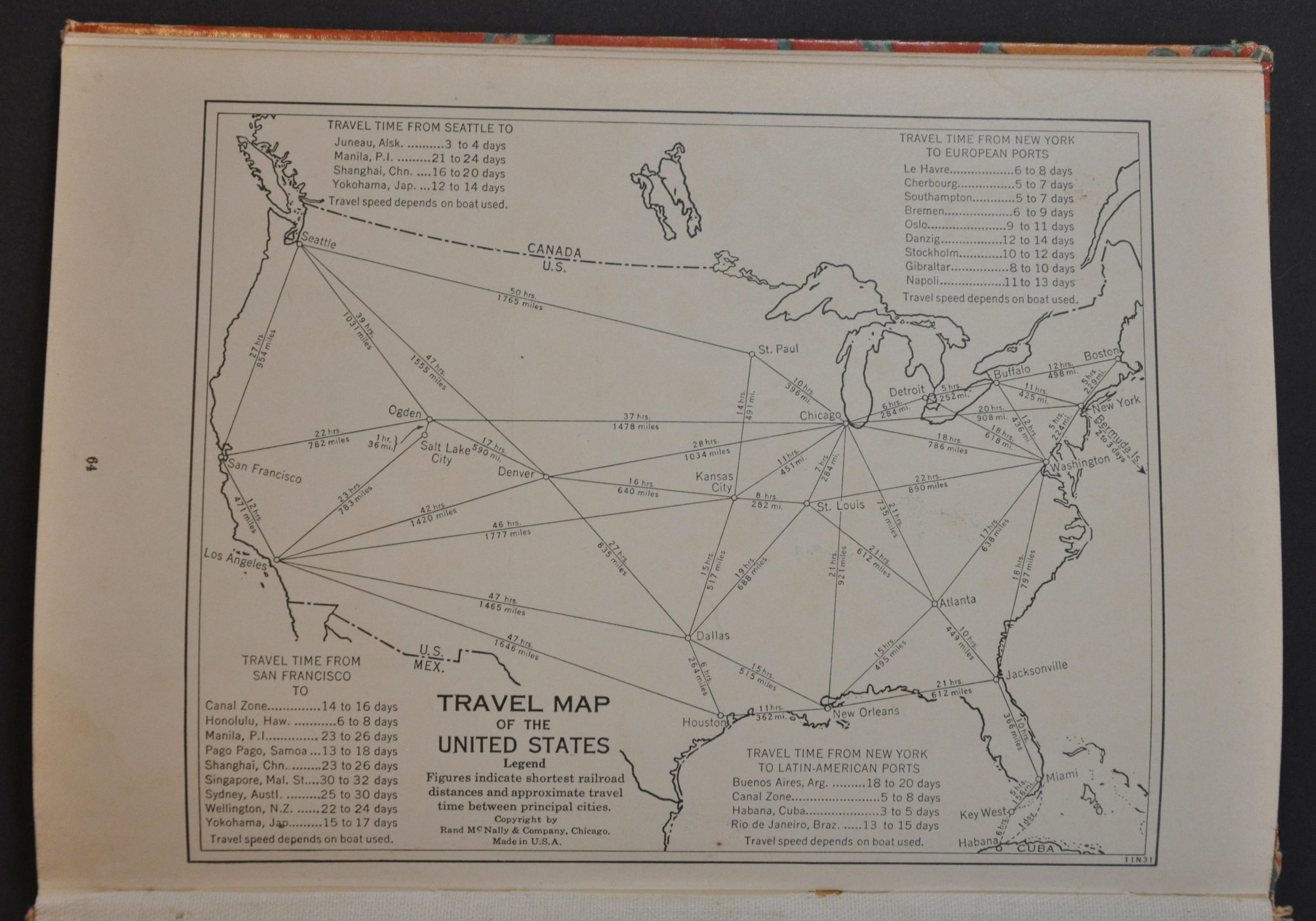
This fascinating atlas from the interwar period provides a detailed snapshot of the globe in the early to mid-1930s. Fourteen double-page maps highlight the political organization, transportation networks, major urban centers and primary geographic features of the entire world, with particular emphasis on Europe, the United States, and the polar regions.
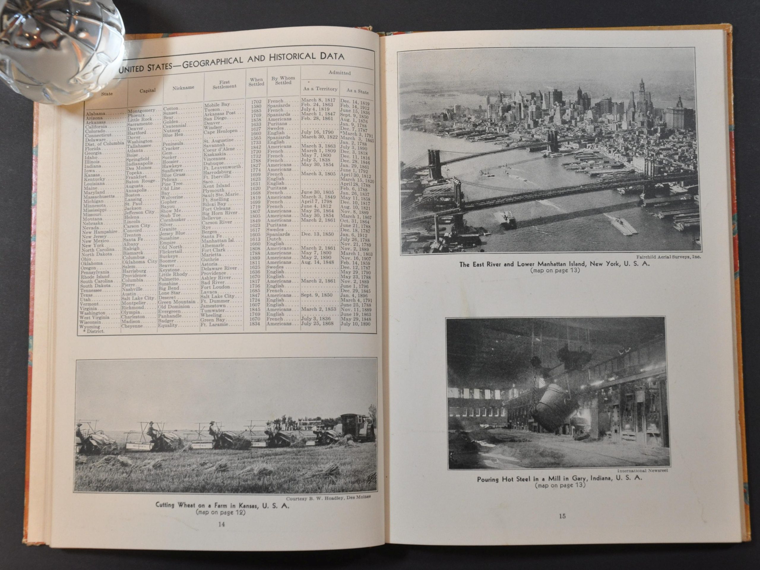
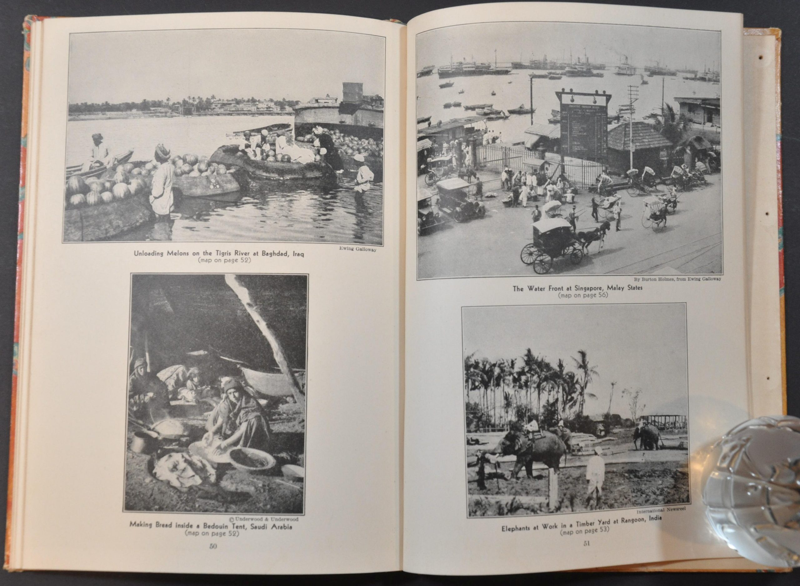
Dozens of captioned photographs add visual context to many of the most exotic places and people. Several pages of charts and indices list interesting world facts, demographics, and historical data. Published in Chicago by Rand McNally in 1934.
Map Details
Publication Date: 1934
Author: Rand McNally
Sheet Width (in): 6.75
Sheet Height (in): 9.5
Condition: A
Condition Description: 64 pp. color atlas bound in original illustrated boards. Covers are slightly scuffed and worn, but contents are complete and in very good condition. Light soiling in a few spots on the endpapers.
Out of stock