Wisconsin U.S. Highway 45 Lake Superior to the Gulf of Mexico
$325.00
A scarce mid-century road map promoting U.S. 45.
1 in stock

Description
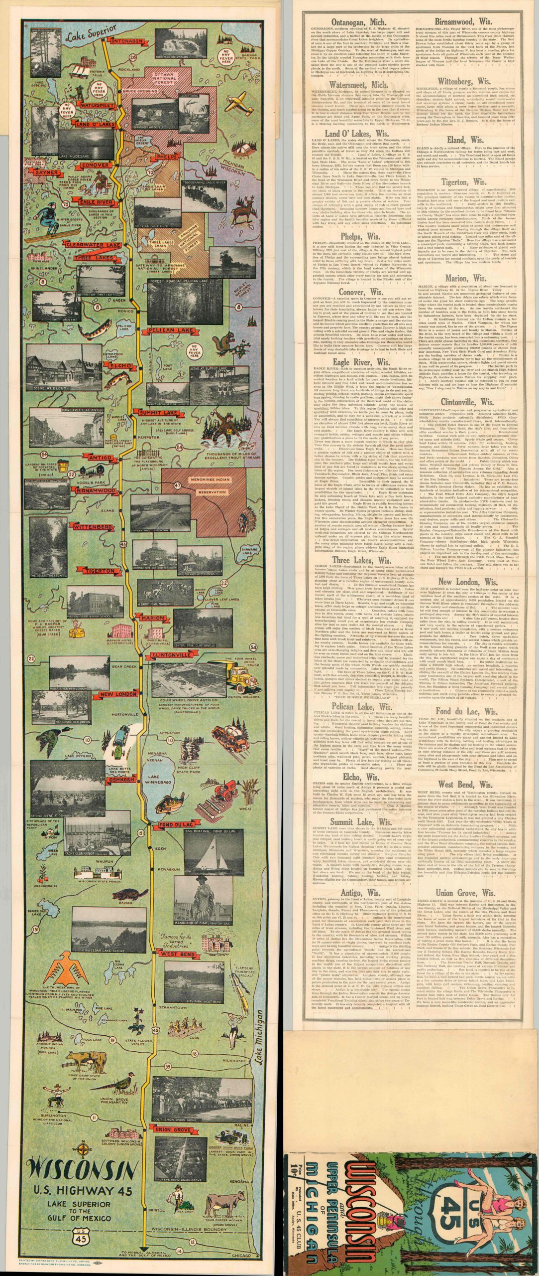
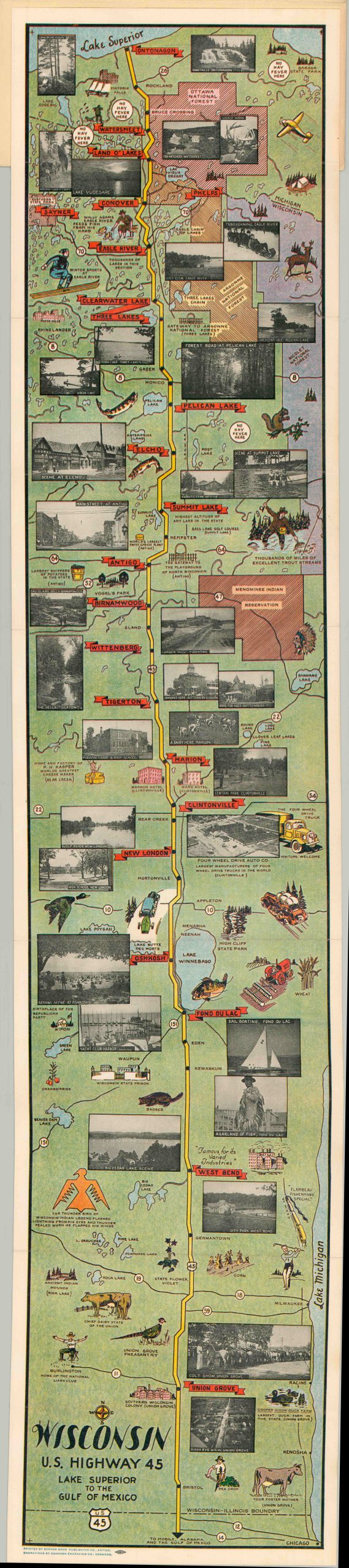
This striking strip map offers an engaging (if heavily stylized) overview of U.S. Highway 45 as it traverses Wisconsin from the Illinois border to Lake Superior. A somewhat misleading plan depicts the route as almost arrow straight, with adjacent transportation routes relegated to small ines almost indistinguishable from streams. Small vignettes and captioned photographs occupy almost all of the negative space, with careful exceptions made for the dozens of well-stocked lakes along the way.
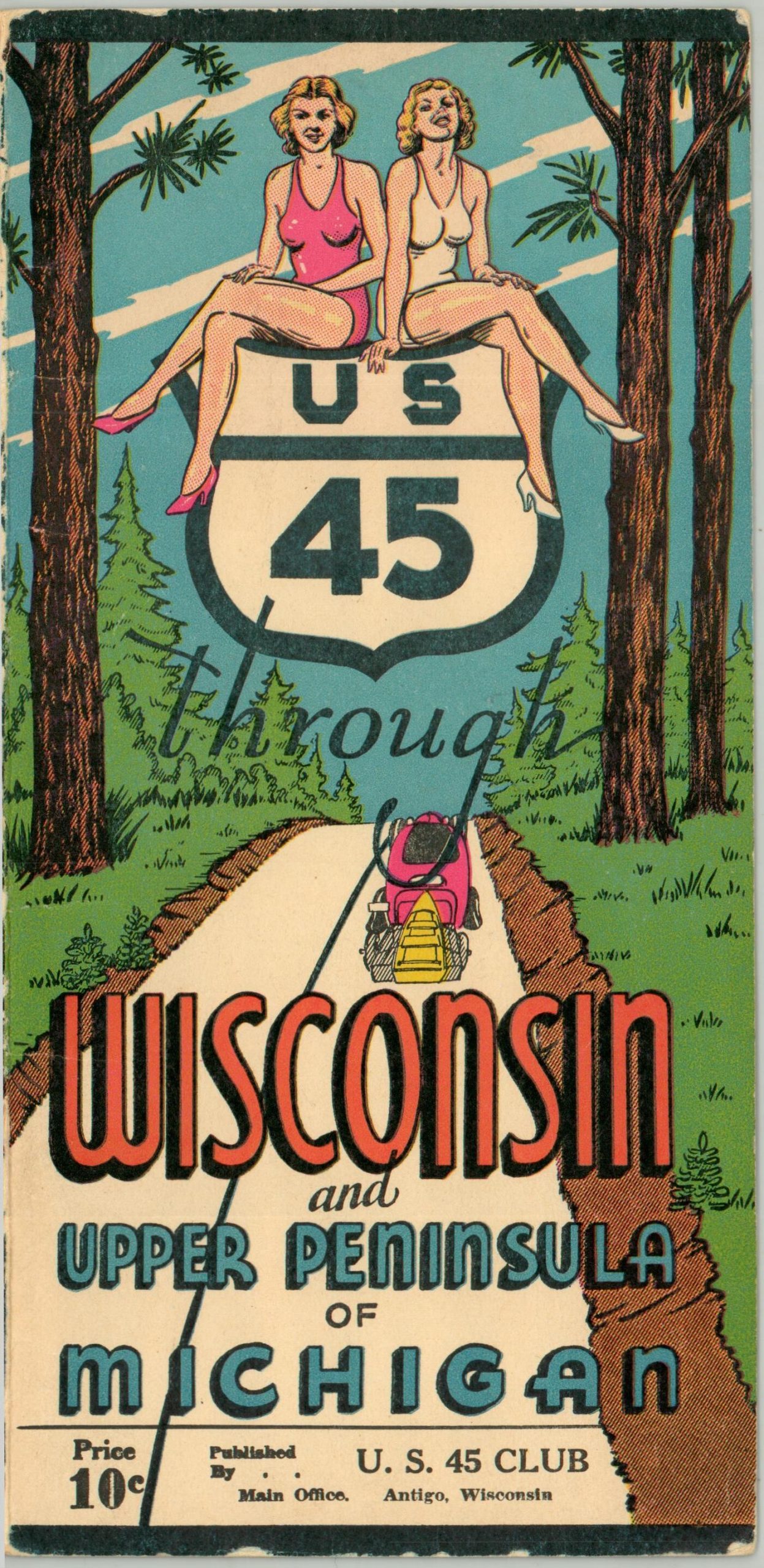
These images capture street scenes, local architecture, outdoor beauty, and major industries (notably, the Four Wheel Drive Co. in Clintonville). Specific features of interest include the National Liars Club in Burlington, the factory of P.H. Kasper (the World’s Greatest Cheese Maker) in Bear Creek, and winter sports at Eagle River. Numerous areas are boldly marked with ‘No Hay Fever Here.’ Text on the verso offers brief biographical sketches of most of the small towns along U.S. 45, from Union Grove to Ontonagon.
Undated, but the given population statistics, styles of vehicles, and ‘pin up’ girls on the front cover indicate the map is likely from the late 40s or early 50s. Engravings by the OshKosh Engraving Company, with printing by the Berner Brothers Publishing Company. Published by the U.S. 45 Club in Antigo, Wisconsin. A scarce and hyper localized piece, unlisted in WorldCat and otherwise unrecorded, as far as I can find.
Map Details
Publication Date: c. 1950
Author: Oshkosh Engraving Company
Sheet Width (in): 6.90
Sheet Height (in): 42.00
Condition: A
Condition Description: Long strip map, folded accordion style into original illustrated paper covers. A bit of faint wear on the wraps and in the margin, consistent with age, but overall in very good condition.
$325.00
1 in stock