Wisconsin
$100.00
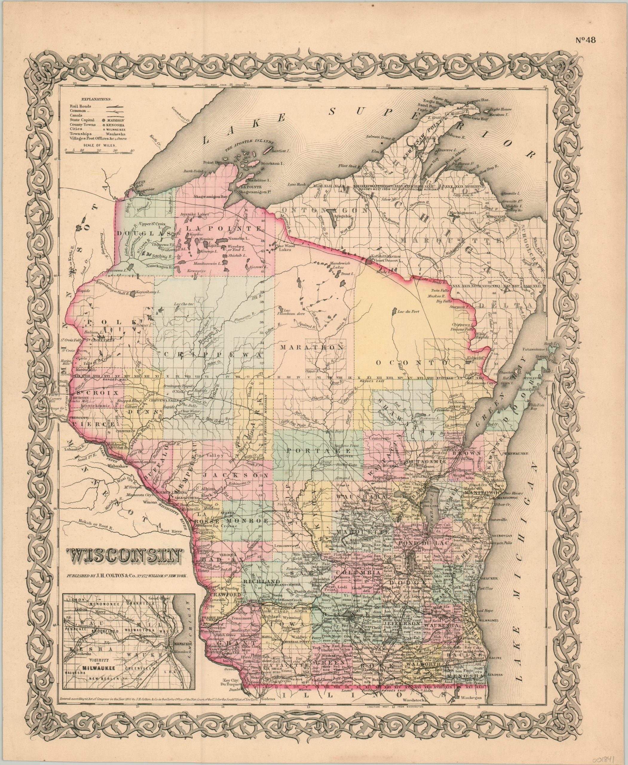
Detailed map of Wisconsin dating from before the Civil War.
1 in stock
Description
This hand colored map of Wisconsin vividly shows the process of white immigration that occurred in the first half of the 19th century. County configurations and railroad density in the southern part of the state reflect patterns of heavy settlement and use.
The further one travels north, however, towns and transportation routes become decidedly more scarce. The progress of township surveys, incomplete in the large northern counties, also reinforce this trend. An inset map in the lower right shows the plank roads and railroads in operation around the vicinity of Milwaukee.
The map was published in New York by J.H. Colton & Co. in 1855.
Map Details
Publication Date: 1855
Author: J.H. Colton
Sheet Width (in): 14.25
Sheet Height (in): 17.25
Condition: A-
Condition Description: Outer edges are slightly toned, consistent with age, but overall the map is in near fine condition.
$100.00
1 in stock