Winnebago County Road Map
$50.00
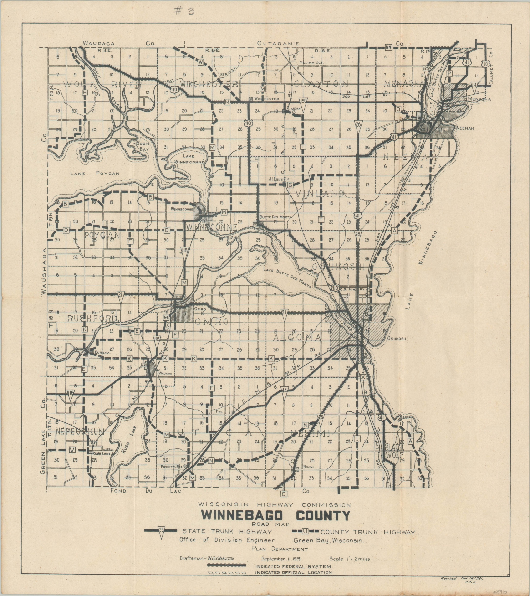
Depression-era highway map of Winnebago, County Wisconsin
1 in stock
Description
This map of Winnebago County, Wisconsin shows the local road network as of the early 1930s. State and County Trunk Highways are noted with solid and dotted lines, respectively, while hash lines adjacent to a route indicate it as part of the Federal System. Townships are labeled and sections are individually outlined and numbered within each.
Originally designed by H.C. Althaus and published by the Wisconsin Highway Commission in 1929 in Green Bay. This example was revised to 1931 by M.F.Z., according to the note in the lower right.
Map Details
Publication Date: 1931
Author: H.C. Althaus
Sheet Width (in): 14.1
Sheet Height (in): 15.9
Condition: A-
Condition Description: Lightly creased along former fold lines and some minor wear and discoloration visible in the lower right margin. Very good overall.
$50.00
1 in stock