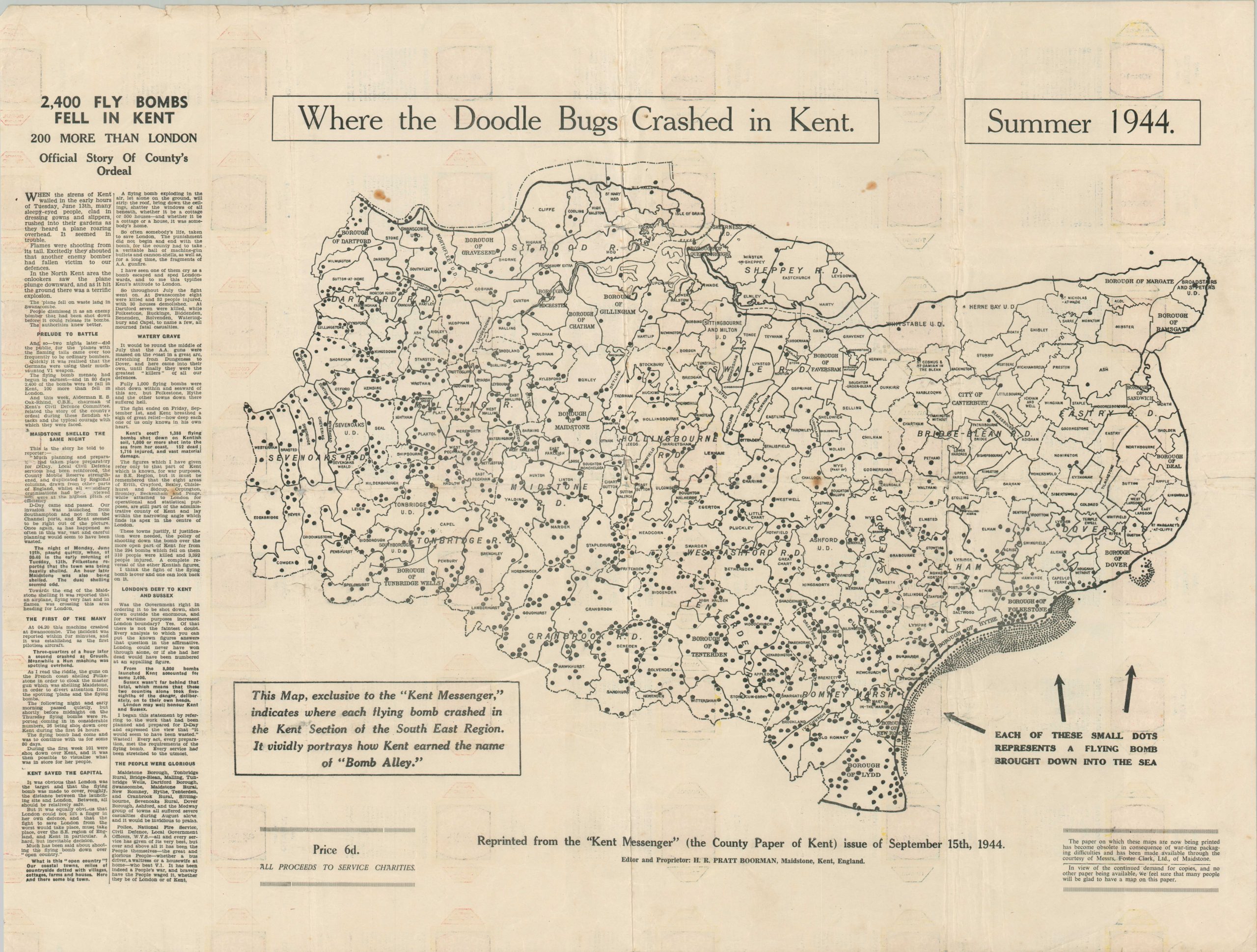
Where the Doodle Bugs Crashed in Kent
$850.00
Visualizing the impartial destruction of the V-1 rocket across Kent.
1 in stock
Description
“This map, exclusive to the “Kent Messenger,” indicates where each flying bomb crashed in the Kent Section of the South East Region. It vividly portrays how Kent earned the name of Bomb Alley.” – Text, lower left.
This disturbing map was reprinted in late 1944 or early 1945 from a September issue of the Kent Messenger, the county newspaper. It pinpoints the location of the approximately 2,400 V-1 Flying Bombs that fell across the area and into the sea nearby. Undoubtedly a point of pride for the local residents, it is noted that the number was ‘200 more than London.’An accompanying description tells the ‘official story’ of the county’s ordeal, ultimately suffering over 150 deaths and almost 1,750 wounded from the unpiloted guided missiles – the predecessor to the modern ICBM.
Because of wartime limitations, this commemorative edition was printed on a roll of soup can labels. A text box in the lower right references these restrictions – “In view of the continued demand for copies, and no other paper being available, we feel sure that many people will be glad to have a map on this paper.”
Sources: Imperial War Museum; National Archives (UK)
Map Details
Publication Date: c. 1944
Author: H.R. Pratt Boorman
Sheet Width (in): 27.1
Sheet Height (in): 20.1
Condition: B
Condition Description: Printed on ration paper (soup labels) that shows heavy wear including scattered toning, irregular tears, and wrinkling. Repairs with archival material on the verso corrects the worst of the damage. A few scattered spots. About good condition overall.
$850.00
1 in stock


