What to See at Niagara and Accurate Map Here
$95.00
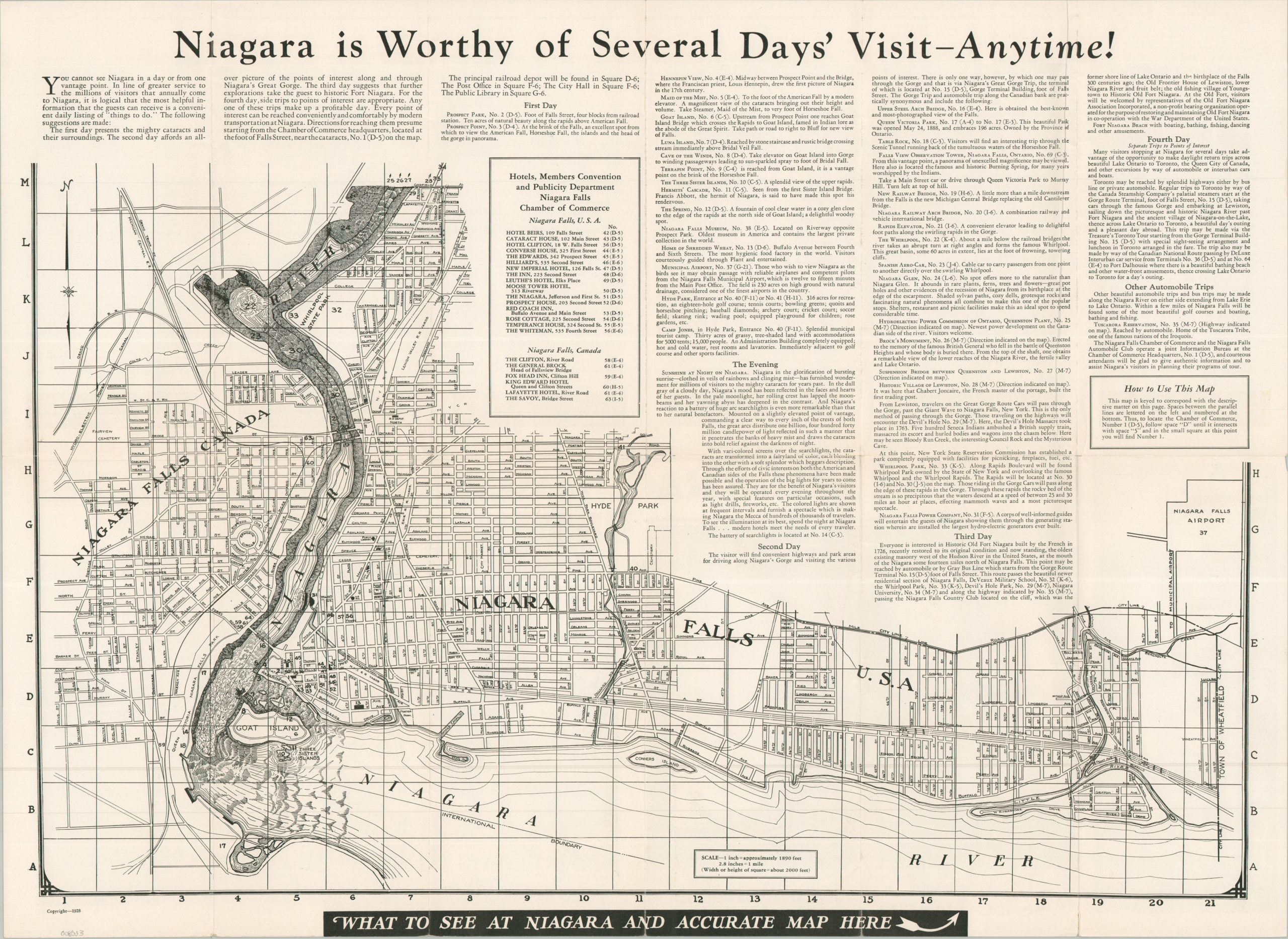
Niagara is Worthy of Several Day’s Visit – Anytime!
1 in stock

Description
This engaging map offers an interesting overview of the area around the world-renowned Niagara Falls. Street plans of cities on both the American and Canadian sides are accompanied by charming pictorial elements that highlight the course of the river and its primary features. Accompanying text offers a suggested four-day tour.
Designed and prepared by a publicity firm called IDEAService in 1928. Published by the City of Niagara Falls, New York and distributed by the local Chamber of Commerce.
Map Details
Publication Date: 1928
Author: IDEAService
Sheet Width (in): 23.75
Sheet Height (in): 17.40
Condition: B+
Condition Description: Double-sided map brochure with light wear along the outer edges of the sheet and a few small splits along the folds. Good condition overall.
$95.00
1 in stock