Weyerhaeuser
Exposing the deforestation across the Eastern United States.
Out of stock
Description
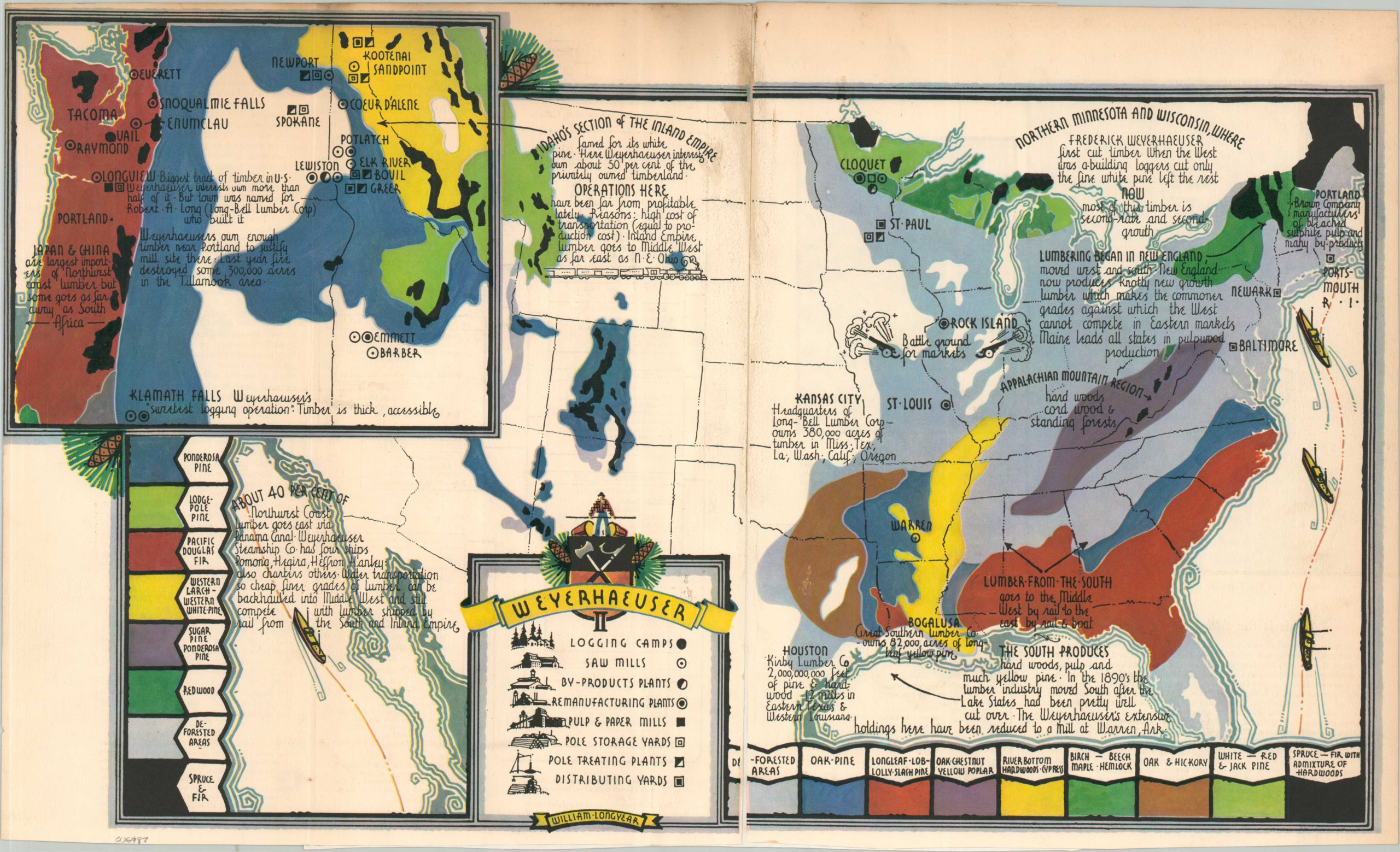
This colorful map of the United States was designed by William Longyear and originally published in a 1934 edition of Fortune Magazine. The focus is the empire of the Weyerhaeuser Lumber Company, owner of nearly 12.5 million square acres of timberland across America. Concentrations of different kinds of trees are noted with a variety of bright shades, though the muted gray of deforested areas outpace all others. Logging camps, saw mills, manufacturing plants, distribution yards, and other cogs in the wheel of the lumbering industry are noted according to the legend in the lower center. An inset in the upper left shows the relatively pristine region of the Pacific Northwest, ripe for the chainsaws of the lumbermen.
Map Details
Publication Date: 1934
Author: William Longyear
Sheet Width (in): 20.3
Sheet Height (in): 12.25
Condition: B
Condition Description: Double-page map extracted from Fortune Magazine and mounted to a scrapbook sheet. A portion of the sheet remains adhered to the back, with a slight resulting gap along the vertical center seam. Soiling in the upper margin and light wear along the edges. About good condition overall.
Out of stock