Westeros
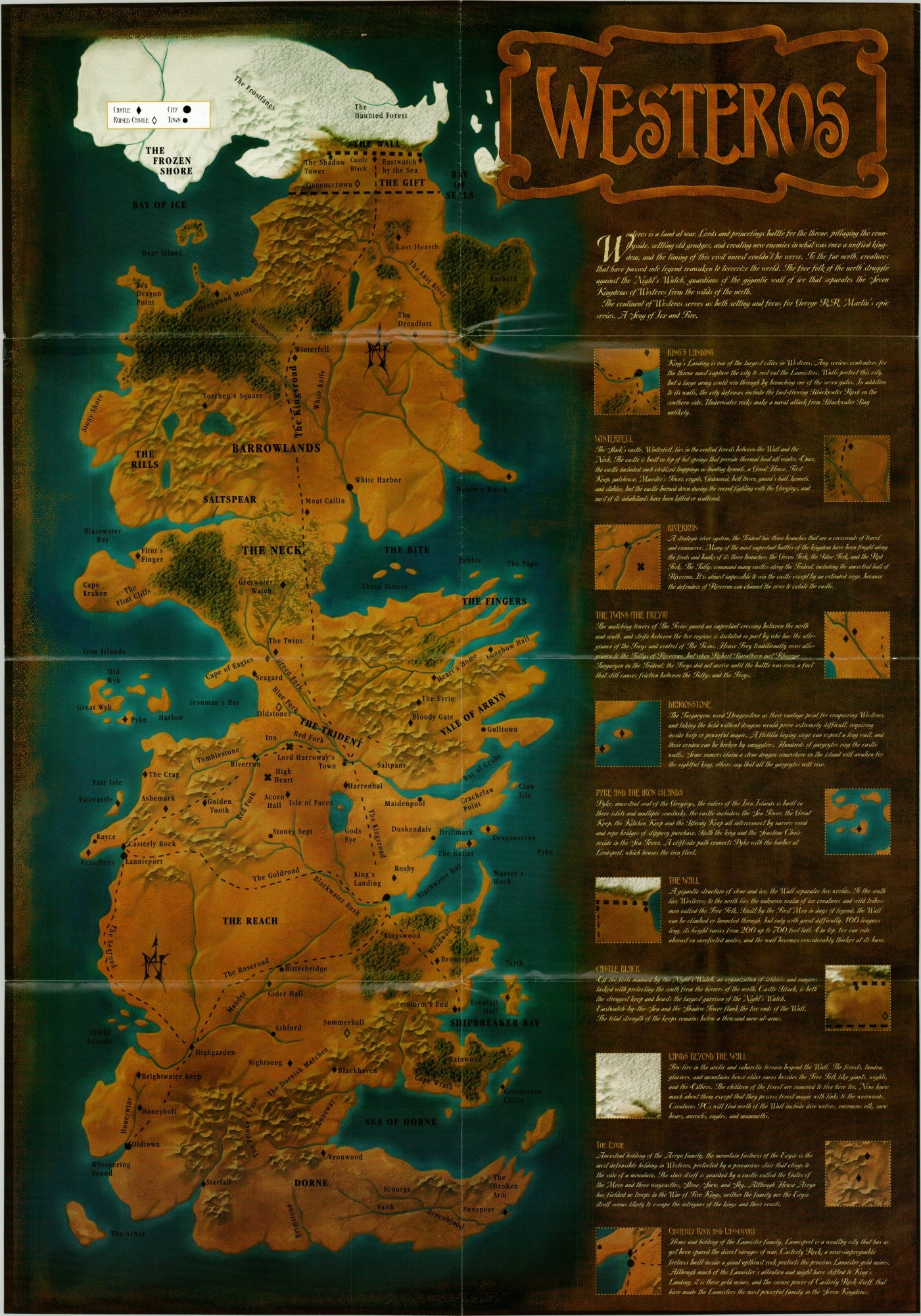
The first ‘official’ printed map of the entirety of Westeros.
Out of stock
Description
According to Adam Whitehead, author of the Atlas of Fire and Ice blog, this is the first printed map of Westeros to include both the northern and southern regions of George R.R. Martin’s popular fantasy world. It was designed by Mike Mayart and published in a 2003 edition of Dragon Magazine – the (former) official publication for the role-playing game Dungeons & Dragons.
The map, which emphasizes continental geography over individual places, was issued to accompany an interview with George R.R. Martin and includes numerous tips on how to run a D&D campaign that takes place in Westeros. The image is accompanied by a wealth of text on various places that would play a prominent role across the series, including in the blockbuster HBO series that was first released 8 years after publication.
Map Details
Publication Date: 2003
Author: Mike Mayart
Sheet Width (in): 20.75
Sheet Height (in): 29.5
Condition: A
Condition Description: Light creasing and faint wear along originally issued fold lines. Very good overall.
Out of stock