
Western Vacationlands
$375.00
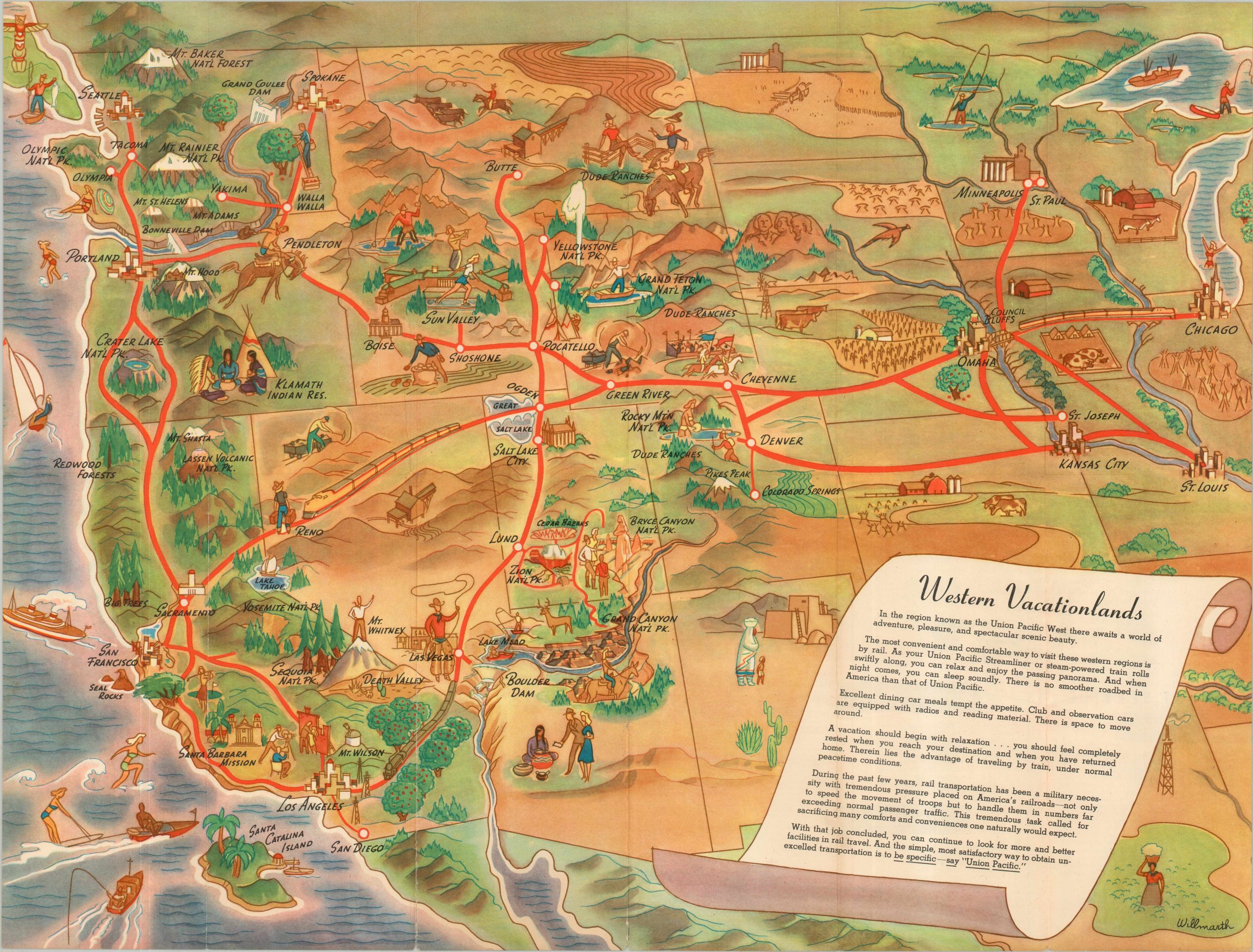
A punchy postwar pictorial encouraging Americans to see the west by rail.
1 in stock
Description
“In the region known as the Union Pacific West there awaits a world of adventure, pleasure, and spectacular scenic beauty.” – Text, lower right.
This gorgeous, stylized pictorial map of the western United States was illustrated by William Willmarth and published in 1946 by Rand McNally for the Union Pacific Railroad. Rail lines head west from the Twin Cities, Chicago, and St. Louis, connecting to some of America’s most beautiful scenery and rich history before arriving at the Pacific coast. Charming vignettes capture the allure of diverse attractions such as Hollywood, Yellowstone National Park, Boulder Dam, and the Klamath Indian Reservation.
The optimistic attitude reflects a nation awash in the glory of victory, free from any significant rebuilding or postwar rationing. However, the rising popularity of the automobile would give Union Pacific officials serious cause for concern. Promotional text in the lower right and on the verso highlights affordability, speed, and reliable service.
Map Details
Publication Date: 1946
Author: William Willmarth
Sheet Width (in): 23.75
Sheet Height (in): 18.00
Condition: B+
Condition Description: Double-sided map brochure with moderate wear along original folds, including about 6" of splits that have been repaired on the verso with archival tape. Faint discoloration visible in a few areas, but overall in good condition.
$375.00
1 in stock