Western Topography
$125.00
It all depends…
1 in stock
Description
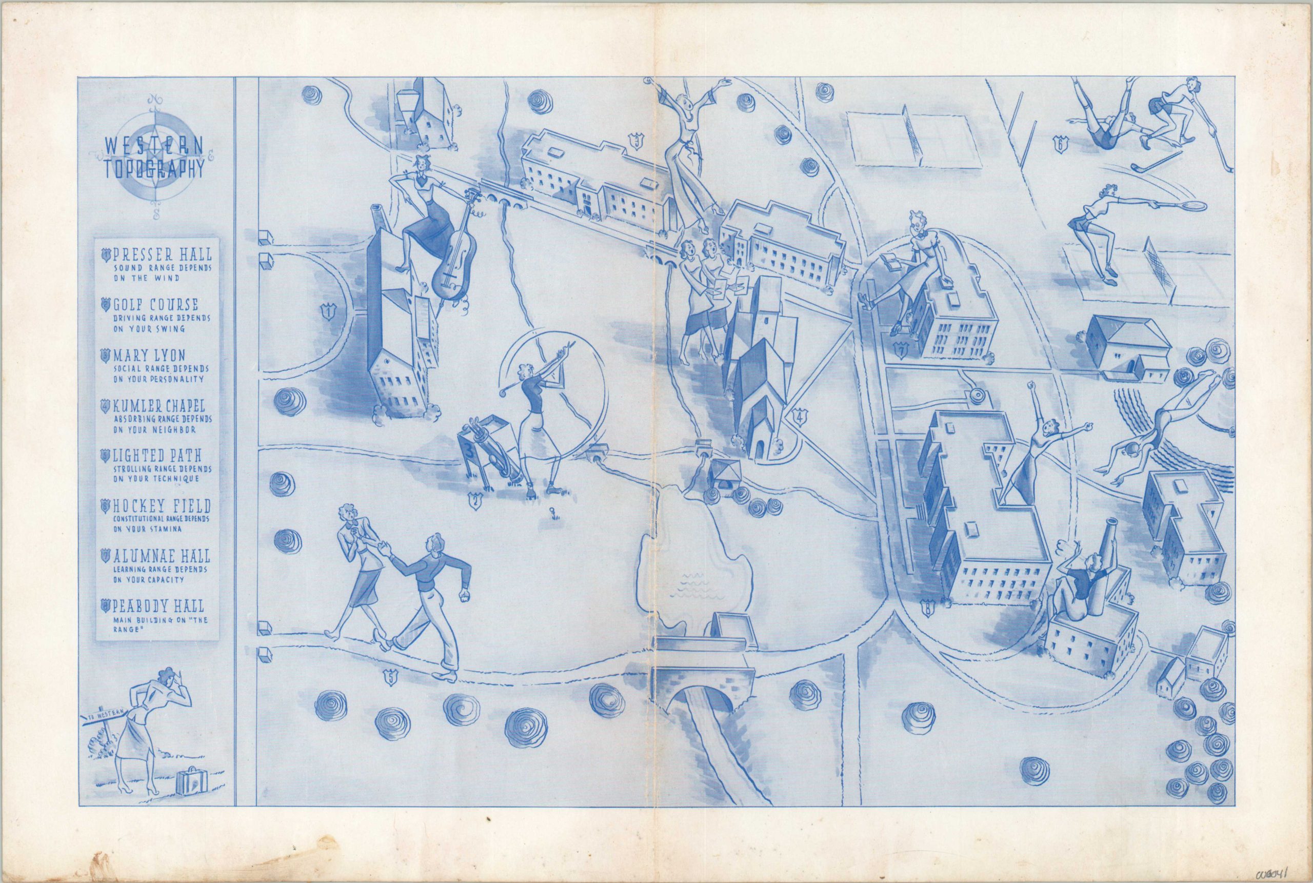
This anonymous mid-century pictorial map provides a simple, yet effective, overview of Western University, a public research university located in London, Ontario. Primary buildings are illustrated at an angled profile, with eight locations distinguished enough to receive their own number and corresponding name. Each has a ‘range’ that is explored via the accompanying label.
Numerous female figures are engaged in a variety of activities, shown with impossibly thin waists that reflect contemporary fashion. The date is estimated, and it’s possible the map was issued during World War II, during which male enrollment dropped significantly.
Map Details
Publication Date: c. 1950
Author: Western University
Sheet Width (in): 17.9
Sheet Height (in): 11.9
Condition: B+
Condition Description: Moderate toning and wear along vertical fold lines and scattered soiling visible in the margins. Old adhesive residue on the (blank) verso that does not affect the image. Good condition overall.
$125.00
1 in stock

