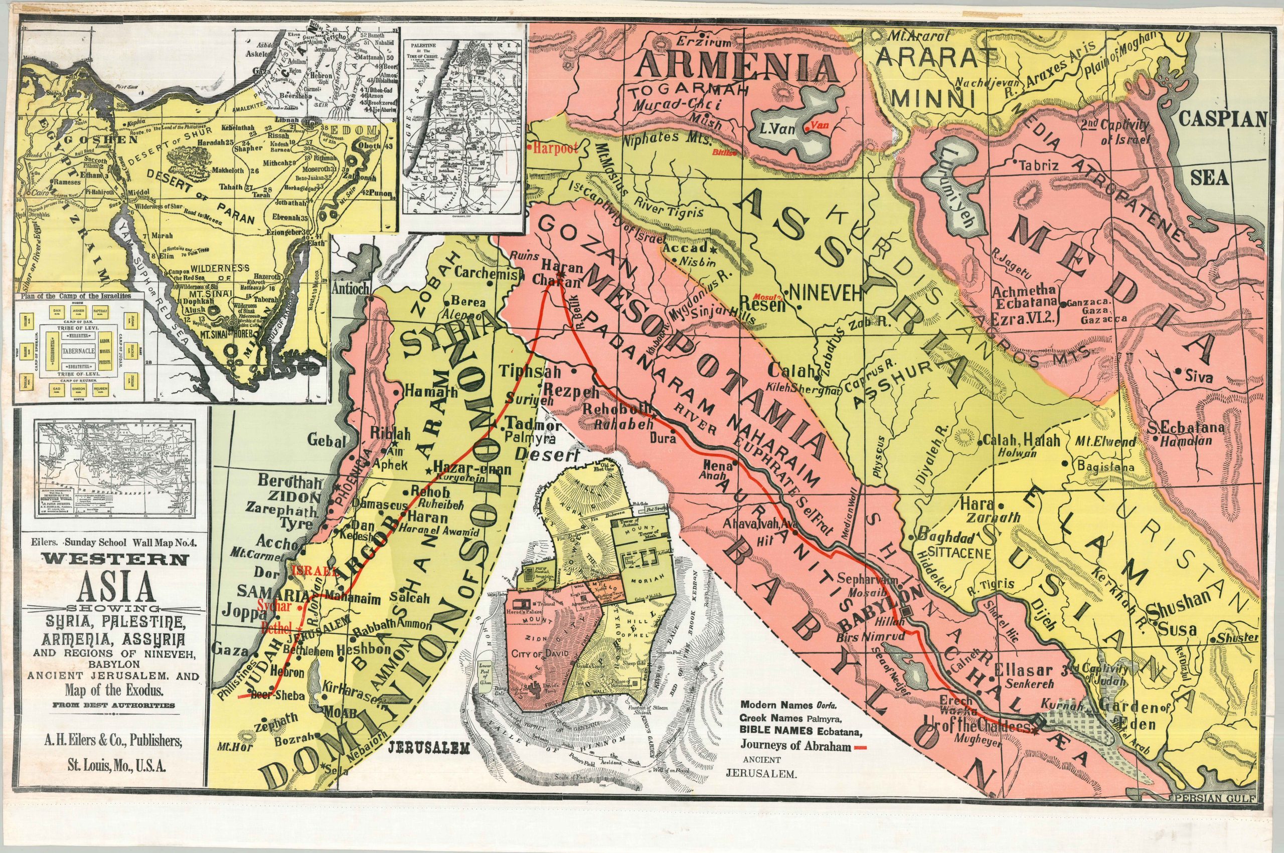
Western Asia Showing Syria, Palestine, Armenia, Assyria, and Regions of Nineveh, Babylon, Ancient Jerusalem, and Map of the Exodus
$145.00
All your Biblical geography needs in one place!
1 in stock
Description
This large and brightly colored composition was designed and issued as a teaching aid for juvenile education on Biblical subjects. The primary image presents a simple geographical overview of ancient Western Asia, noting Abraham’s route from Ur of the Chaldees (his presumed birthplace) to Beer-Sheba and further west. Various locations of interest are labeled, mostly according to the Hebrew Bible. Smaller insets show the route of the Exodus, a city plan of Jerusalem, the journeys of St. Paul, Palestine at the time of Christ, and a plan of the Israelites’ Camp – an impressive assortment of religious cartography!
The undated sheet was published around 1930 by A.H. Eilers & Co. as Map Number 4 in the Eilers Sunday School Wall Map Series. The company was originally established in St. Louis during the early 1870s as a bookseller and stationer, but soon transitioned to the production of material related to Sunday School education in the United States. Eilers produced a number of religiously themed materials, including collection envelopes, marriage certificates, ledgers, and wall maps in a variety of sizes and formats.
Map Details
Publication Date: c. 1930
Author: A.H. Eilers
Sheet Width (in): 35.75
Sheet Height (in): 53.75
Condition: B+
Condition Description: Color printed map (probably silkscreened) on treated linen. Formerly on wooden rollers, now removed, with binding holes along the upper and lower margins as a result. Moderate toning on the left side, from where previously rolled, and a few wrinkles and spots of foxing throughout. Good condition overall.
$145.00
1 in stock