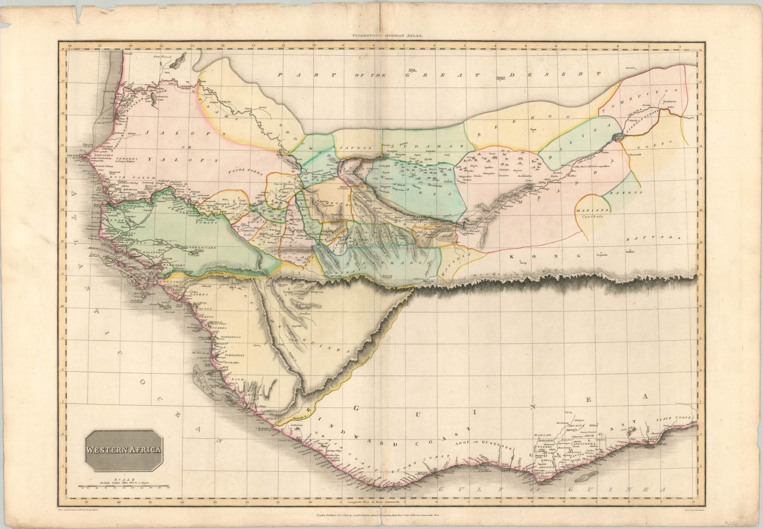
Western Africa
$300.00
West Africa featuring a prominent (albeit fictitious) Mountains of Kong.
1 in stock
Description
This stunning map of Africa’s western coast captures in great detail the regions’ geographic features as they were known to European cartographers in the early 19th century. The coastline is well-mapped, with place names, rivers, capes, and forts all individually labeled. The last were of particular importance, and operated as warehouses and factories for the gold, ivory, spices, and slaves that were extracted from the continent’s interior.
Details here are more sparse, though a prominently featured mountain range reflects one of the most persistent myths of African cartography – the Mountains of Kong. The mountains were first depicted by James Rennell in the late 18th century on a map that detailed the explorations of Mungo Park. It would appear on subsequent cartographic publications for nearly a century.
Other interesting details include a convoluted hydrological system, gold and salt mines, numerous local tribes (some labeled as cannibals), and the semi-legendary city of Timbuktu (upper right).
The map was engraved by Samuel Neele and published in London by Cadell & Davies in 1813. Included in Pinkerton’s Modern Atlas.
Map Details
Publication Date: 1813
Author: John Pinkerton
Sheet Width (in): 31.90
Sheet Height (in): 21.90
Condition: B+
Condition Description: Moderate wear visible in the margins, including soiling and several tears that have been repaired on the verso. Slight paper loss in the upper left corner, away from the image. Light scattered soiling throughout the sheet, but the map remains in good condition with attractive hand color.
$300.00
1 in stock

