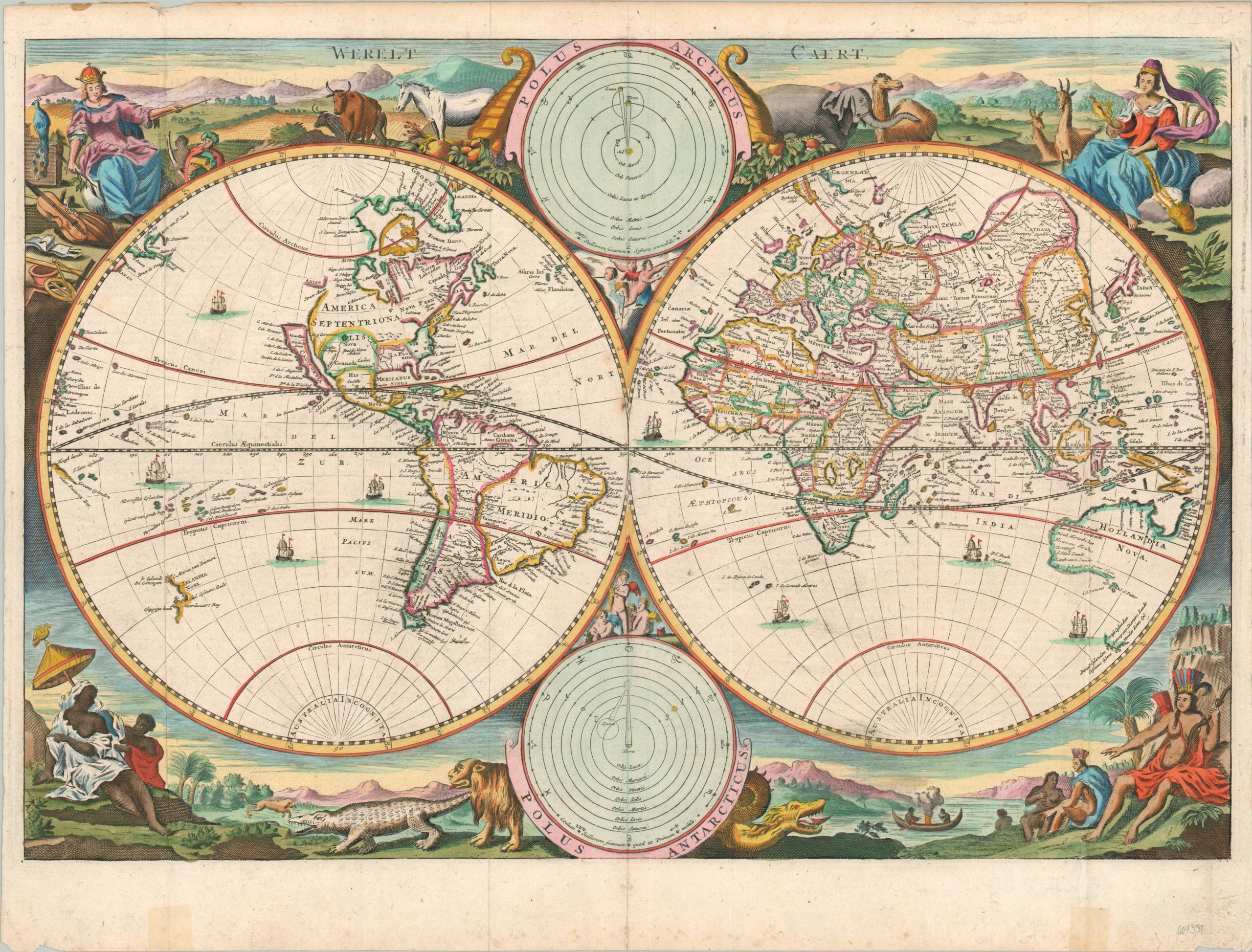
Werelt Caert
Beautiful double-hemisphere map featuring California as an island.
Out of stock
Description
This eye-catching world map was designed by Daniel Stoopendahl and was originally published as part of a Dutch Bible around the year 1700. It is based largely on an earlier work created in 1663 by Nicholas Visscher, an important figure in Dutch cartography near the end of the industry’s height in the Netherlands. Though by the time it was issued the image was largely outdated in terms of geographic information, the map represents an incredible synthesis of visual allegory, scientific diagrams, and cartographic mythology that is emblematic of Dutch mapmaking during the 17th century.
The most iconic contemporary misconception is the depiction of California as an island. The myth originated with a Spanish romance novel of the early 16th century that was apparently later verified with reported observations in the Baja Peninsula. It would persist on European maps of North America into the 1740s. Other notable geographic fallacies include fictious lakes Xarayes and Parime in South America (the city of Manoa, reportedly the location of El Dorado, can be seen near the latter), the Sea of Verrazzano on the East Coast, amorphous Great Lakes, and distorted islands in Southeast Asia (among many others).
Incomplete coastlines in the Arctic Circle and around Oceania reflect ongoing spheres of exploration during the Age of Discovery, while Africa’s interior is almost entirely theorized and based on earlier cartography, including that of Ptolemy. Australia Incognita can be seen near the South Pole – an entirely speculative continent not yet charted by Cook. Throughout all are dotted numerous sailing ships, plying the waves.
Surrounding the fascinating image are four allegorical scenes of equal, if not greater, visual appeal. Each represents a different continent. Europe in the upper left, is wearing a regal crown and surrounded by musical and scientific instruments, draft animals, and foreigners bearing gifts of ivory and gold. Asia, upper right, is a maiden dressed in flowing silks, holding incense and spices with elephants and camels nearby. The Americas (note the two bodies of land separated by water) can be seen in the lower right, bare-chested and evidently ‘savage.’ Curiously, the only animal is a fierce dragon. Africa, lower left, shows a black female figure, possibly a queen, under the shade of a careful attendant. An alligator and lion look on, with the latter expressing an admittedly goofy smile. Final details include both heliocentric and geocentric models of the universe, though by the time of publication, the question had firmly been settled in favor of the Copernican system.
Map Details
Publication Date: c. 1700
Author: Daniel Stoopendahl
Sheet Width (in): 18.25
Sheet Height (in): 13.75
Condition: A-
Condition Description: Light wear and a few scattered tears around the full margins. Gorgeous modern hand color. Dutch text on the verso.
Out of stock

