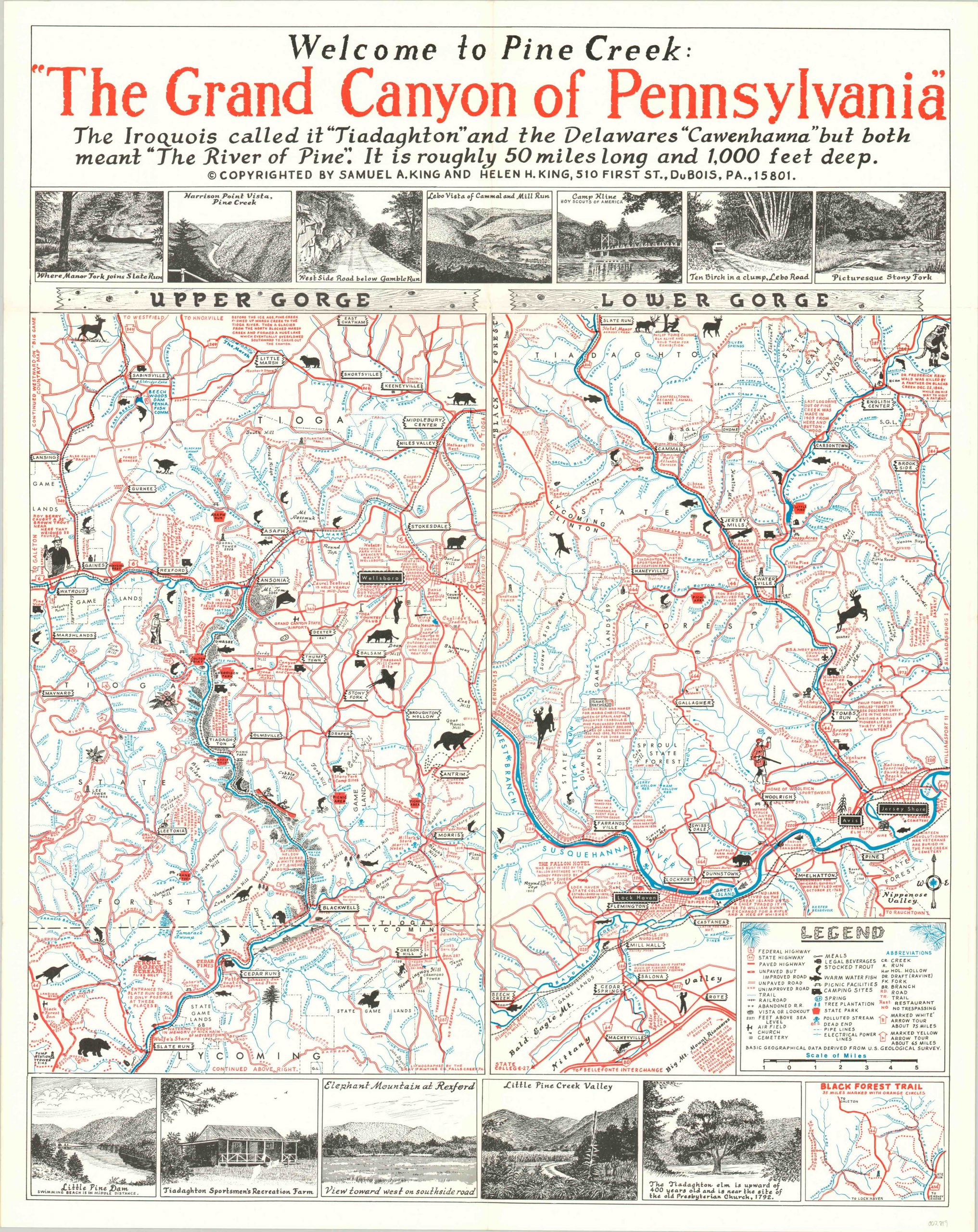
Welcome to Pine Creek: The Grand Canyon of Pennsylvania
A pictorial invitation to the ‘Grand Canyon of Pennsylvania.’
Out of stock
Description
This map, evidently a labor of love, presents all the wonderful recreational opportunities available in the Pine Creek region of Pennsylvania. The nearly 88 mile long waterway is a tributary of the Susquehanna River and is considered America’s longest ‘creek.’ The area is popular among outdoor enthusiasts, and features an abundance of hiking trails, fishing spots, and camping facilities.
Such amenities are shown throughout the region on this map, which is divided into two images capturing the Upper and Lower Gorges. An accompanying legend in the lower right identifies the various symbols used to denote transportation routes, geographic features, park facilities, and much more. Picturesque vistas are illustrated along the top and bottom of the page, providing a glimpse of the natural beauty available to residents and tourists alike.
Copywritten by Samuel and Helen King and published in 1969. Blank on verso.
Map Details
Publication Date: 1969
Author: Samuel and Helen King
Sheet Width (in): 22.90
Sheet Height (in): 28.90
Condition: A
Condition Description: Light creasing along originally issued fold lines and a bit of faint discoloration on the verso. Near fine overall.
Out of stock

