Webster’s Map of Glen Ellyn DuPage County, Illinois
$150.00
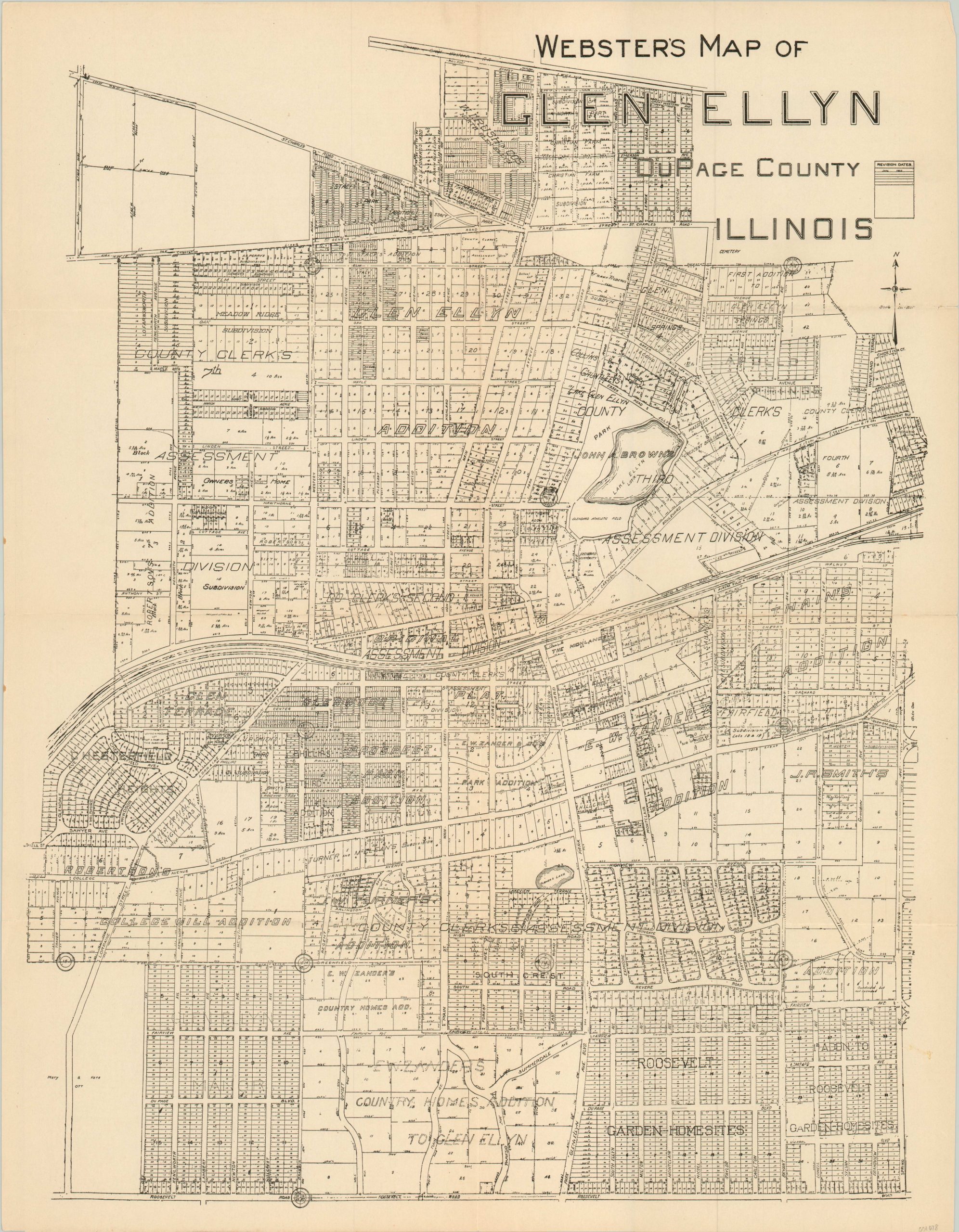
A real estate map of Glen Ellyn, Illinois from 1925.
1 in stock
Description
This real estate map of Glen Ellyn, Illinois is dated 1925 and attributed to Arthur L. Webster. It shows the area from Roosevelt Road to The Great Western Trail and Spring Avenue to the eastern city limits. Each parcel of land is labeled by size; along with information related to transportation routes, subdivisions, survey lines and land owners.
The cartographer, Arthur Webster, was a resident of the area who worked variously as a railroad engineer, county surveyor, and real estate agent. He was a driving force behind the increasing connectivity between Chicago and its western suburbs in the first decades of the 20th century. Blank on verso.
Map Details
Publication Date: 1925
Author: Arthur Webster
Sheet Width (in): 18.60
Sheet Height (in): 24.00
Condition: A-
Condition Description: Minor wear and faint discoloration along fold lines. One 1" tear (repaired on verso) and a smudge on the left side of the sheet, both confined to the margin. Excellent condition overall.
$150.00
1 in stock