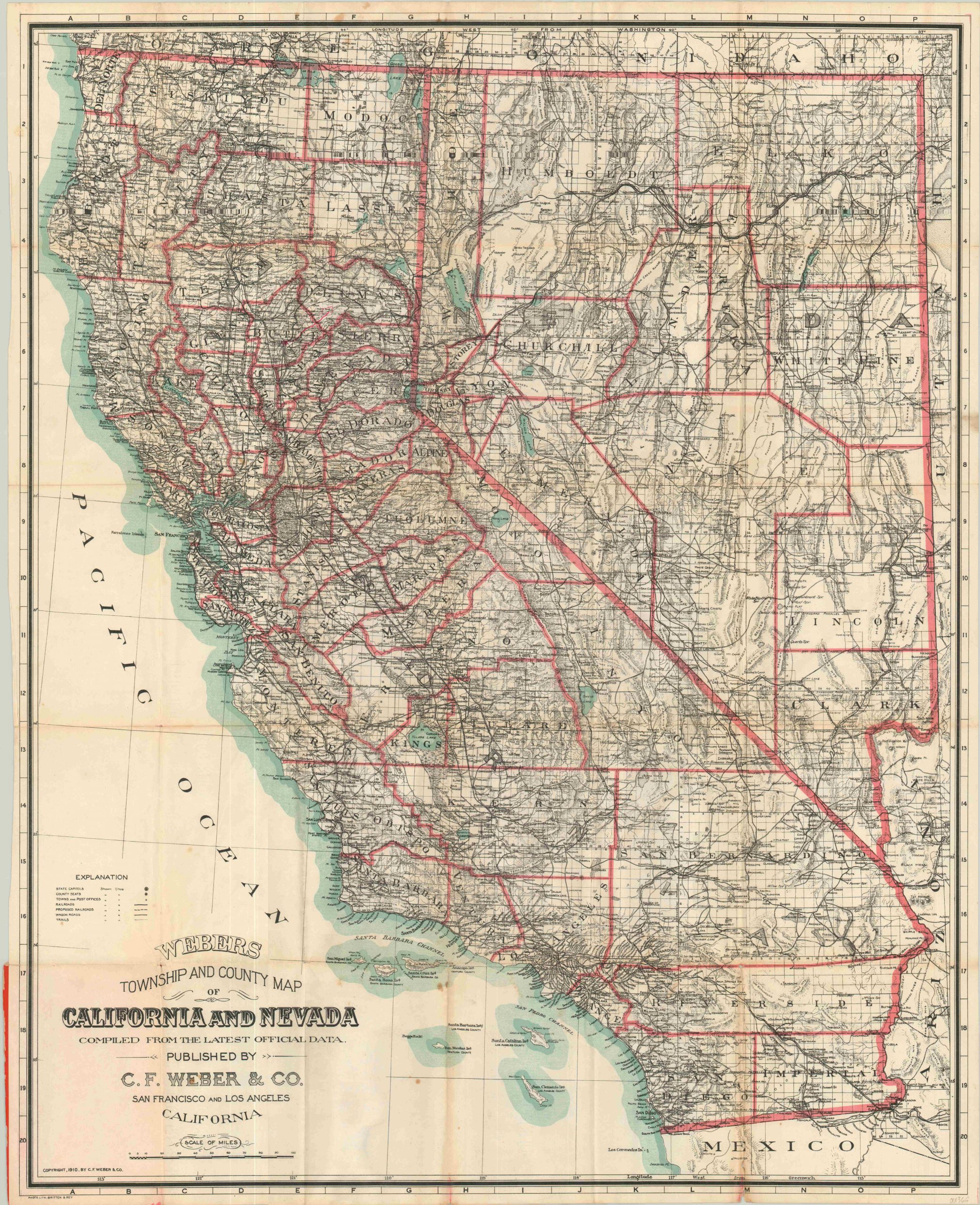
Webers Township and County Map of California and Nevada
$175.00
An interesting 20th century map of California and Nevada showing some of the final remnants of the American frontier.
1 in stock

Description
This detailed map of the states of California and Nevada shows an early transportation network on the cusp of rapid development in the latter decades of the 20th century. Wagon roads and trails are depicted alongside railroads, both proposed and in operation.
Numerous towns are shown without connection to either, and the majority of them are ghost towns today. Basic topography is depicted in hachure so as not to crowd the image, and the region’s extensive mining industry is on full display. Local geographic features like mountain peaks, freshwater springs, desert areas and salt flats are also individually labeled.
Accompanying the map is an extensive 29 page index to the various towns and cities found within the image. Published in San Francisco by C.F. Weber & Company in 1910.
Map Details
Publication Date: 1910
Author: C.F. Weber & Co.
Sheet Width (in): 27.5
Sheet Height (in): 33.5
Condition: B
Condition Description: The map originally folded into 35 panels and is affixed to the original back paper cover. Moderate discoloration and breakage along fold lines, including three 2" tears that have been repaired on the verso with archival tape. Scattered soiling in the lower center and upper margins. One area of particular wear and toning visible in the lower right. The front cover and accompanying 30 page index is present, but loose and separated.
$175.00
1 in stock