
Waukesha County Wisconsin
$95.00
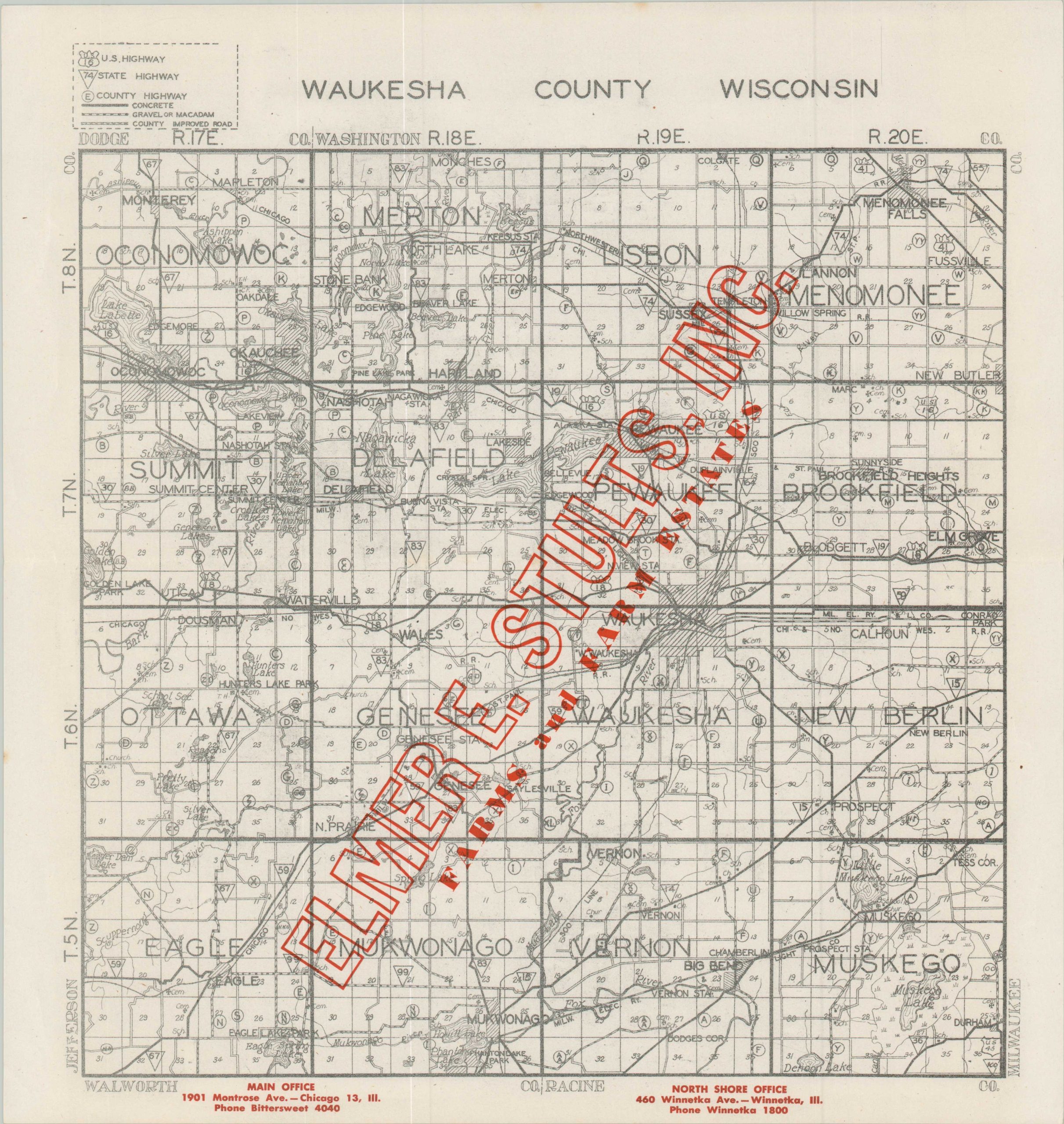
Interesting Depression-era map of Waukesha County, Wisconsin.
1 in stock
Description
This uncommon map of Waukesha County, Wisconsin was originally published anonymously, probably in the mid-1930s, and possibly by a county highway department, based on the content presented. Red overprinting indicates this example was distributed by the real estate firm of Elmer E. Stults, Inc.; specialists in ‘Farms and Farm Estates’ with offices in Chicago and Winnetka (a northern suburb), according to the bright text.
The image presents the network of road surfaces with different styles of lines – concrete (solid), improved (dashed), and dirt (empty) – shown by the legend in the upper left. Highways and state routes are numbered, where applicable. Geographic features (mostly lakes), railroads, townships, settlements, schools, churches, and cemeteries are also identified.
Map Details
Publication Date: c. 1935
Author: Anonymous
Sheet Width (in): 13.75
Sheet Height (in): 14.5
Condition: A-
Condition Description: Lightly creased along old folds and a few spots along the upper edge of the sheet. Very good condition overall. Blank on verso.
$95.00
1 in stock